


Bitter cold settles in
INDIANAPOLIS (WISH) — Temperatures remain well below average over the extended forecast, with several snow chances for the week ahead.
Sunday:
Bitter cold temperatures through the day under mostly cloudy skies. Highs only hit the mid-teens this afternoon, with wind chills barely getting above zero in many locations.


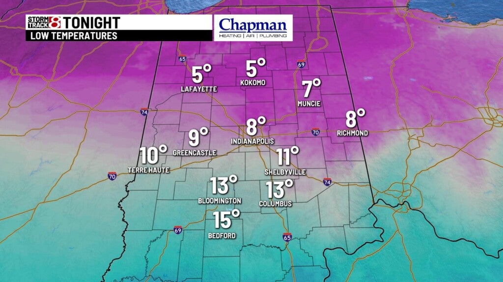
Sunday night:
A weak wave moving through late tonight should provide some scattered light snow showers, with very little accumulation. Snow should be long gone before people head to work and school for Monday morning.
Lows will fall to the upper single digits and lower teens.
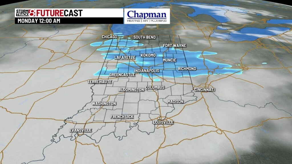
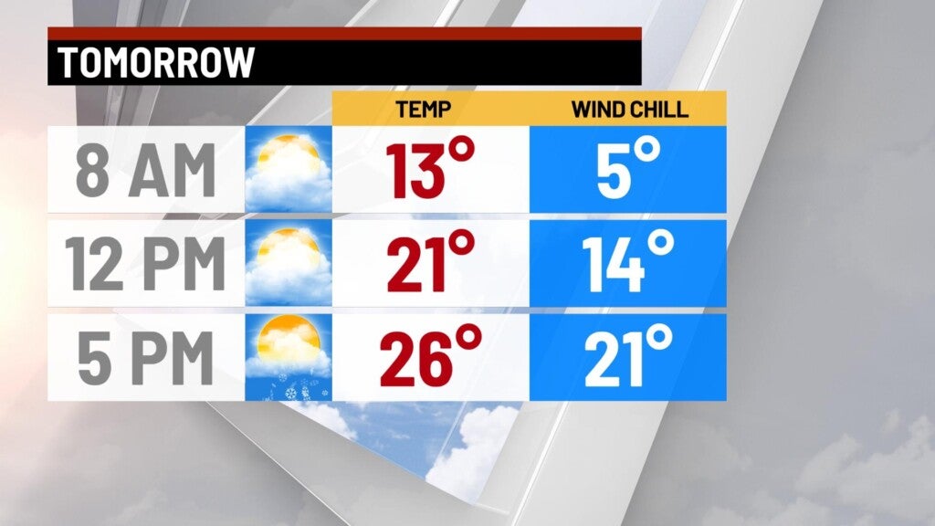
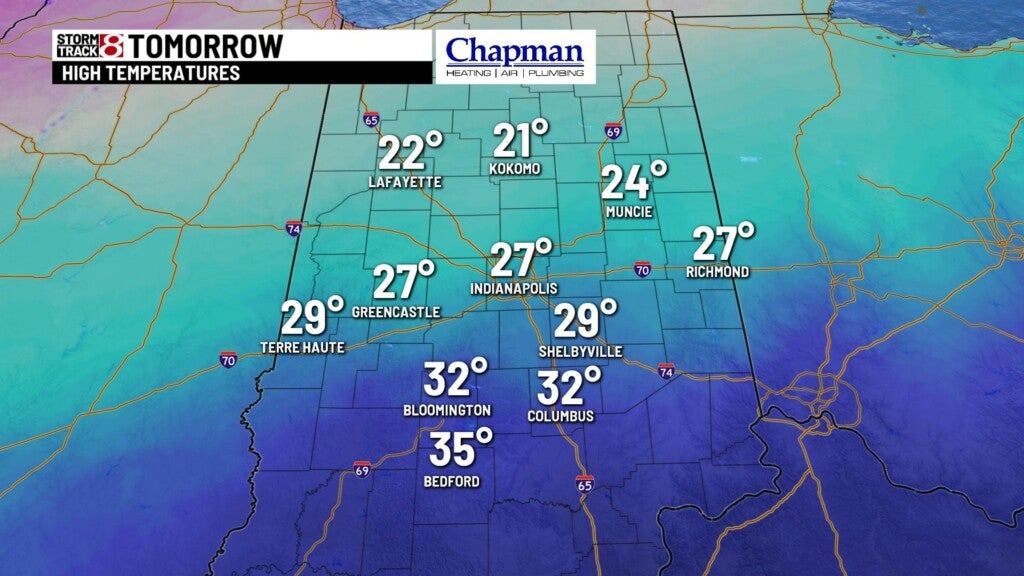
Monday:
Dry and cold start to the day, with mostly cloudy sky. Another system will move through by Monday afternoon and bring in widespread snow to the area for the evening commute. Accumulation looks likely, with heaviest amounts across much of central Indiana to the tune of 2 to 4 inches.


Highs will top out in the mid 20s.
8 day forecast:
Tuesday should be a dry day before another round of snow showers move in for Wednesday and Thursday, which could bring more accumulation to the state. Another significant shot of arctic air will settle in for the end of the week, with highs in the teens for Friday and into the weekend, and possible subzero lows.
