


Cold start to the weekend; wintry mix moves in Sunday
INDIANAPOLIS (WISH) — Quiet conditions to start off the weekend. Two systems Sunday and Monday will provide a chance for snow, rain and freezing rain to the area.
SATURDAY:
Highs pressure keeps us sunny and cold through the day. Highs top out in the lower 30s this afternoon.


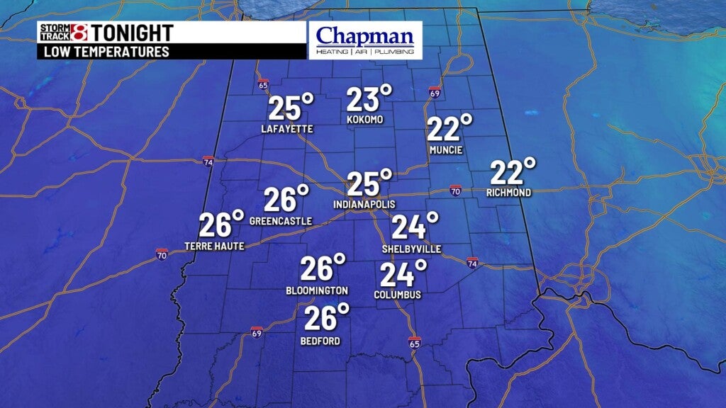
SATURDAY NIGHT:
Clouds will be on the increase overnight as our next storm system moves in. Lows fall to the middle 20s.
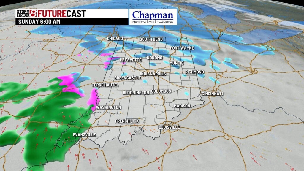
SUNDAY:
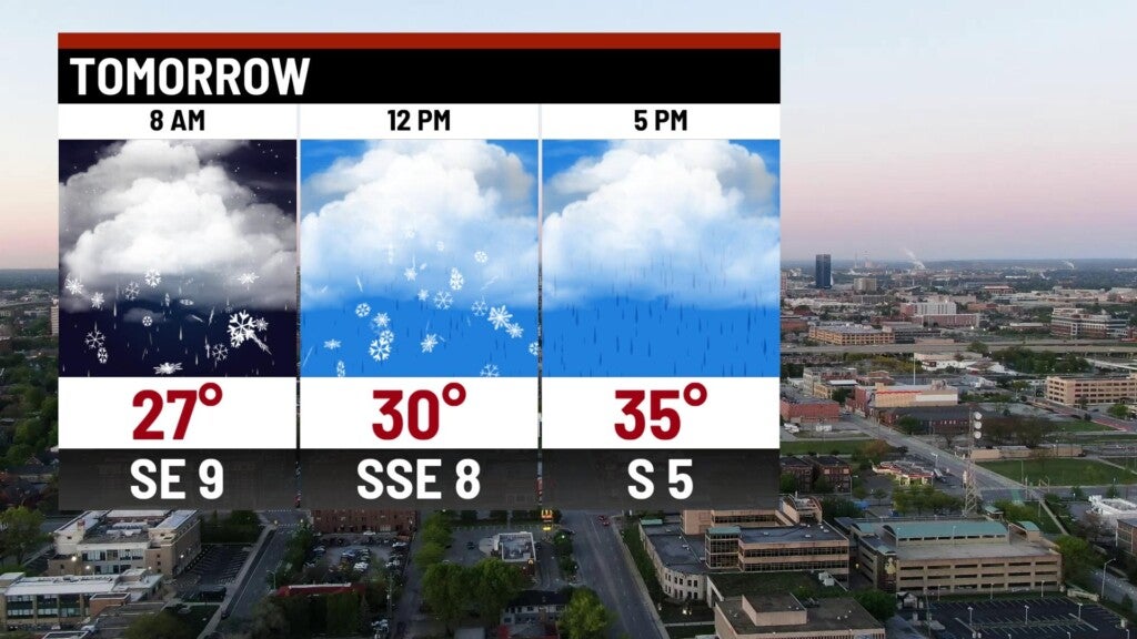
Low pressure will slide through the state to wrap up the weekend. Expect light snow showers for the northern half of the state for the early morning hours with little to no accumulation. By mid-morning, light freezing rain will move into much of central Indiana. We should start to see a changeover to chilly rain by the afternoon hours.

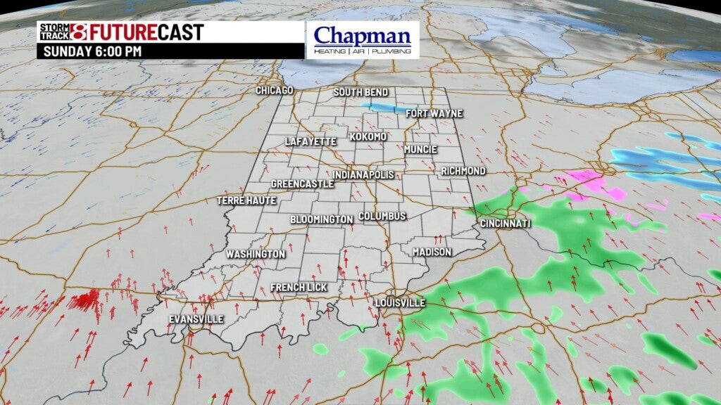
Highs top out in the middle 30s.

8 day forecast:
The second wave moves in on Monday, providing another round of freezing rain to the area by mid-morning, and making a transition over to all rain by the afternoon, as highs top out near 40. Snow showers will continue for the northern third of the state in Tuesday morning, providing a few inches of snow by Tuesday afternoon.

The rest of the extended is quiet, with seasonable temperatures through the work week and into next weekend.
