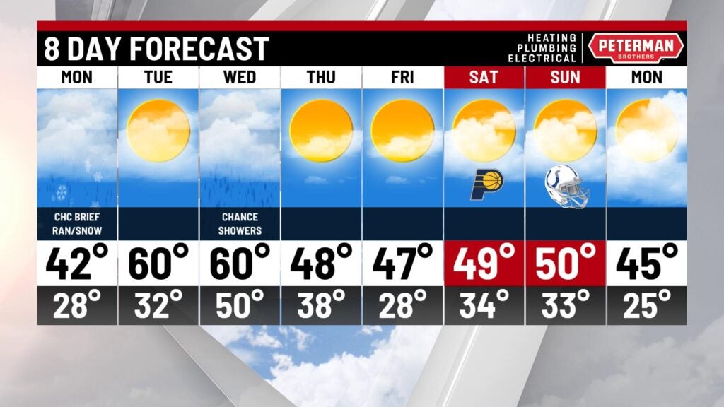
David Says One More Winter-like Day
One more winter-like day and then a real warm up for midweek. For the most part, any rain showers of snow flurries are moving out of Indiana. There is another chance for brief flurries or rain showers Monday afternoon.
Tonight – Flurries and light rain ending. windy and cold. Low 28.
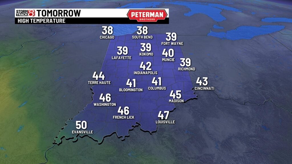
Monday – Watch out for scattered slick spots early Monday. Mostly cloudy with a chance for brief snow flurries or rain showers in the afternoon. High 42.
Tuesday – Becoming partly cloudy and much warmer. High 60.
Big change in the past week or so. looked and felt like October last weekend, this weekend it looked and felt like December. November weather got lost temporarily!

The light snow melted almost as fast as it fell. Here here are some snowfall amounts from cold surface measured about 10:30 to 11:00 this morning.

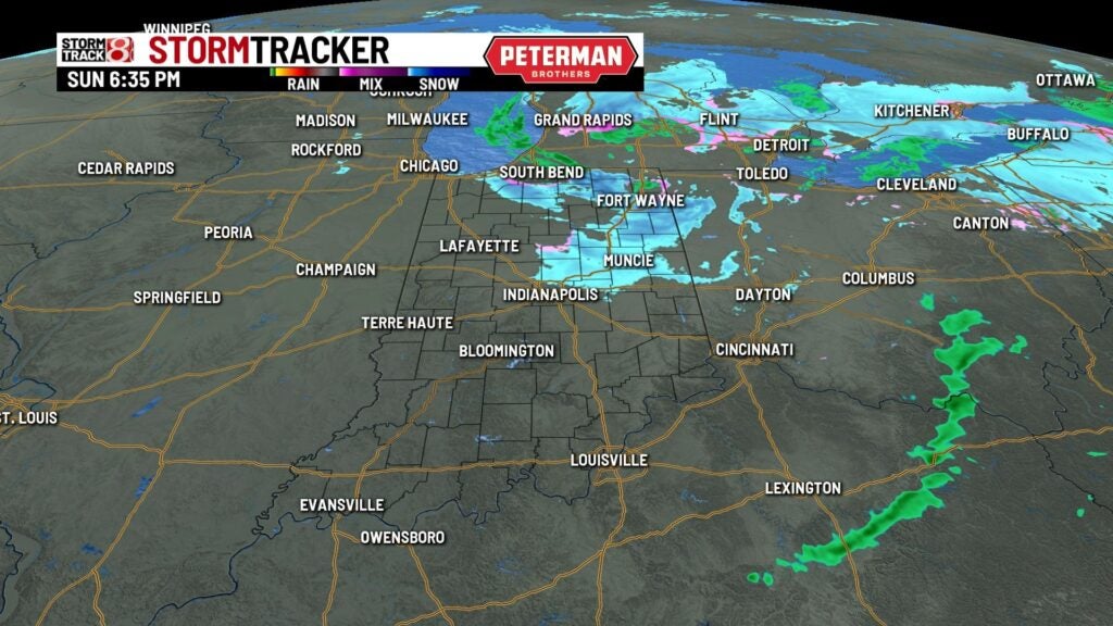
This evening StormTracker shows the significant rain and snow in northeast Indiana, A few flurries and light rain showers in north central Indiana.
FutureCast shows another little patch of snow flurries and rain showers zipping through Indiana early Monday afternoon. Little or no accumulation and no travel problems are expected.

With the early morning Monday temperatures in the upper 20s, there could be some scattered slick spots on bridges and in cold areas. Be careful on the way to work or school Monday morning.

Slightly warmer but still below average high temperatures for Monday afternoon
With the passage of a warm front the temperatures zoom back to above average on Tuesday.

8 Day Outlook – Another warm day Wednesday but the next cold front approaches. So scattered showers possible late Wednesday. Then back to typical colder weather to finish out the week. Thursday, Friday and Saturday should be dry.