


Increased fire danger today, rain returns Sunday
INDIANAPOLIS (WISH) – Strong winds return later this afternoon. Several rain chances move into the forecast as we enter the new week.
Today:
Dry conditions combined with strong afternoon winds will create an increased fire risk across all of Indiana today. A Red Flag Warning is in effect for much of the day because of the increased fire danger.
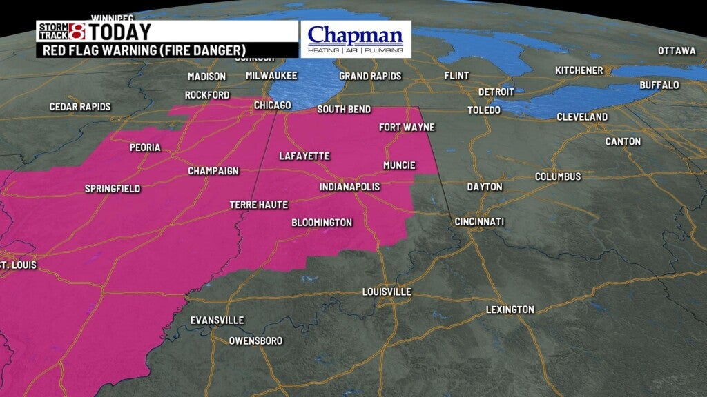
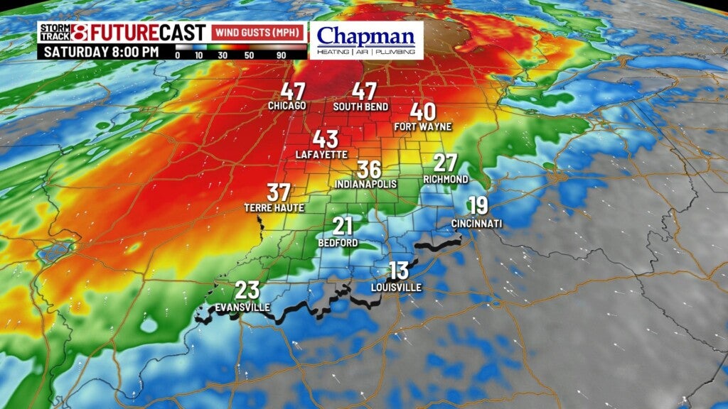
Winds could gust over 40mph – especially north of I-70.
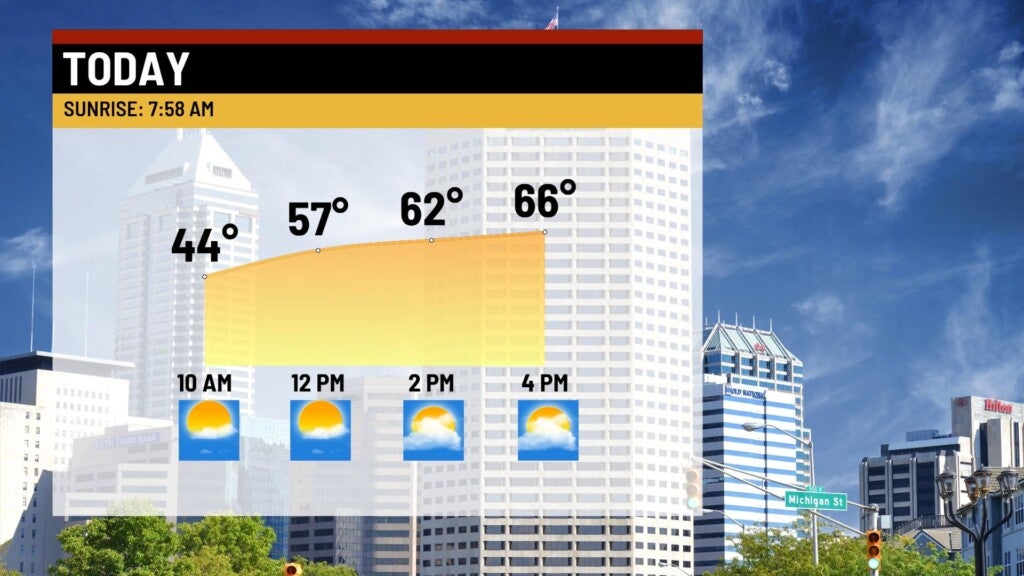
Meanwhile, expect dry and sunny conditions today, with highs hitting the middle 60s.
Tonight:
Winds should ease back a bit under partly cloudy skies. Temperature shouldn’t be quite as chilly, with lows falling to the middle and upper 40s.

Sunday:
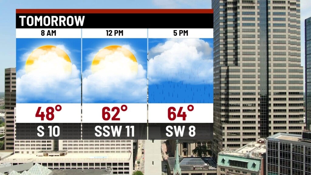
Dry start to the day. An approaching cold front will increase cloud cover and bring a return of showers to the area by the afternoon hours. A few downpours could be possible in the southern portions of central Indiana late in the afternoon.

The southern 1/3 of the state could see over 0.5″ to as high as 1″ of rain close to the Ohio River.

Highs top out in the mid 60s.
8 day forecast:
Sunday’s cold front will stall out of the region, providing isolated rain chances for Monday through Wednesday. We should see temperatures jump back to near 70° by mid to late week, before front completely moves out by Friday, bringing another cool down by next weekend.
