


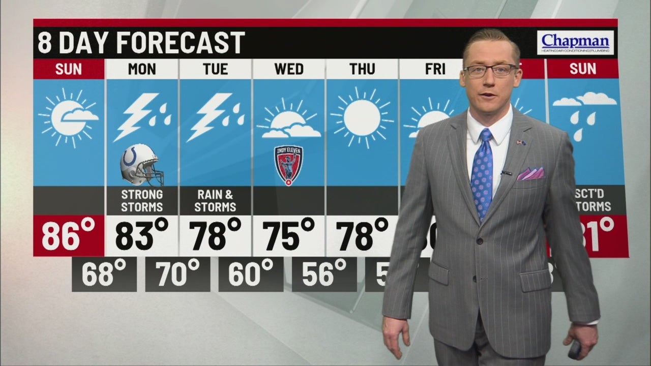
Mostly dry and hot weekend underway, but strong storms look to return Monday
INDIANAPOLIS (WISH) — Good Saturday evening, everyone! After a foggy start, the skies cleared by late morning and high temps managed to climb into the low to mid 80s in most areas this afternoon.

We’ve seen a few stray downpours, as expected, though more of us than not ended up staying dry to start the weekend.

Any lingering rain will move out or fall apart by late this evening. Temps will sink into the low 70s before midnight.

We’ll slowly work our way down into the upper 60s by daybreak Sunday under mostly clear skies.


Similar to today, we’ll start our day with patchy fog and then rebound quickly under mostly sunny skies.

Highs tomorrow will climb into the mid to upper 80s in many areas.

We’ll see a chance for a few isolated downpours to close out the weekend, also similar to what we’ve seen today.

Better chances for rain and strong storms will return Monday with high temps in the mid 80s.

A MARGINAL Risk for severe storms is already in place Monday, meaning a few storms could be strong to severe with a threat for damaging wind and hail.

We’ll likely stay dry to start the day, but better storm chances return by midday and the threat will linger into early Tuesday morning.


Widespread rain will continue through Tuesday evening before we clear out late Tuesday night.

This storm system will be a catalyst for a big cool down through mid-week, providing an early taste of fall with highs in the mid to upper 70s and low temps in the 50s Thursday and Friday mornings.


We’ll stay mostly dry through mid-week with better rain chances slated to return by the second half of next weekend.