Nice weekend ahead, snow next week
INDIANAPOLIS (WISH) — Quiet conditions continue as we roll through the holiday weekend. Much colder air with snow accumulations will be possible early next week.
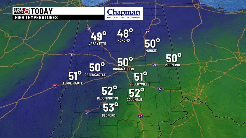
Today:
Relatively quiet conditions for much of the day, with some sun at times. Temperatures should warm just a bit, topping out in the lower 50s this afternoon.
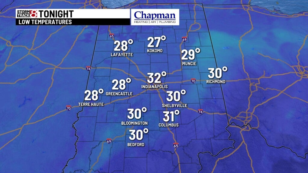
Tonight:
Mostly cloudy, quiet and seasonably chilly. Lows fall to the lower 30s.
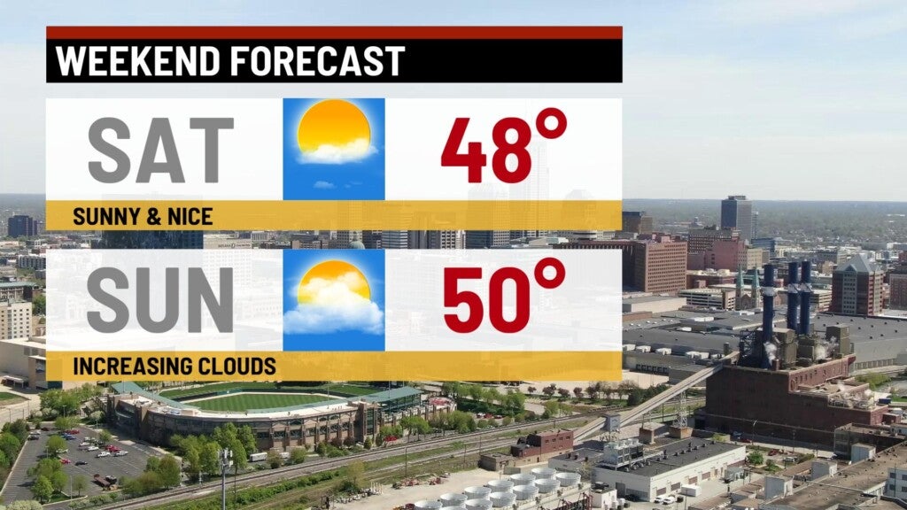
Weekend:
Slightly cooler for Saturday and Sunday, but both days should be dry until later Sunday evening. Expect mostly sunny to partly cloudy conditions, with highs in the upper 40s both days.
Cold and snow:
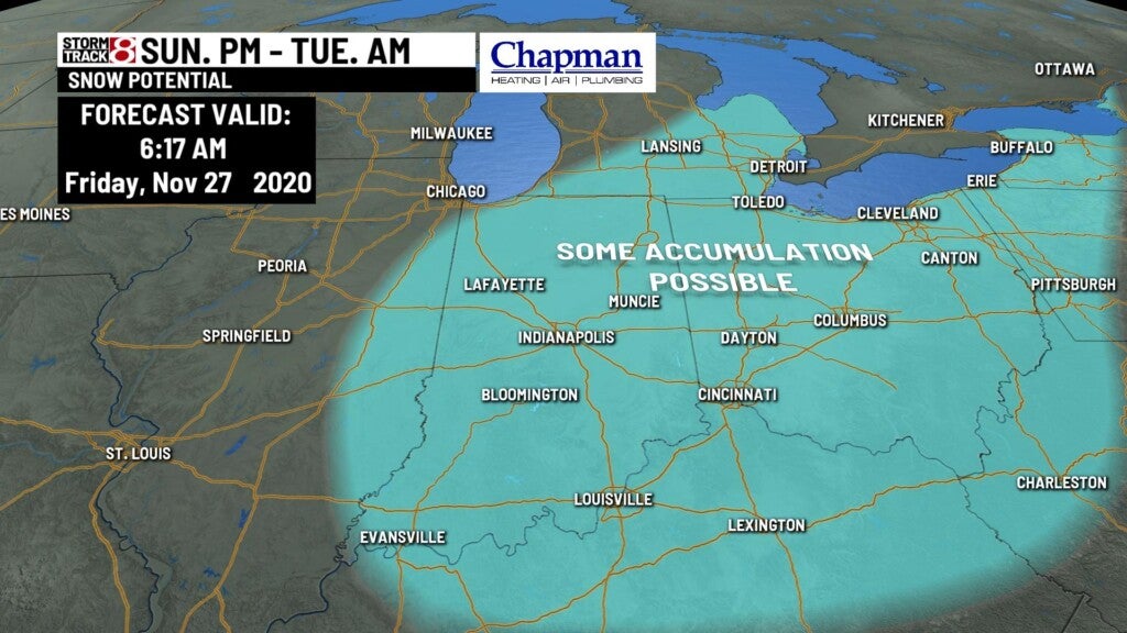
We’re starting to see some agreement in terms of snow chances to open up the work and school week. Southwestern system will merge with an upper level low, along with cold Canadian air starting Sunday night into Monday. Initially, we’ll see rain showers moving through Sunday night. As colder air comes into play Monday on the back end of the system, we should start to see a changeover to snow.
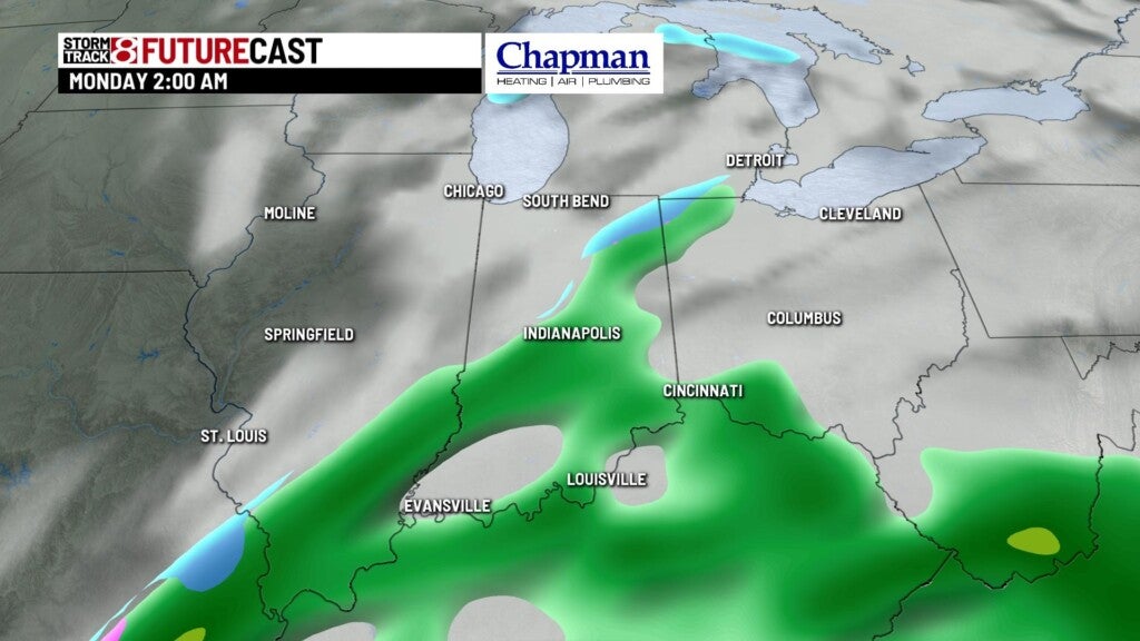
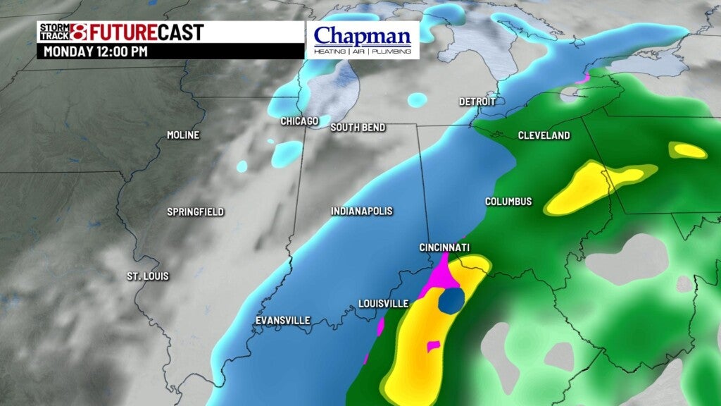
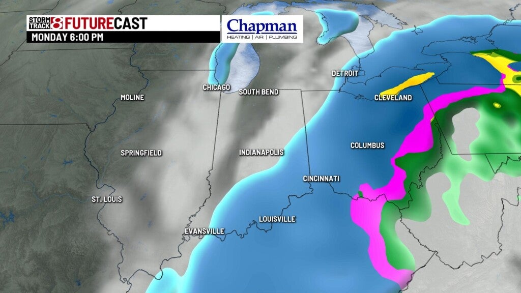
There’s still some question as to where the heaviest snowfall will set up, but it does appear that parts of central Indiana could see a least a couple of inches. Still many aspects to be ironed out at this point, including snowfall amounts and timing of rain to snow changeover. Regardless, be prepared for a tricky commute into work Monday morning.
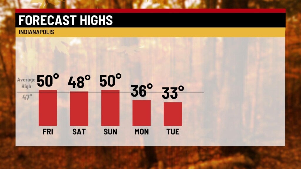
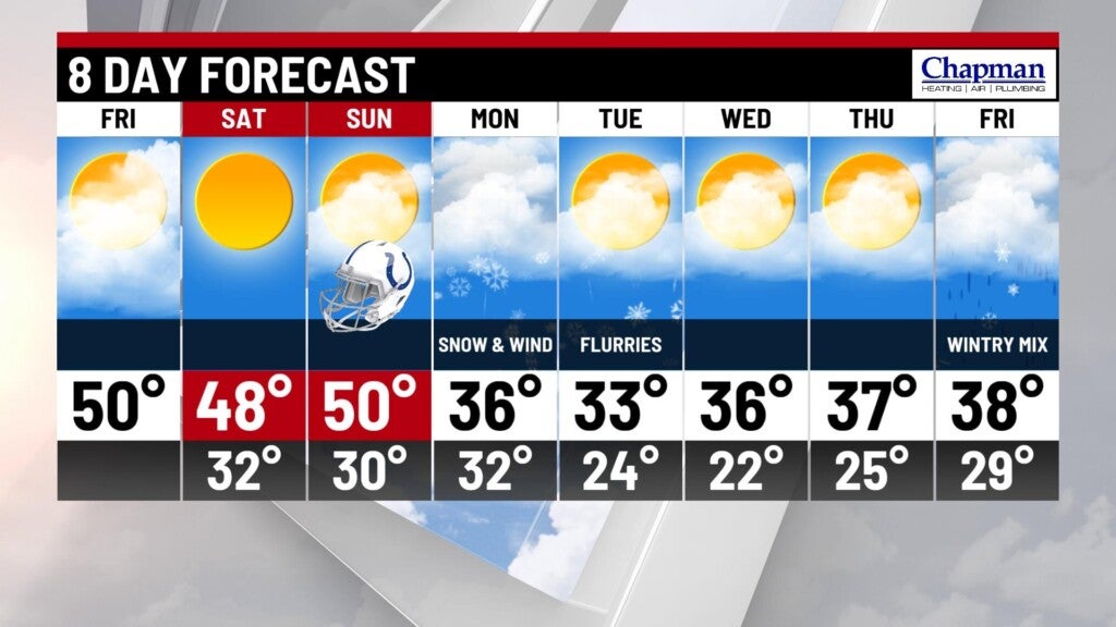
8 day forecast:
Colder air will settle in with our first snowmaker of the season. Highs will remain below average for the rest of the week, struggling to get out of the middle 30s. Temperatures should rebound slightly heading into next weekend, but still well below average, with highs around 40°