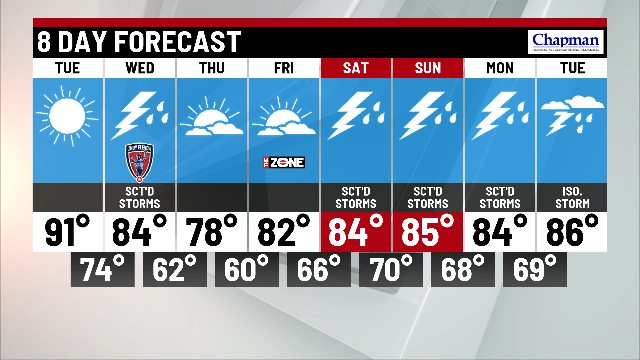
One more hot day with storms possible Wednesday

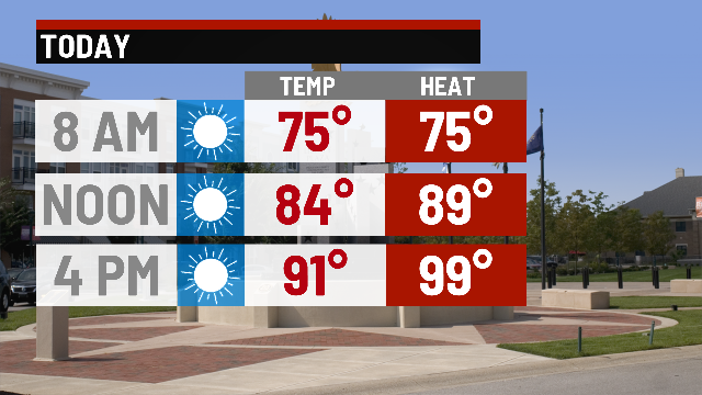
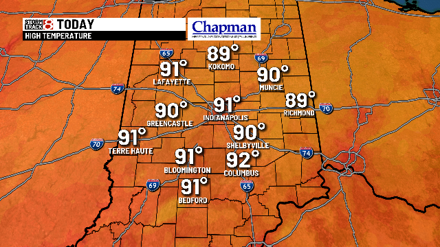
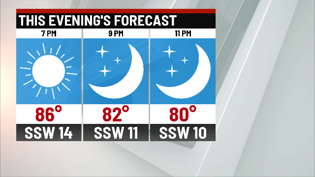
Yesterday was the 29th day with highs in the 90s! It’ll be another hot and muggy day with highs in the lower 90s and feel like temperatures in the upper 90s and lower 100s once again. Lots of sunshine for today as well. Mostly clear and quiet throughout the overnight with temperatures still uncomfortably warm with lows in the mid 70s.
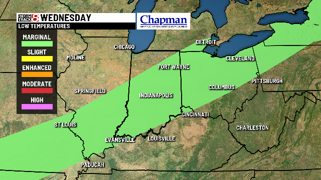
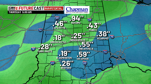
A cold front will sweep through during the day tomorrow sparking up round of storms through the day. The morning commute could be soggy for some but not all with an isolated shower chance possible. A better chance of showers and storms develop during the later half of the morning with the possibility of strong thunderstorm. A Marginal Risk of strong to severe thunderstorms possible during the afternoon main threats being damaging winds and hail. Highs during the afternoon will top out in the mid 80s.
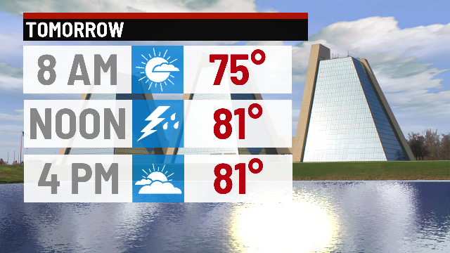
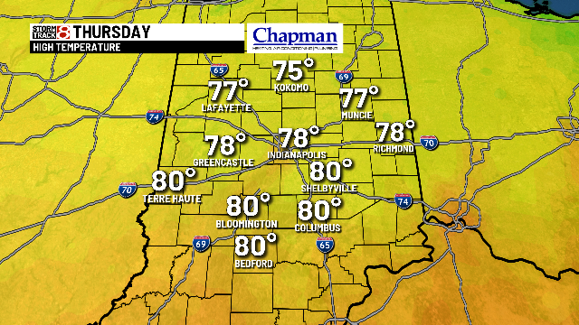
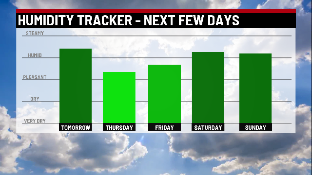
After the cold front moves east it ushers in cooler and comfortable air! Highs in the upper 70s with low humidity during the day with mainly sunny skies! Temperatures will warm to the lower 80s by the end of the week with rising humidity.
Labor Day weekend for now looks to be welcomed in by scattered showers and storms with highs in the imd 80s.