


Quiet and cooler weekend; snow and cold next week
INDIANAPOLIS (WISH) — Quiet weather will continue for the back half of the holiday weekend. An active pattern could bring our first accumulating snow of the season, with colder temperatures to follow early next week.
Saturday:
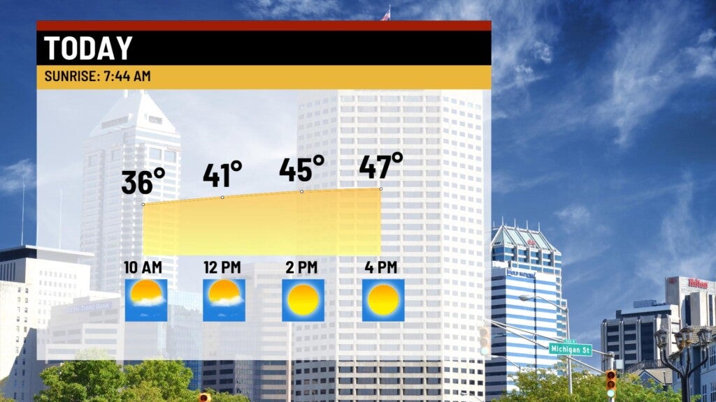
High pressure keeps us quiet and slightly colder Saturday. Expect mostly sunny skies with highs in the upper 40s Saturday afternoon.

Saturday Night:
Conditions will be clear and seasonably chilly. Lows will fall to the lower 30s.

Sunday:
Increasing clouds through the day, but the daytime hours should be dry. The next system will arrive late Sunday night bringing a chance of rain showers just before midnight.


Highs will top out in the upper 40s.
Snow maker?
A system moving in late Sunday night into Monday will be meshing with another upper level wave, along with some much colder Canadian air. We expect a change from rain to a rain/snow mix early Monday morning, and changing to all snow through much of our Monday. Surface temps just above freezing, along with warmer ground temps should limit snow accumulations across much of the state – however, snow could come down hard enough to provide some accumulation – especially in the eastern portions of the state.


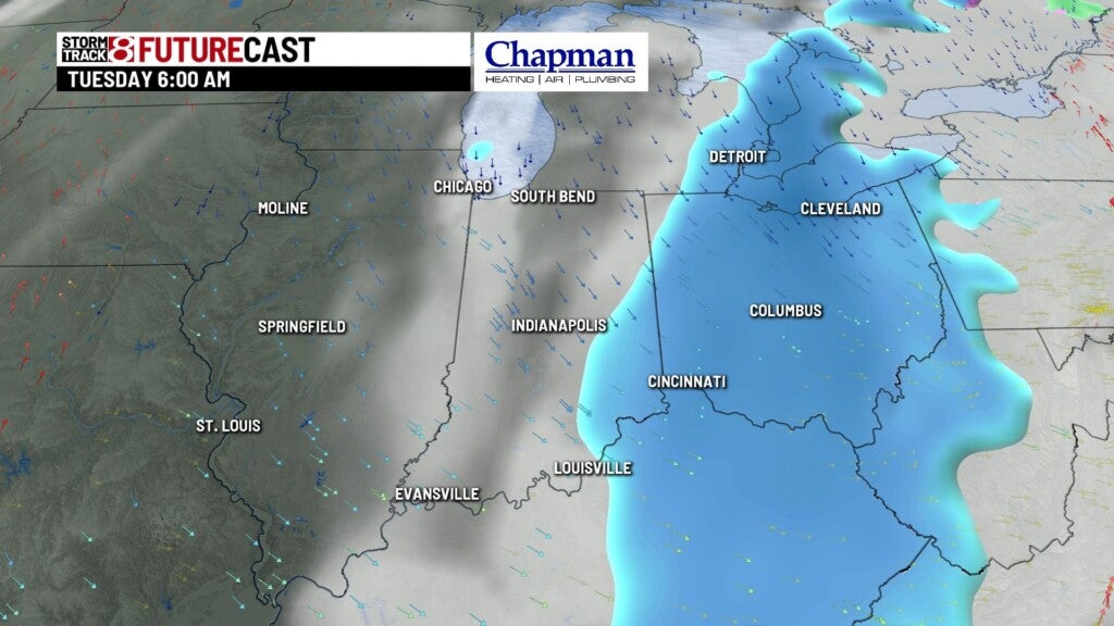
Here’s the early thinking on snowfall accumulations for Monday into Tuesday.

In addition, expect some pretty blustery winds Monday afternoon, with gusts over 40 mph at times.
8 day forecast:
Much colder air settles in starting Monday. Highs stay in the 30s through Wednesday, with a slight warm up, but still well below average highs Thursday into the weekend.
