Rain and snow showers continue Sunday
INDIANAPOLIS (WISH) — Main batch of accumulating snow will move out this morning, with scattered rain and snow chances possible over the next few days.
- Interactive radar | Live blog | Closings and Delays | Storm Track 8 weather app
- Send your snow photos to WISHWeatherpics@wishtv.com
- Check the Indiana Travel Advisory map
Sunday:
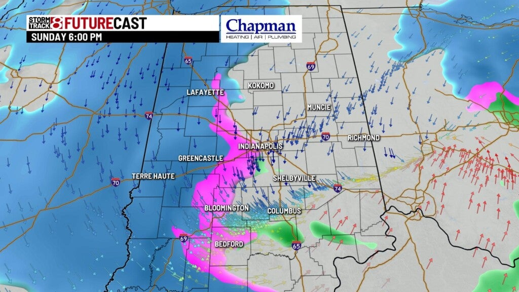
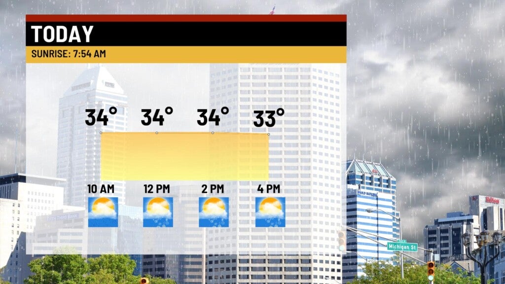
Area of low pressure responsible for the quick shot of accumulating snow Saturday night will be overhead today. With slightly warmer air coming in ahead of the low, expect mostly rain showers, mixing with snow at times for much of the morning. On the back end, colder air will surge in behind the low, and allow for a changeover to snow for the afternoon hours. Snow should be relatively light, limiting accumulations of less than one inch for most of the area, with a few outliers receiving around one inch.
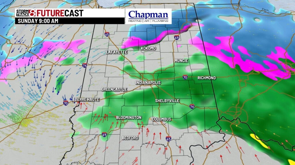


Highs top out in the middle and upper 30s this aftenroon.

Sunday night:
Scattered snow showers continue. Again, we should see relatively light snow across the area, but enough to create slick spots on untreated roads.

Lows fall to the middle and upper 20s.

Monday:
Some lingering leftover flurries and light snow showers will be possible for much of the day, with little to no accumulation expected.

Highs top out in the lower 30s.


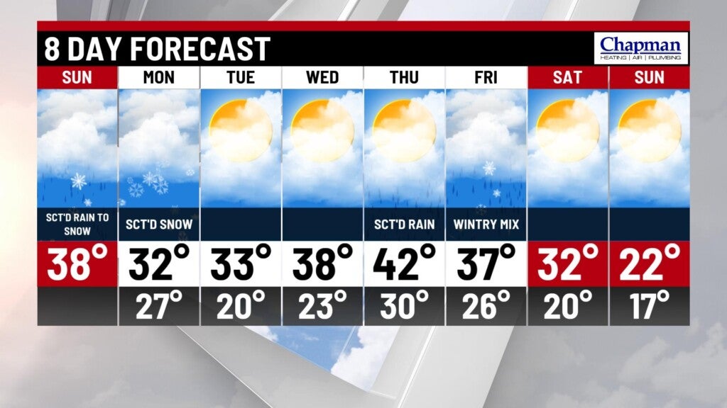
8 day forecast:
Quiet pattern for the mid-week, with partly cloudy conditions Tuesday and Wednesday and near normal temperatures. Brief warm up on tap on Thursday with our next system moving in, bringing rain to the area. Some changeover to a rain/snow mix or even snow will be possible on Friday, before much colder air settles in for the weekend.