


Rain and storms move in Saturday

INDIANAPOLIS (WISH) — Heavy rain possible for many, with a few strong storms possible south of Indianapolis.
Today:
Expect quiet and cloudy conditions for the first half of the day. A strong system moving out of the Central Plains moves in by the early afternoon, bringing showers to western portions of the state. Rain will fill in across the area for the rest of the afternoon.
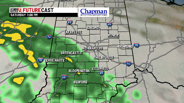
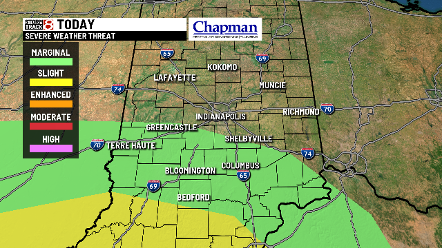
A few strong storms could be possible for our southern counties by mid to late afternoon. Damaging winds will be the primariy concern. An isolated tornado can’t be ruled out, although the higher tornado threat will be well to the south of Indiana, where many areas are under an enhanced risk for severe weather. Closer to home, much of the southern half of the state is under a marginal risk.


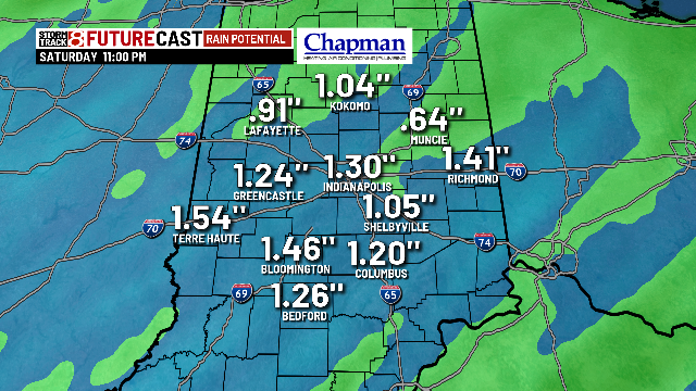
Many areas could be looking at over an inch of rainfall before the system moves out this evening.
Highs Saturday should make a run to the lower 50s for many.

Tonight:
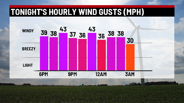
Rain will pull away. In the wake of the system, strong winds are expected, along with quickly cooling temperatures. Wind gusts could exceed 40mph at times.


Sunday:
Dry and windy day on tap. Winds should start to diminish heading into the afternoon and evening hours. Numbers will be much cooler as well, but closer to normal for this part of the year.

8 day forecast:
Quiet start to the work week with near normal temperatures. Big time warm up by mid-week, with highs in the 60s both Wednesday and Thursday with chances for rain and storms. Windy day on tap for Thursday as a strong frontal system moves through. Temperatures return back to near normal levels for the end of the week into the weekend.
