Saturday Night Weather
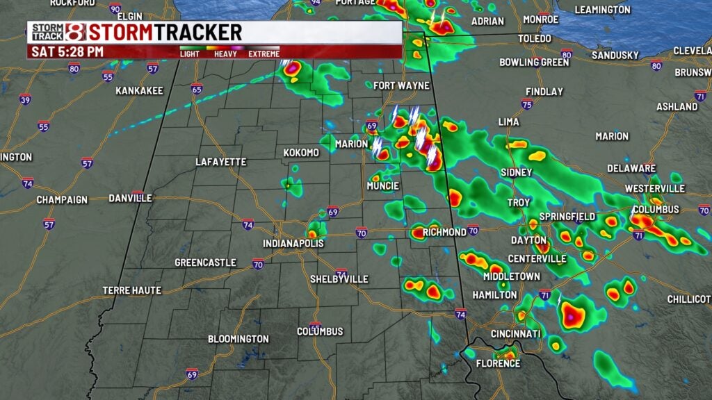
An interesting weather situation developing late today. As we talked about yesterday, some scattered showers have popped up in northeast Indiana and Ohio. These showers are moving from the northeast to the southwest towards Central Indiana. The scattered showers will diminish after dark. Then very warm and dry weather expected the rest of your weekend.
Tonight – Showers fizzling out and becoming partly cloudy. Low 64.
Sunday – Becoming mostly sunny and very warm again, but not too humid. High 87.
Monday – Mostly sunny and still warm but not too humid. High 86.
Extended Outlook (Tue-Sun) – A chance for scattered showers on Tuesday and then near normal temperatures the rest of the week. That means high temperatures near 80 and low temperatures in the upper 50s. A really nice week ahead.