Scattered storms to move in overnight

INDIANAPOLIS (WISH) — Another round of rain will move in after midnight Tuesday.
Warmer temperatures will move in later this week.
Tuesday night:
Scattered showers will hang around for the early evening. A weakening line of storms will enter into the state well after midnight.


While we aren’t anticipating numerous severe storms, there could be a strong storm or two, especially in our western counties.

A line of showers and storms will continue to march through the state as we approach daybreak.

Temperatures should hold pretty steady, if not rise a bit overnight, hovering close to 60 degrees.

Wednesday:
Scattered showers and storms will hang around through mid to late morning. Much of the afternoon should be dry and much warmer, with highs returning to the lower 80s.


Thursday:
It will be heating up with some higher humidity values. With both in place, along with a stalled-out front camping out across the state, look for a few isolated showers and storms to develop with the heating of the afternoon.

HIghs will top out in middle 80s

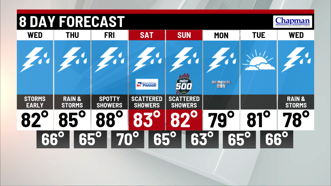
8 day forecast:
Here are daily rain chances from Friday through the Memorial Day holiday: The best rain chances look to be on Monday. Many of the rain and storm chances likely will come with daytime heating in the afternoons Thursday through Sunday. Temperatures will be hitting the middle to upper 80s for much of the holiday weekend.