Snow returns Thursday

INDIANAPOLIS (WISH) — Another round of snow could leave the area with some lighter accumulations.
Tonight:
Relatively quiet conditions rolling into the overnight. Expect a mainly clear to partly cloudy sky, with lows in the upper teens.

Thursday:
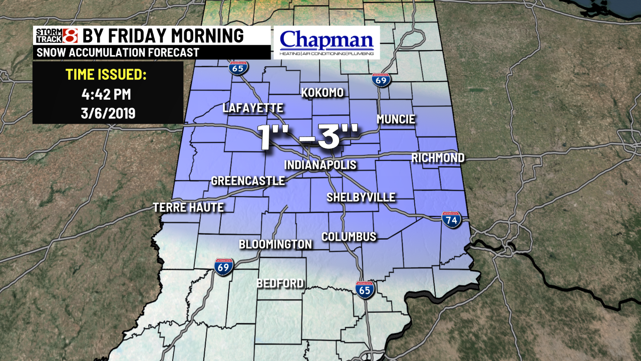
Expect clouds to be on the increase thorugh the morning. Quick hitting system moves in from the northwest by the afternoon and evening hours. We may initially start off as rain, or a rain-snow mix, before changing to all snow by the late afternoon and evening hours. Snow will continue into the overnight and into the Friday morning commute.


Expect a general 1- to 3-inch swath across much of our state, with lighter amounts in our far southern most counties. The Friday morning commute could be a bit messy, so please give yourself extra time heading to work and school.
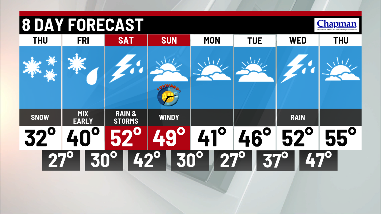
8 day forecast:
A bit of a pattern flip on tap as warmer air slides into the area for the weekend. After Friday morning snow, we should dry out for the afternoon with highs near 40. A potent system moves in for the weekend, bringing rain, wind and even a few thunderstorms to the area by Saturday afternoon and evening as high temperatueres surge to near 50. Winds will continue to crank on Sunday. Relatively quiet weather settles in, with near normal temperatures for the start of the workweek.