


Storm chances return Saturday evening
INDIANAPOLIS (WISH) — A brief relief from the high heat this weekend, with needed rain chances coming our way Saturday evening into Sunday.
Today:
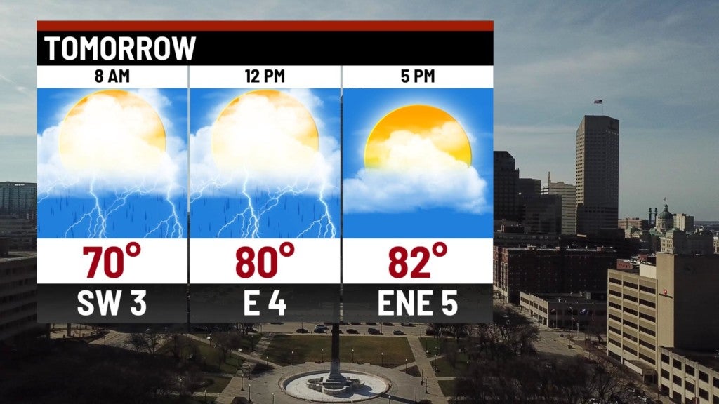
Dry start to the day with mostly sunny skies. Clouds will build this afternoon. An upper level wave coming in from the northwest will bring scattered showers and storms to the area by late this afternoon.

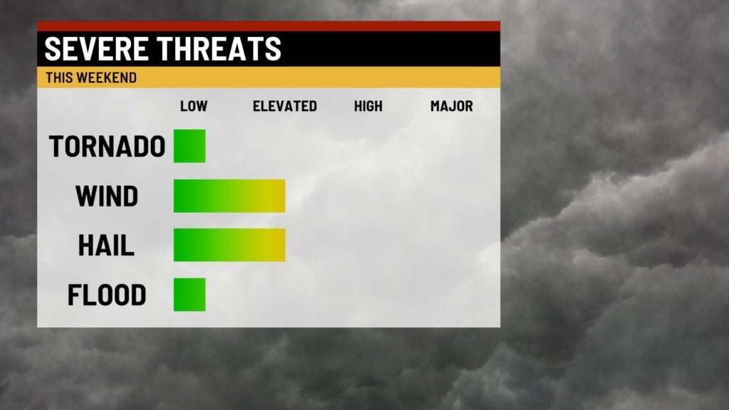
There is a marginal risk for severe storms for the western half of the state. Damaging wind and large hail are the primary threats.

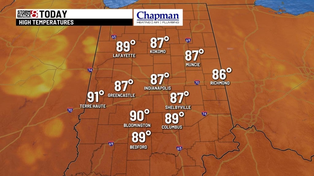
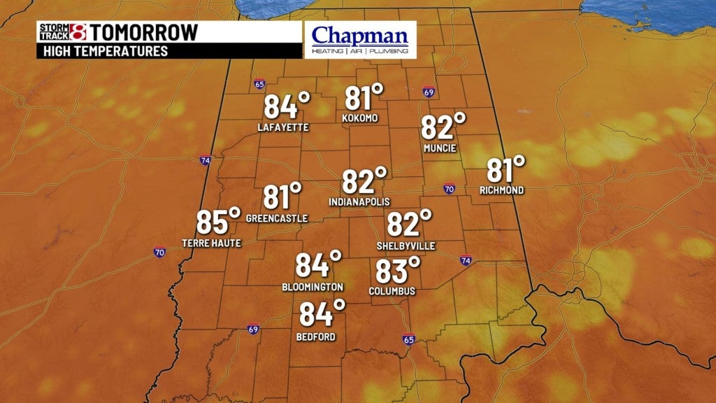
Highs top out in the middle to upper 80s this afternoon.

Tonight:
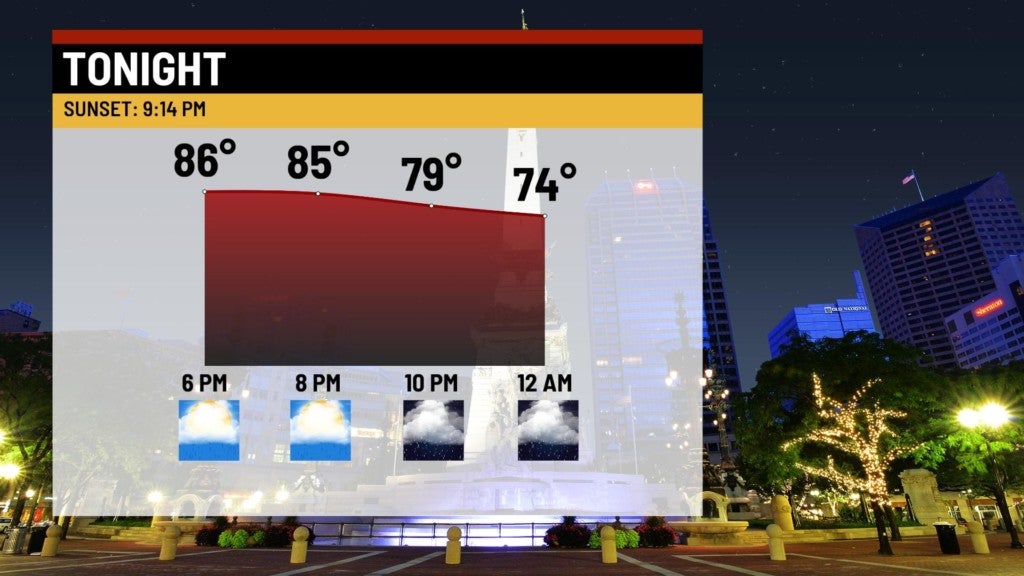
Scattered storms will continue to march east through the evening. With the loss of daytime heating, storms should weaken as the move into eastern parts of the state, and wind down during the overnight.

Lows fall to the upper 60s and lower 70s.

Sunday:
Frontal system will move through the state sparking showers and storms for the first half of the day. A few storms in the south could be on the strong side.
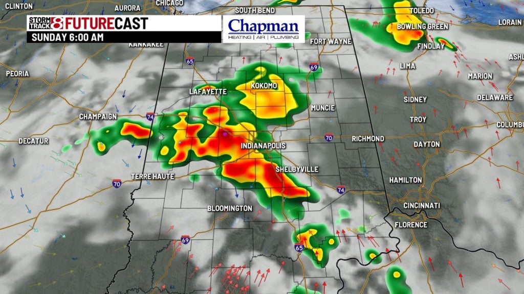
Expect partly cloudy conditions and less humid air for the afternoon hours. Highs top out in the lower 80s.
8 day forecast:
Quiet start to the work week, with highs in the mid to upper 80s Monday and Tuesday. Highs heat looks to return starting Wednesday, with several more days of 90° temperatures, and heat indices over 100° potentially for the end of the week into next weekend.


