


Storms return to central Indiana Sunday

INDIANAPOLIS (WISH) — A few storms could be strong to severe this afternoon.
Sunday:
A couple rounds of rain and storms will work into the state Sunday. The first wave will be a non-severe event, and it is slated to impact much of central Indiana from mid morning to early afternoon.

The second wave will be our threat for severe storms. A strong cold front pushing through the area will provide a potent line of storms to swing through the state by mid afternoon through early evening.
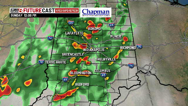
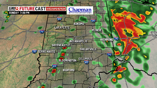
As of now, all modes of severe weather are in play. Damaging winds will be the primary concern, but hail and a few tornadoes can’t be ruled out.


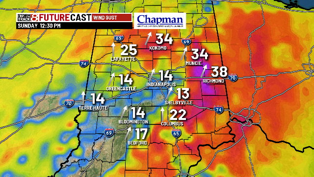
In addition to the severe threat, non-thunderstorm winds will also be quite high gusting over 40 mph at times Sunday afternoon.
Highs will top out in the middle 70s this afternoon.

Sunday Night:
Rain will push out of the area late Sunday night. We can expect mostly cloudy skies with slightly cooler temperatures. Lows will dip to the lower 50s.

Monday:
It will be a cool and quiet start to the work week. Highs will top out in the middle 60s with a mix of sun and clouds.

8 day forecast:
Temperatures will quickly warm up through the week. We can expect highs to return to the 80s starting Wednesday. Scattered storm chances will move in for Wednesday into Thursday, with a slightly better chance Friday into Saturday.
