Two rounds of wintry precipitation
INDIANAPOLIS (WISH) — Active pattern will provide a few chances for rain, snow and freezing rain over the next few days.
Saturday:
An upper-level system moving into the Midwest will continue to march into our state. Clouds will continue to build. Thanks to very dry air at the surface, we likely will hold off on any precipitation hitting the ground until mid-morning. Expect a few light snow showers with little to no accumulation for the northern half of the state. Scattered light freezing rain showers will be possible for the southern half of the state through early to mid-afternoon.
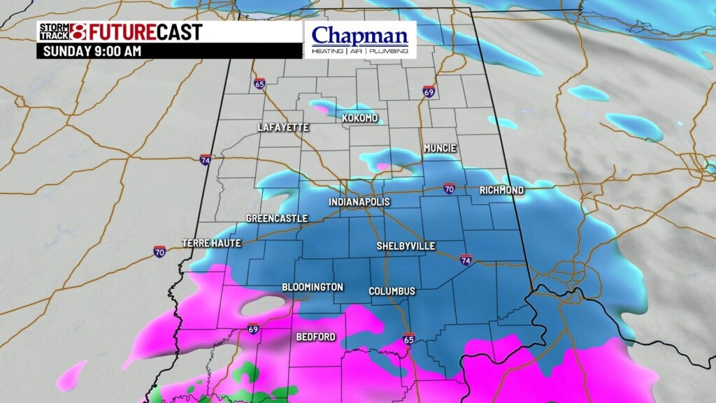

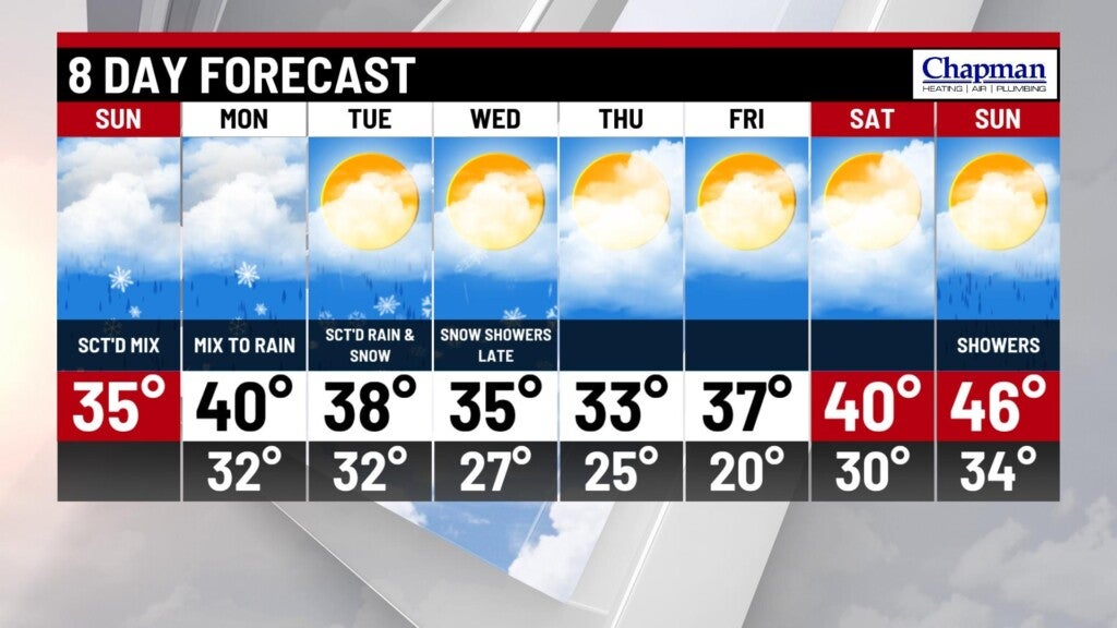
Highs will top out in the mid-30s.


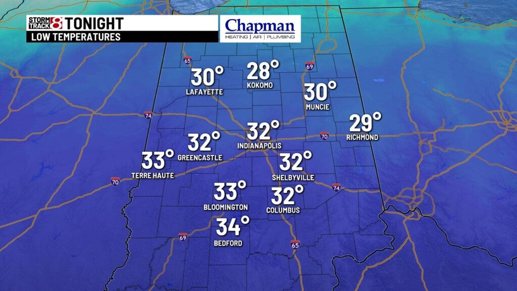
Saturday night:
Relatively quite conditions under cloudy skies this evening into the overnight. Lows fall to the lower 30s.
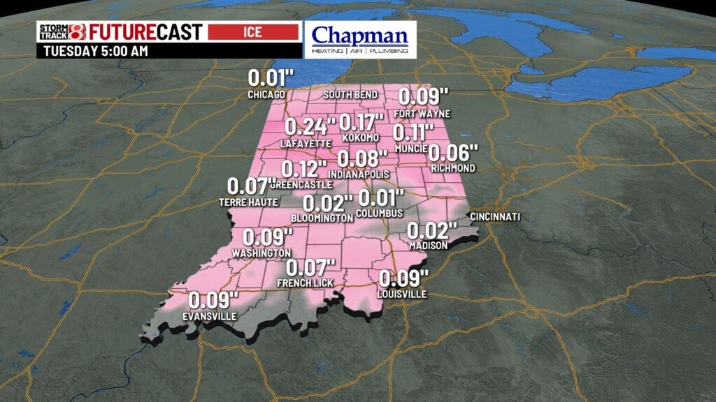
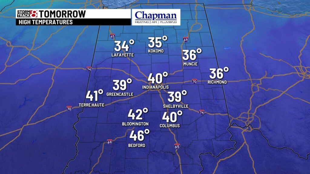
Monday:
A more significant storm system will invade the state as early as Monday morning, providing rain showers initially. As the system continues to push north, will likely see a thin band of snow and ice setting up for the northern half of the state. The system will continue through much of the daytime hours, Monday. The main chunk of precipitation should exit by Monday evening, with snow showers hanging around for the northern third of the state through Tuesday morning.


Highs top out in the upper 30s to around 40°.

8 day forecast:
Another system will bring scattered snow showers to the area on Wednesday. We’ll dry out for the remainder of the work week into the weekend, where temperatures will warm to the 40s for Saturday and Sunday.