Warmer end to January, colder February ahead

INDIANAPOLIS (WISH) — After a brief blast of cold air it looks like temperatures will stay above normal through the end of the month.
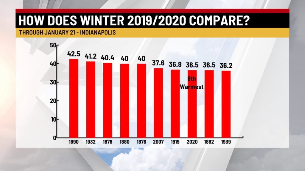
It’s been a relatively warm winter so far. In fact this winter is the eighth-warmest start to winter on record in Indianapolis.
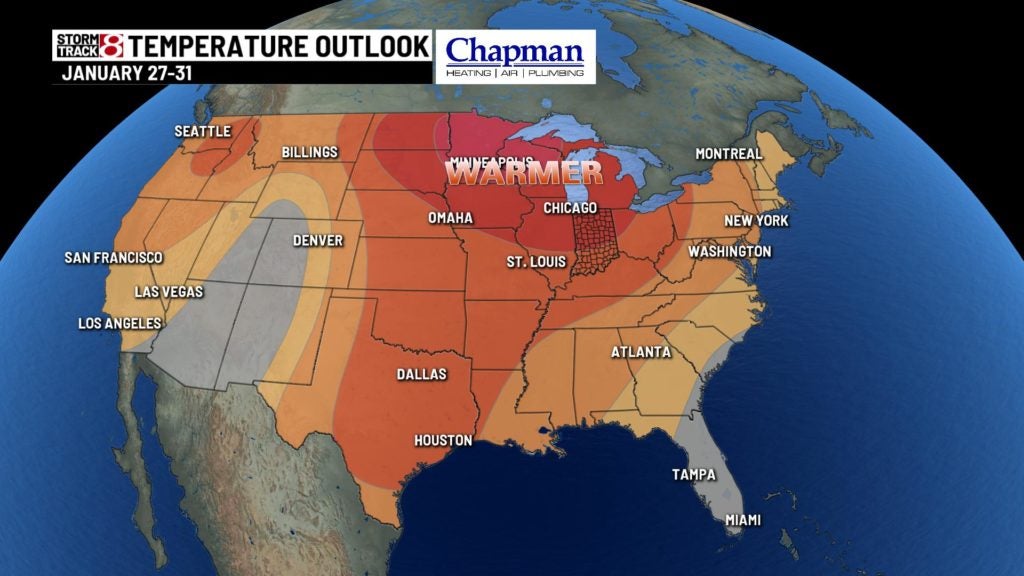
The 6-10 day outlook from the Climate Prediction Center has much of the country with above normal temperatures. This is due to the modified Pacific air in place across much of the United States. Above normal precipitation is also expected through the central plains and southern states. This above normal precipitation threshold does extend into parts of Indiana as well. The overall confidence in this forecast is high. So it looks like we’ll end the month with above normal temperatures and the chance for above normal precipitation in Indiana too. Normal highs for this time of year in Indianapolis are in the middle 30s. We’ll see readings into the upper 30s and even 40s during the next 10 days.
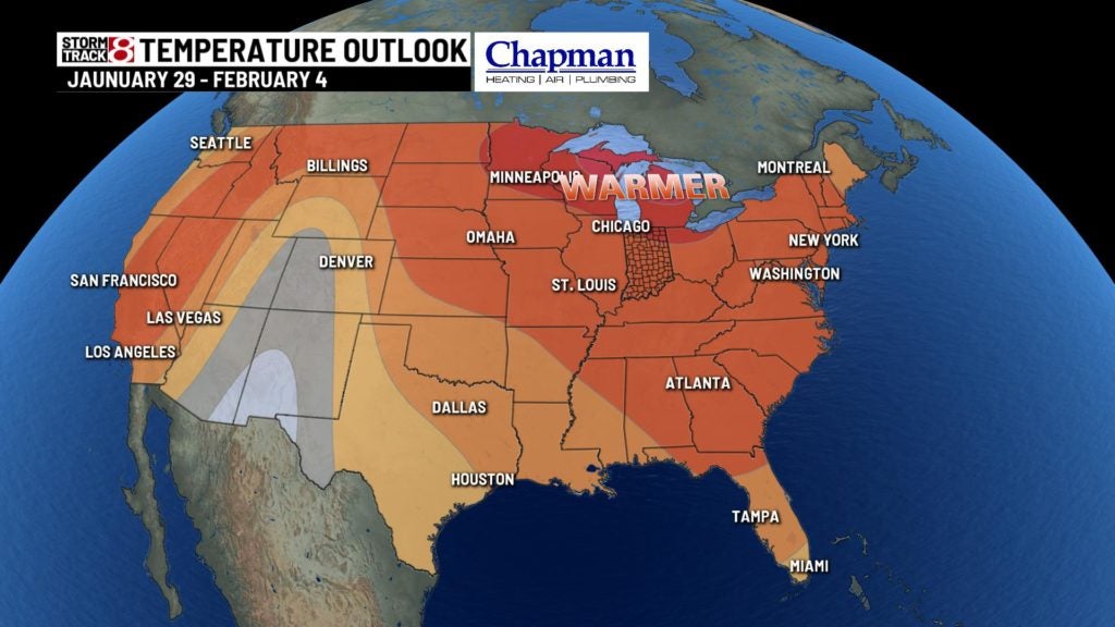
Looking at the following week, above normal temperatures will continue. Much of the Great Lakes and central part of the US will see above normal temperatures and precipitation. There will be a quick westerly flow in the upper levels of the atmosphere from the west coast tot the Great Lakes ushering in the above normal temperatures. A few storms will move through during the 8-14 day time period and with the Gulf of Mexico moisture pushing north above normal precipitation will be likely. The Climate Prediction Center feels the confidence in the forecast is near average.
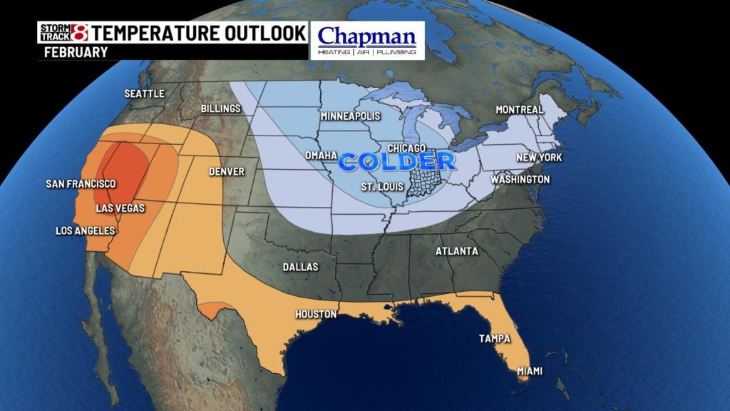
As far as February goes it looks like this is when we could see some real winter like weather. Below normal temperatures are expected for much of the Great Lakes. There’s a good signal suggesting precipitation would be below normal for much of Illinois and Indiana. So while we may see colder temperatures for February, it may not bring significant amounts of snow with it.