


Wind advisory Sunday
INDIANAPOLIS (WISH) — Windy conditions will wrap up the weekend with cooler temperatures over the next several days.
Sunday:
Showers and storms will continue to move out of the state. A tightly wound up storm system will continue to push through the Midwest. As a result, clouds will hang around, along with strong winds. A Wind Advisory will be in effect until 8 p.m. Sunday, as wind gusts could reach up to 50 mph at times Sunday.


Temperatures will fall to the upper 40s through lunchtime, before rebounding into the upper 50s later this afternoon.

Sunday Night:
Clouds will decrease as winds gradually relax. Temperatures will turn colder, with overnight lows falling to the lower 40s.

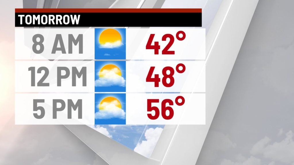
Monday:
It will be a dry start to the week, with a mix of sun and clouds with near normal temperatures. Highs will top out in the middle 50s.
8-Day Forecast:
Weather will be quiet for much of this work week, with near normal temperatures for the most part. The exception will be Tuesday, as a storm complex will move just to our south, allowing for chilly highs in the middle and upper 40s Tuesday afternoon. Next best chances for rain will return next weekend.
