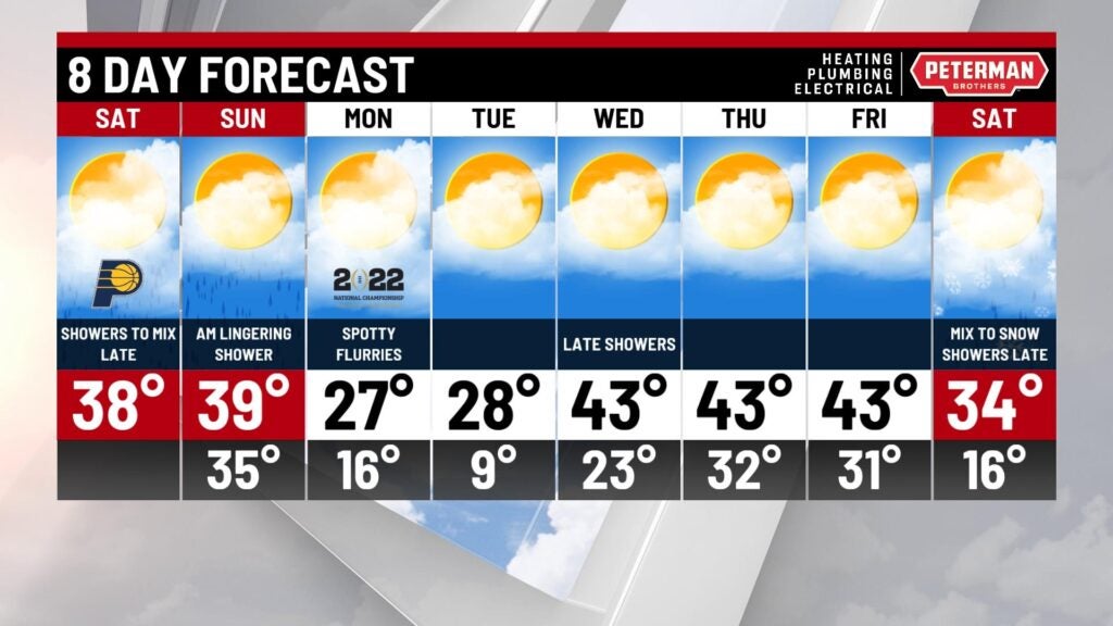
An active start to the weekend
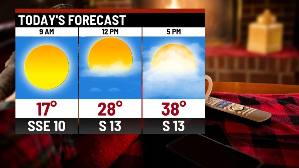
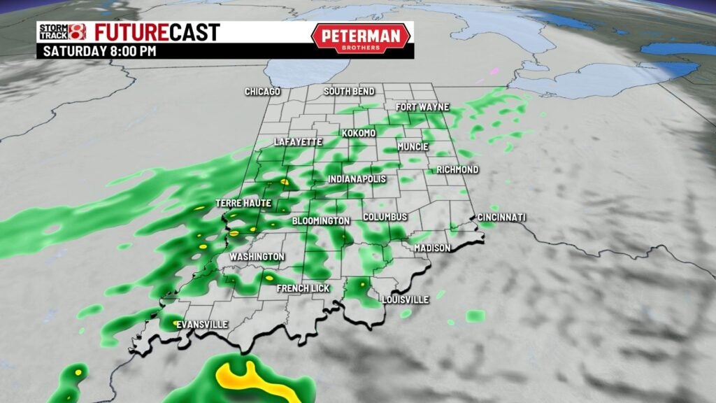
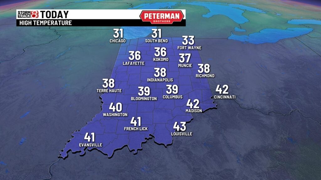
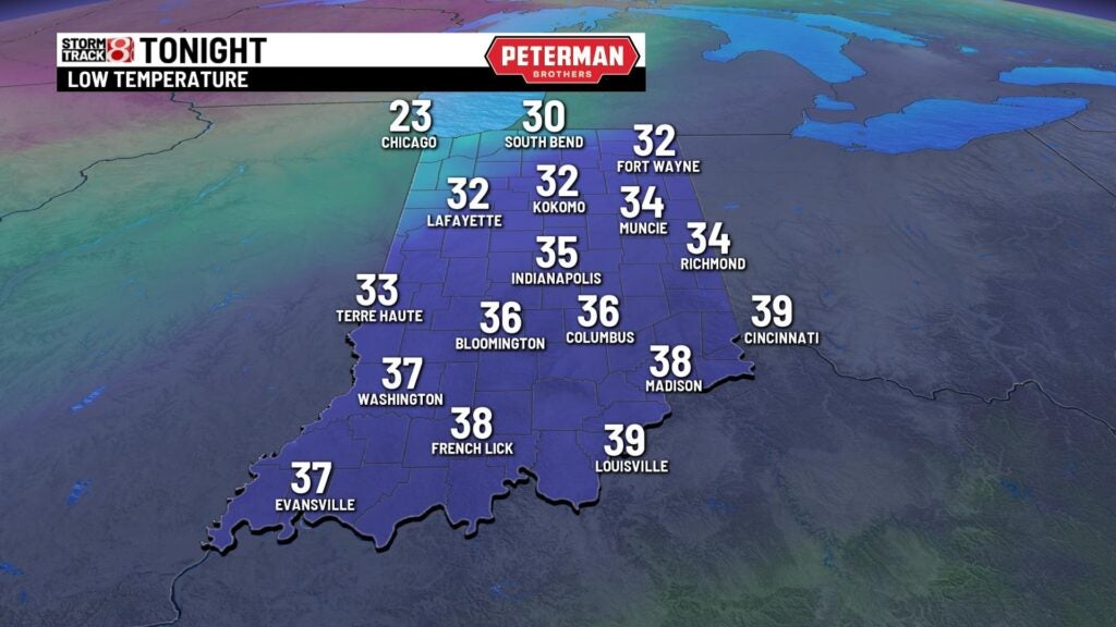
INDIANAPOLIS (WISH) — The weekend is off to a cold start with temperatures in the lower teens and feel like temperatures in the single digits. We will see a nice warm-up today with highs reaching the upper 30s and an increasing number of clouds. That will be associated with our next cold front. This will bring light rain as early as 6 p.m. with a light wintry mix north of the city. We could see some light ice accumulation, which will create slick roads late tonight and overnight in northern Indiana. Showers become more numerous late tonight and overnight with lows in the mid 30s.
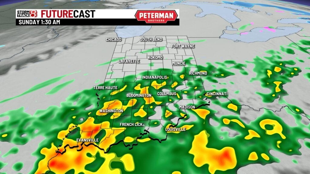
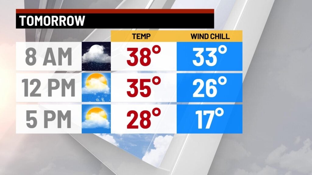
Early Sunday we could see a light wintry mix possible, but most of the rain and mix should move out just before noon. Highs will tumble through the day ending the afternoon in the mid teens.
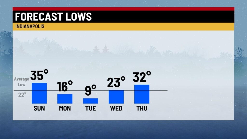
It’ll be a cold start to the workweek next week with highs in the mid 20s and mostly sunny skies. There could be a few light flurries around as well. Temperatures will begin to trend warmer through midweek with highs in the mid 40s through the end of the week.