Cloudy and chilly end to the weekend
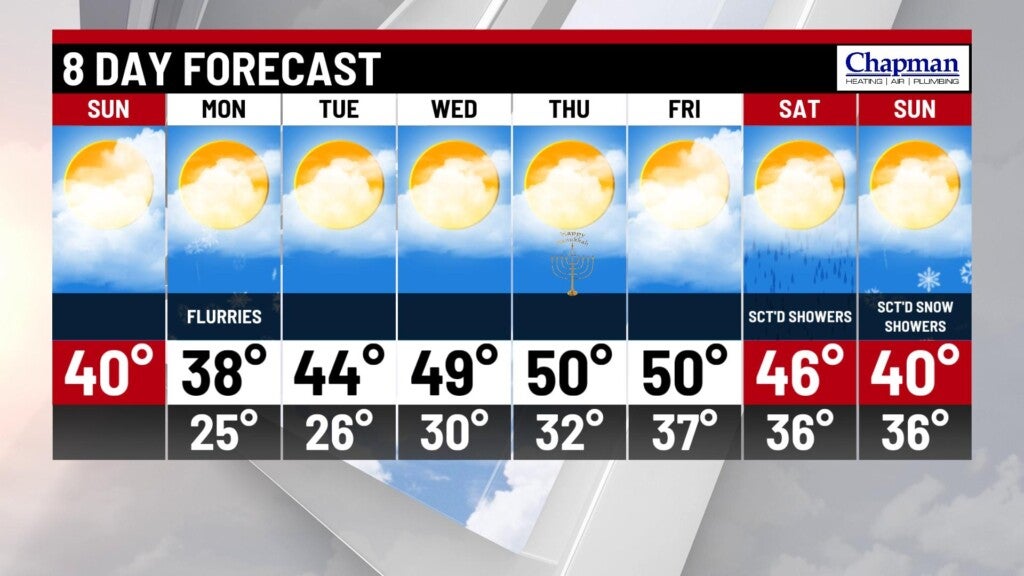
INDIANAPOLIS (WISH) — Slightly below average temperatures on tap for Sunday, with flurries returning to parts of the state on Monday.
Sunday:
An area of low pressure moving through the Midwest will bring more cloud cover to our state. As a result, we’ll likely see high temperatures a few degrees cooler compared to Saturday. Highs top out in the upper 30s to around 40° this afternoon.


Sunday night:
Mostly cloudy and quiet conditions, with seasonably chilly temperatures. Lows fall to the middle 20s.


Monday:
Another upper level wave moves through the state Monday morning. Not much moisture associated with this system, but could be enough for a few flurries to fly early Monday morning – certainly not enough to cause any traffic concerns for the commute. Highs top out in the middle to upper 30s.


8 day forecast:
Quiet pattern shakes out for the remainder of the work week, with a nice warm up on tap. 40s will return starting Tuesday, and we should see numbers flirting with 50° for Wednesday and Thursday.

Next weather maker arrives next weekend, with the chance for rain on Saturday, and some lingering light snow showers on Sunday.