


Cold Saturday, warming begins Sunday
INDIANAPOLIS (WISH) — Another day of very cold temperatures before a welcomed warm up moves into the state over the next several days.
Saturday:
A few flurries will be around for the morning hours, amounting to a dusting at worst for isolated areas. The rest of the day will be a mostly cloudy and chilly day, with highs in the upper 20s. Wind chills will be in the teens much of the day.


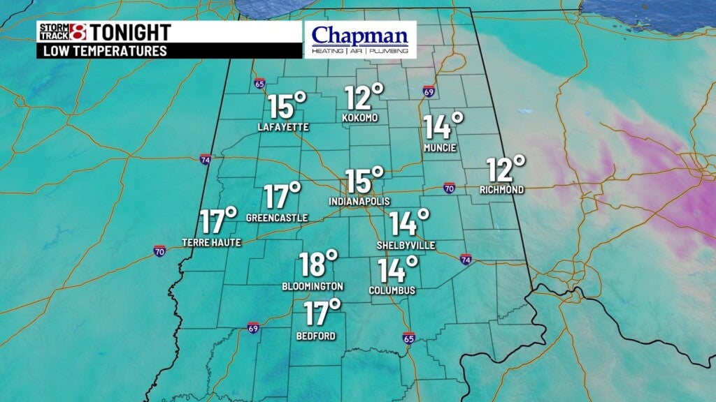
Saturday night:
Mostly cloudy and quiet. Lows fall to the mid-teens.
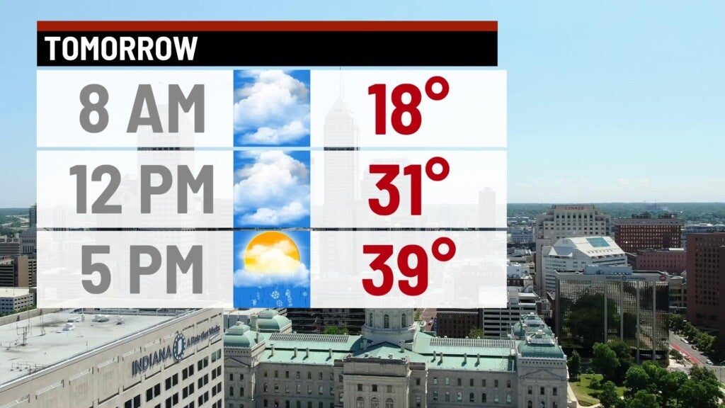
Sunday:
Mostly cloudy conditions on tap for a majority of the day. We should warm nicely, with highs in the upper 30s to lower 40s by the afternoon.

The next storm system will move in Sunday night. We should be warm enough across a majority of the state for this to be mainly rain. The concern will be the frozen ground, which could cause some icing concerns overnight.
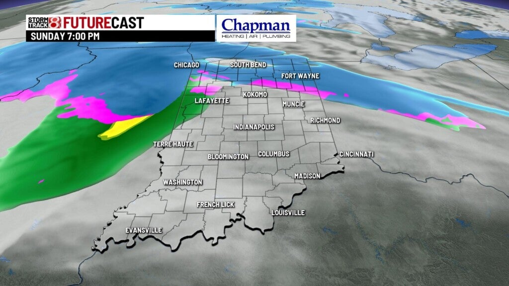

At the tail end of the event near daybreak Monday, we could see some light freezing rain or snow – with little to no accumulation expected.
8 day forecast:
Warm up will continue through the week, and our significant snow pack across the area should start to slowly melt over the coming days. Highs flirt with 40° on Monday, and should jump into the middle 40s for Tuesday and Wednesday. Pattern should be relatively quiet for much of the weekend with near normal temperatures heading into next weekend.
