


Cooler and windy Sunday
INDIANAPOLIS (WISH) — Rain moves out this morning, opening the door to much cooler temperatures and blustery winds this afternoon.
Sunday:
Cold front continues to march through the state. Some leftover showers should work out of the area by mid-morning. Clouds will hang tough through much of the morning, gradually clearing by the afternoon hours.

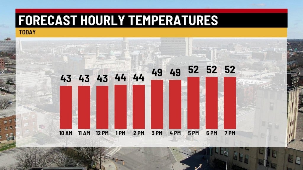
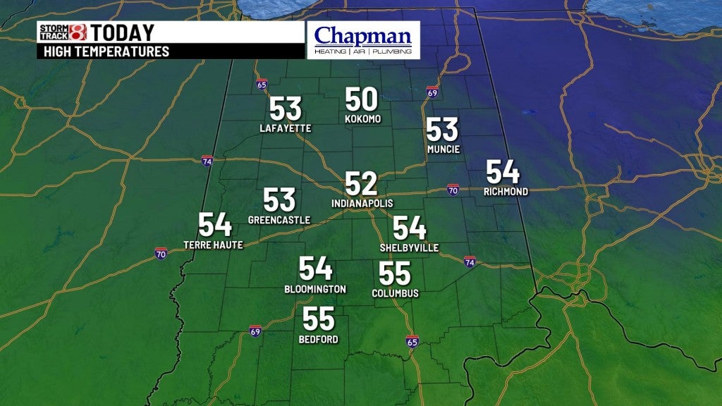
Temperatures will struggle, hovering in the lower 40s for the morning hours, and finally sneaking into the lower 50s with some afternoon sunshine.
Strong northwest flow bringing the cooler temperatures will also provide gusty winds between 25-30mph, with locally higher gusts possible through the day.

Sunday night:
Mainly clear conditions, with winds calming gradually overnight. Temperatures will much be much colder, with lows falling to the upper 20s and lower 30s.

Monday:
Much nicer day on tap, with sunny skies and warmer temperatures. Highs top out in the upper 50s and lower 60s.


8 day forecast:
Mild and windy day on tap for Tuesday ahead of another cold front, which will bring another round of showers to the area by Tuesday night into Wednesday morning. Colder air files in behind the front behind a strong northwest flow starting Wednesday. As a result, well below average temperature are slated for Wednesday through Friday, where highs will hover into the 40s, possibly struggling to hit 50° on Friday. Temperatures look to rebound heading into Easter weekend.
