


David’s Saturday Evening Weather Update
The end to our recent mild and rainy weather will be coming to an abrupt end tonight. Cold winter-like temperatures and even some snow showers or snow flurries are possible late tonight and early Sunday. There could be some slick spots on roads and sidewalks so be careful if you are headed out Sunday morning.
Sunday – Snow showers or snow flurries possible in the morning. Then drying out but staying cold. 27 Sunday morning and only 31 for a high Sunday afternoon. And with a brisk northwest wind it will feel like the 20s all day.
Monday – Sunshine returns but temperatures stay very cold. A low of 14 Monday morning and a high of only 32.
Tuesday – Mostly sunny and not quite as cold. 23 Tuesday morning and high 50 Tuesday afternoon.
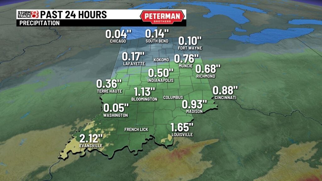
Heavier rain came through central Indiana earlier Saturday. By evening, the rain was less intense and moving to the east.

After all day rain on Saturday, it amounted to about 1/2 to 3/4 inch in central Indiana and more than 1 inch in southern Indiana.
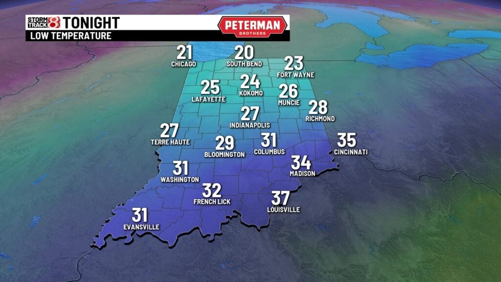
Now that the rain will be moving out tonight, colder air will be moving in. Many areas down to the upper 20s by early Sunday morning.

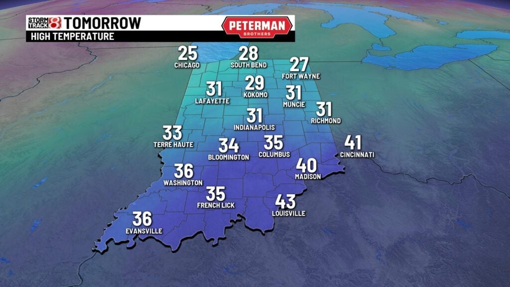
The significant snow stays to our north as the weather system moves out Sunday. However, we may see some light snow showers or snow flurries Sunday morning.

Cloudy skies and a brisk northwest wind will keep the temperature from rising above the low 30s in central Indiana on Sunday.
With those early morning temperatures below freezing and some light snow showers, there could be some slick spots on roads and sidewalks on Sunday. Wind chill temperatures in the low 20s all day.

8 Day Outlook – Thursday a chance for light snow as anther cold front moves through. That leads to the coldest weather so far this winter. Lows of around 10 Friday and Saturday.
