


Rain chances returning by midweek
INDIANAPOLIS (WISH) — We kicked off the new workweek with a mix of sun and clouds with near normal temperatures.
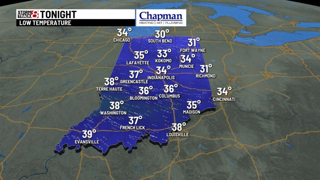
Monday night: Skies will be mainly cloudy by the overnight hours with near normal low temperatures. Lows will dip into the low to mid 30s.
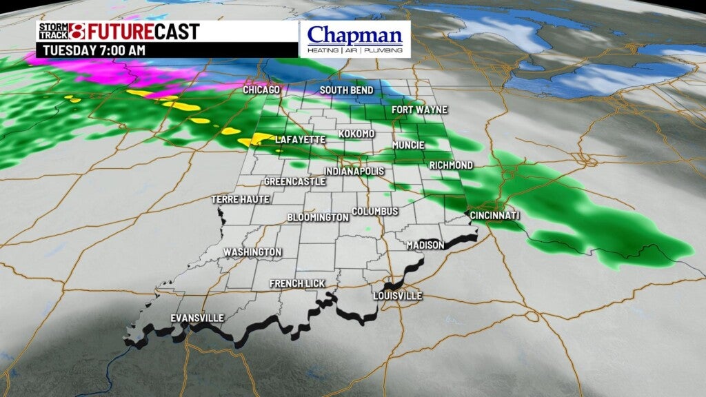
Tuesday: We may see some mixed precipitation move in early Tuesday morning for areas north of interstate 70, and then it will changeover to rain. Once that moves out by early afternoon at the latest, we will be left with mainly cloudy skies ahead of our next main weather system. This system will begin pushing rain showers into the state as early as very early Wednesday morning.
Highs will top out in the mid to upper 40s.

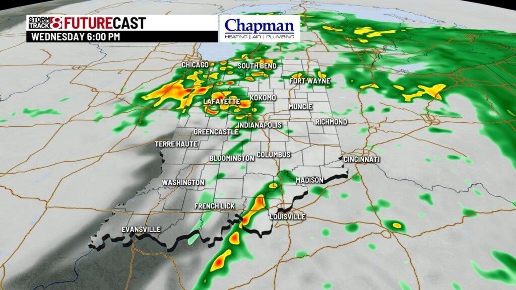
Wednesday: Have the rain gear handy as rain is likely through a majority of our Wednesday. Rain chances will slowly diminish as we work our way towards the end of the day. An isolated storm or two is not out of the question with a stronger storm possible in southwestern Indiana. Winds will also pick up early in the morning, becoming breezy by sunrise.


Highs will rise into the mid to upper 50s.

8 Day Forecast: After Wednesday’s system moves out of the state, we will be greeted with a calm and mostly cloudy Thanksgiving Day. Temperatures will remain above normal through the remainder of the workweek. Rain chances look to re-enter the forecast this weekend.
