


Rain moves in late, colder temperatures return Tuesday
INDIANAPOLIS (WISH) — Another round of showers move into central Indiana later Monday afternoon. Colder air will follow the rain for the middle of the week.
Today:
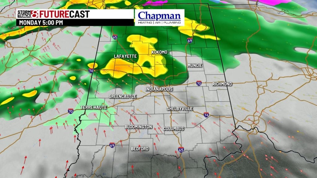
A cold front will move through the area this afternoon and evening, sparking showers across much of the area for the second half of the day. Look for increasing clouds through the morning, with scattered rain showers moving in during the early afternoon hours.


Highs today top out in the middle to upper 40s.


Tonight:
Widespread showers expected through the early and late evening hours, with rain tapering off deep into the overnight. The cold front should be well east of the area by daybreak on Tuesday.

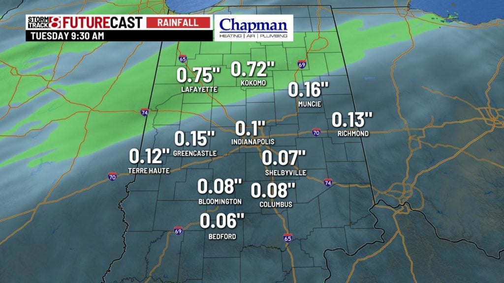
Total rainfall will range between 0.25″ to 0.50″ for much of the area, especially the northern half of central Indiana.
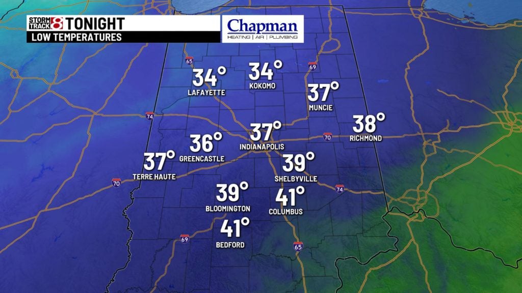
Temperatures should fall to the middle 30s overnight.

Tuesday:
Could see a few isolated showers early in the morning, but as previously mentioned, the cold front should be east of the state by daybreak, leaving most of the area dry.

We’ll be much colder through the day, with nearly steady temperatures hovering in the middle to upper 30s.

8 day forecast:
Another quick blast of colder air moves in for mid-week, with highs in the middle 30s for Wednesday, and only in the upper 20s/lower 30s for Thursday. We’ll rebound quickly starting Friday, with highs near 40°, and pushing well into the 40s and near 50° for Saturday and Sunday.
