Scattered snow Sunday
INDIANAPOLIS (WISH) — Another round of light snow continues across much of the state Sunday. Seasonably cold temperatures on tap for much of the work week.
Sunday:
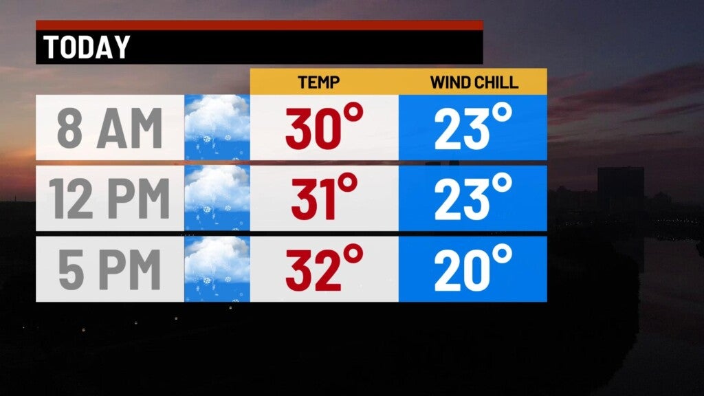
An upper-level system will continue to pump light snow showers into the state today. Expect fairly consistent snow starting by mid-morning, and continuing well into the evening. A few isolated areas of snow squalls will be possible, but few and far between.


Total accumulation should only range between half an inch, to an inch and a half when all is said and done. An isolated two inches can’t be ruled out. Treated roads should remain wet with road temperatures hovering around freezing much of the day.
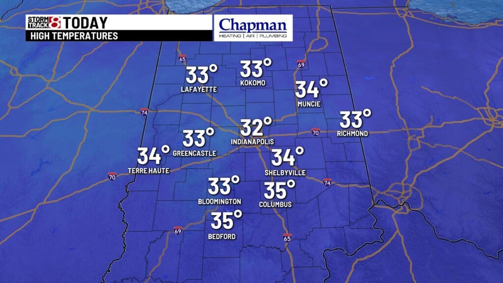
Highs only top out in the lower 30s this afternoon.
Sunday night:
Snow showers wrap up, leaving us with cloudy and chilly conditions. Lows fall to the middle 20s.

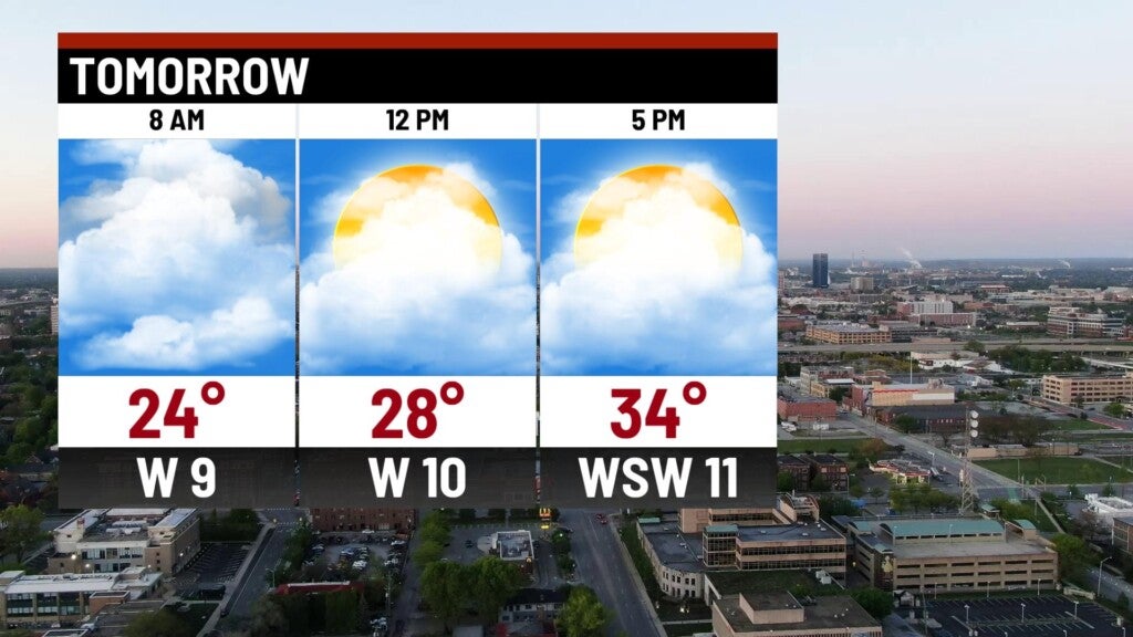
Monday:
Cloudy conditions through much of the day, with highs in the middle 30s.

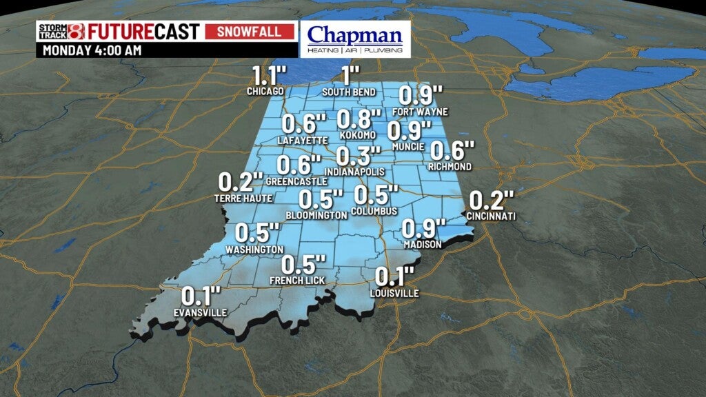
Quick-hitting system pushing into the state late Monday night will provide a brief wintry mix to the area, but should be well past central Indiana in time for the Tuesday morning commute. Any wintry impacts should be minimal to none.

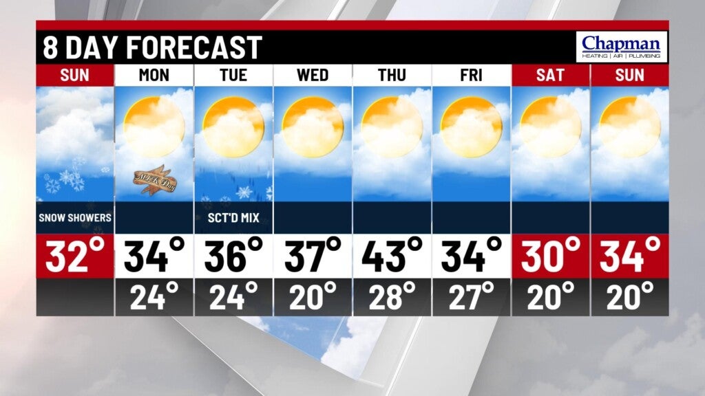
8-day forecast:
Quiet and chilly pattern ahead, with near-normal temperatures through Wednesday. A brief warmup into the 40s on Thursday, before seasonably chilly temperatures, return for the end of the week into the weekend.