Scattered storm chances
INDIANAPOLIS (WISH) — A couple of rounds of rain move through the area to start off the week. Meanwhile, a much welcomed cool down is waiting on us later this week.
Monday:
Some pop up showers and storms have already developed here this morning. Outflow boundaries from these storms will help to initiate more storm development through the late morning into the afternoon, especially for the southern half of the state.

Highs top out in the middle and upper 80s.


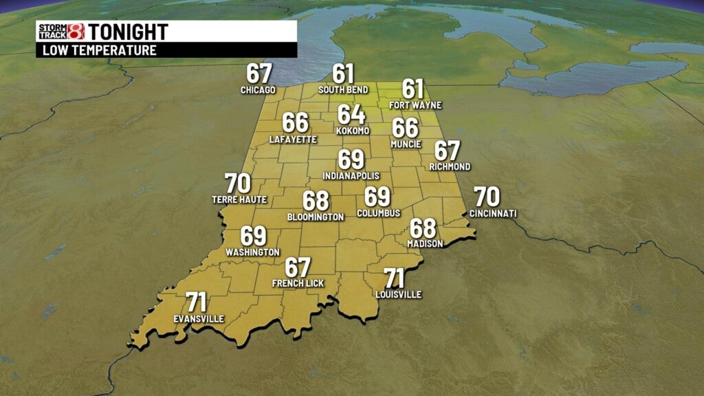
Monday night:
Cold front slowly moving through will cause scattered showers to continue for areas along and south of I-70. A few storms will be possible too.
Lows fall to the upper 60s and lower 70s.
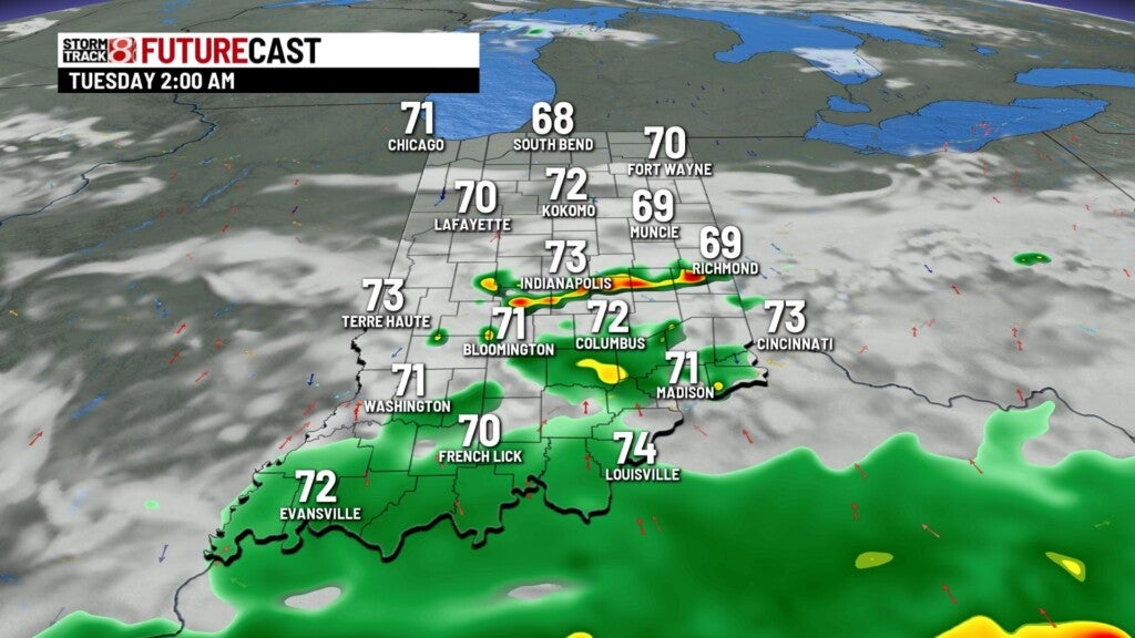
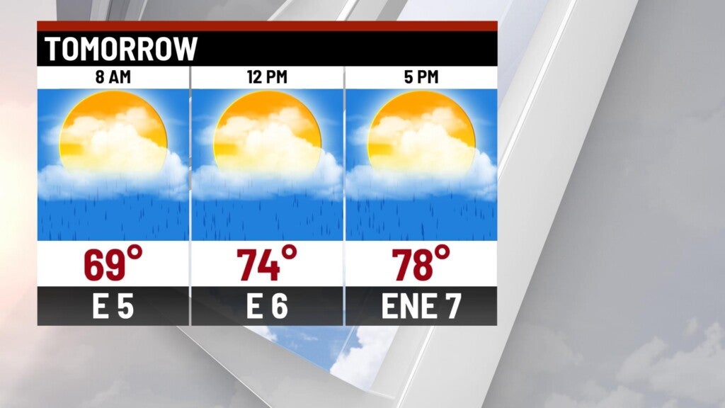
Tuesday:
Cold front will finally push through once the remnants of Ida pass to our south. Showers with a few rumbles of thunder should start to move out by Tuesday afternoon/evening. Areas south of I-70 could see between 1″-2″ of rainfall, so some minor flooding issues will be possible.


Cooler temps work in behind the front. Expect highs to only hit the upper 70s.
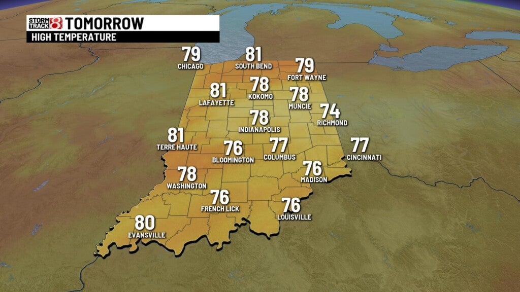
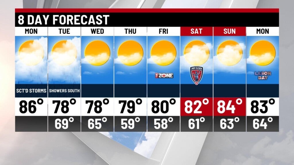
8 day forecast:
Refreshing air for the rest of the week as the pattern quiets down. Highs close to 80° through the end of the week with low humidity. Holiday weekend looks great! Dry weather wit highs in the middle 80s.