Smoky sky Friday, much needed rain this weekend
INDIANAPOLIS (WISH) — One more day of overhead wildfire smoke before our best chance for widespread precipitation moves in for the end of the weekend.
Friday:
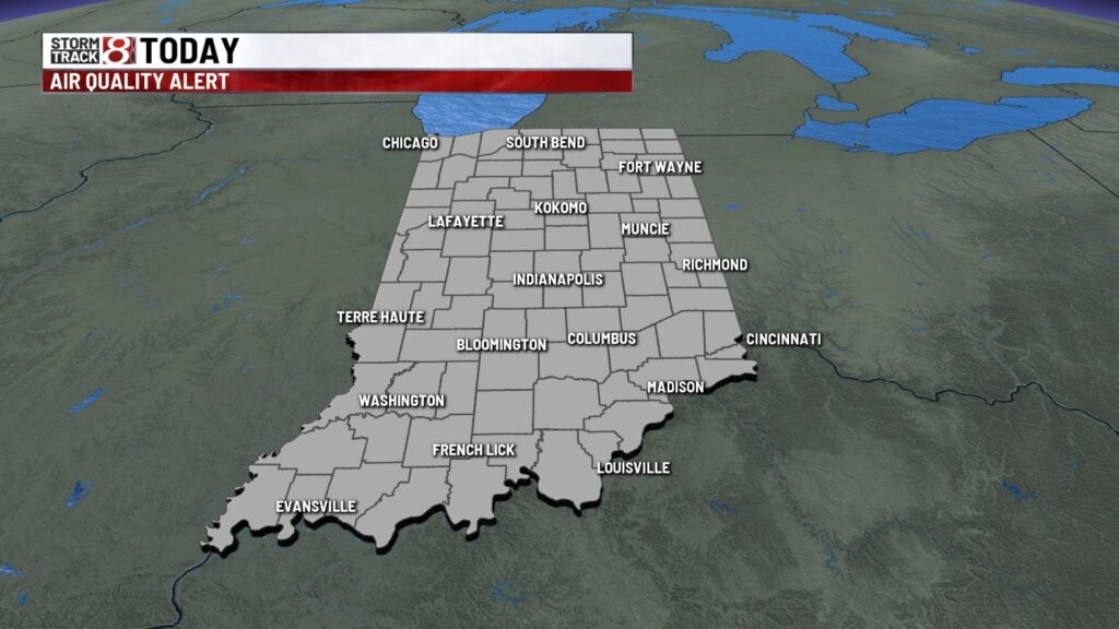
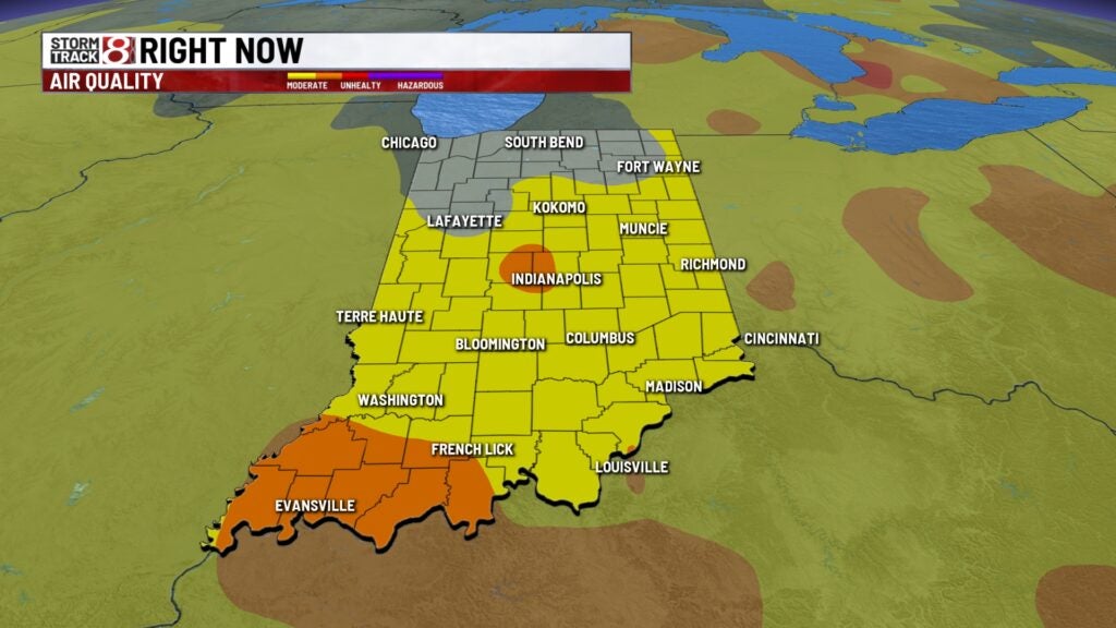
Air quality alerts are again in place for most of the state, as northeasterly winds continue to drag down smoke from the ongoing wildfires in Canada.
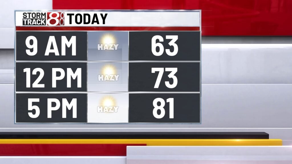
Outside of that, it should be another really nice day. Highs should hover around 80° with lots of sunshine this afternoon.

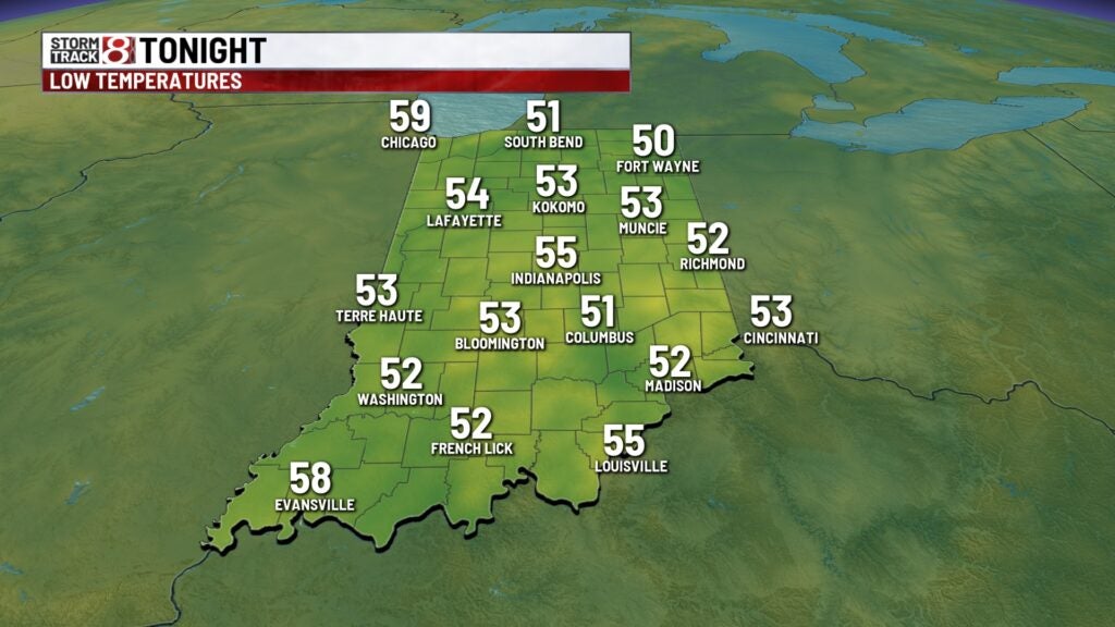
Friday night:
Still a bit hazy through the overnight, but otherwise quiet. Lows fall to the low/mid 50s.
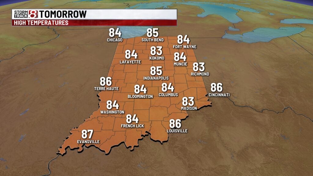
Saturday:
Winds will shift ahead of a cold front, which should help to clean the air up a bit. We should see a lot of sunshine with highs in the mid 80s.
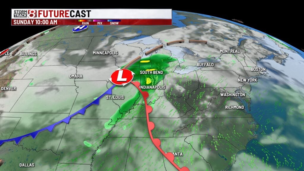
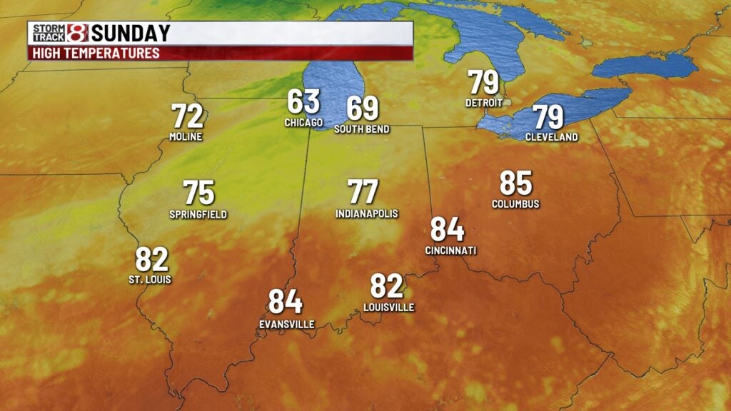
Sunday:
Low pressure with trailing cold front will take aim on the state Sunday – likely for the afternoon and evening hours, brining Indiana’s best chance for rain in almost 3 weeks. No severe weather is expected, and many areas around the state should see at least 0.5″ of rainfall for the day, while others could go as high as 1.0″ with some isolated higher amounts possible.

Highs top out in the mid 70s.
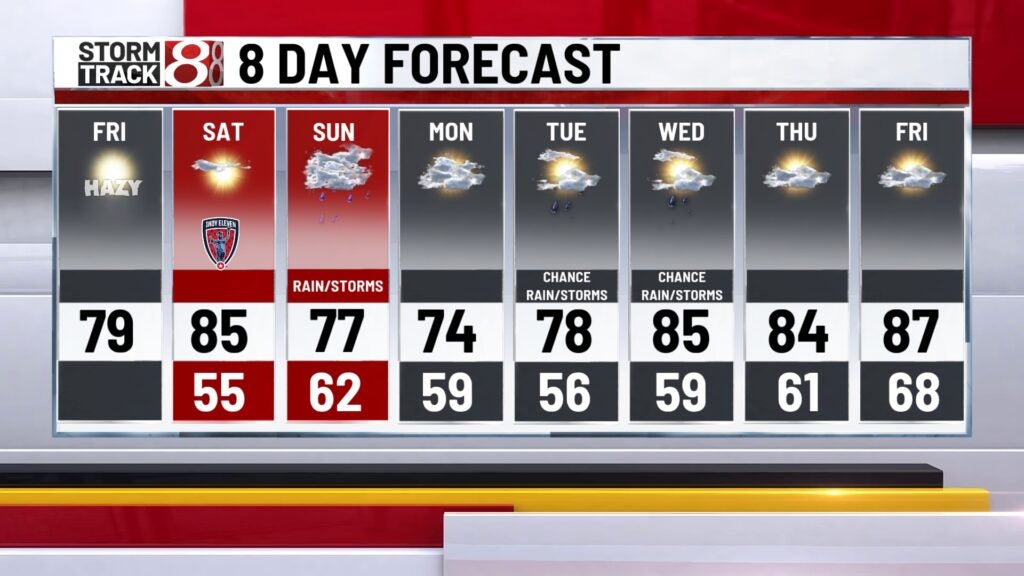
8 day forecast:
Dry air quickly moves in behind the Sunday storm system. Monday will be partly cloudy with highs in the mid 70s. Low pressure spinning east of Michigan could drag down a few isolated showers for Tuesday and Wednesday, but we’re not expecting widespread rain at this time. Temperatures will hover just below to near normal through the middle of next week. Could see an uptick in temps near the end of the extended.