Snow and rain early Saturday; warmer Sunday
Some scattered rain and snow showers to start your Saturday, but a big warm-up is on the way. This warm-up, however, will bring in a series of rain and storm chances.

RAIN/SNOW SHOWERS SATURDAY MORNING: Scattered snow showers with a wintry mix will linger into through Saturday morning, especially eastward.
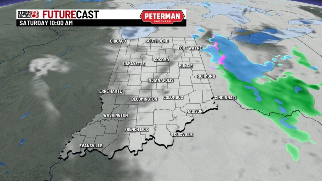

TODAY: The morning rain/snow mix will then gradually clear out by the afternoon. Highs are expected to struggle to get into the low to mid 40s. Breezy winds will also make it feel a bit colder than the actual temperature.
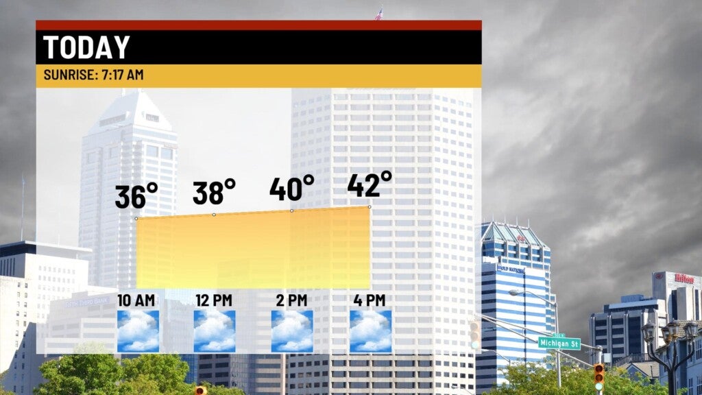


COLD TONIGHT: Skies look to clear up by the nighttime hours. Due to the clearing skies Saturday night, temperatures are set be even colder Saturday night than they’ll be Friday night. This has prompted freeze watches for almost all the southern half of the state from late Saturday night until early Sunday morning.

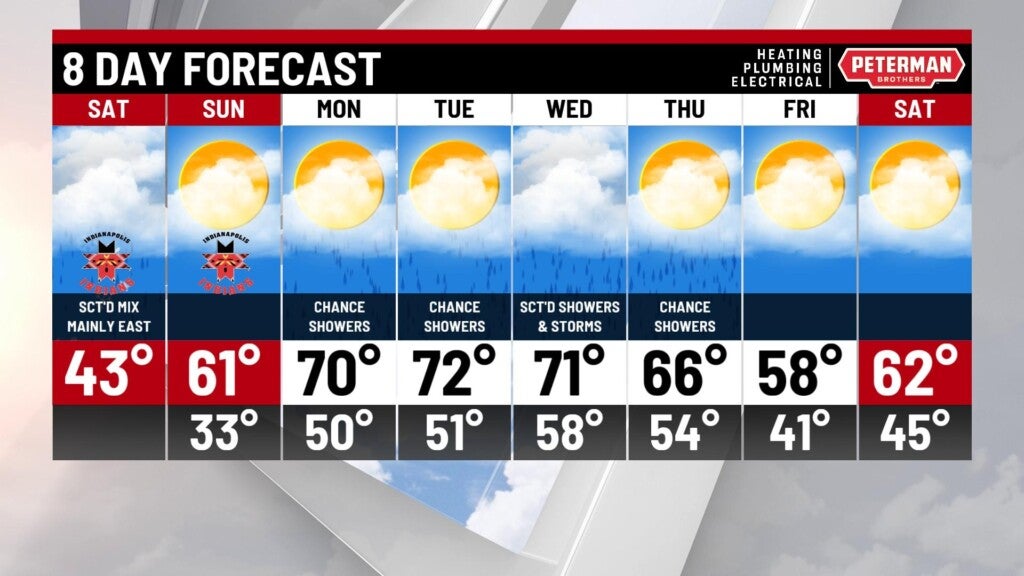
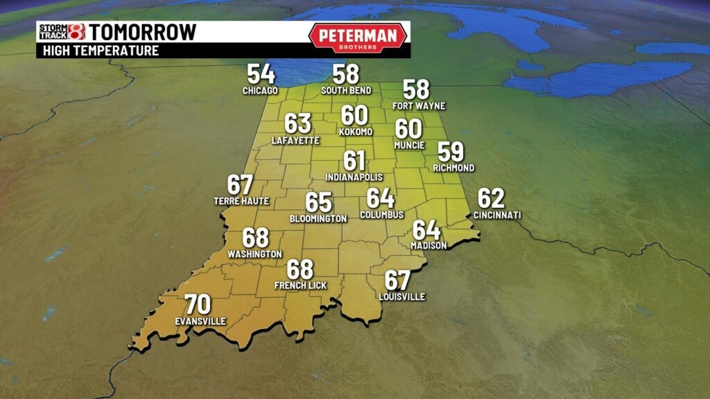
SUNDAY: We are going to get a nice turnaround in this forecast on Sunday. The return of abundant sunshine and winds out of the south will open the door for much warmer temperatures. This will be the pick of the weekend as highs look to jump into the upper 50s to low 60s.
8-Day Forecast: The warming trend rolls on into the new workweek with highs quickly getting back into the 70s. However, this will come with a cost as another series of rain and storm chances enter the picture. We are still keeping an eye on the system by midweek next week. This could try to pose a severe weather threat, but it is still too early for specifics and if it’ll impact our main viewing area.