Snow showers possible Saturday
INDIANAPOLIS (WISH) — A quick-hitting band of snow is moving through the area Saturday. Quieter conditions are expected on Sunday.
Saturday:
The back end of an upper level system that brought rain to much of the area Thursday night/Friday will push through the area Saturday. You can expect light to moderate snow showers for the northern half of the state from mid-morning through mid/late afternoon.

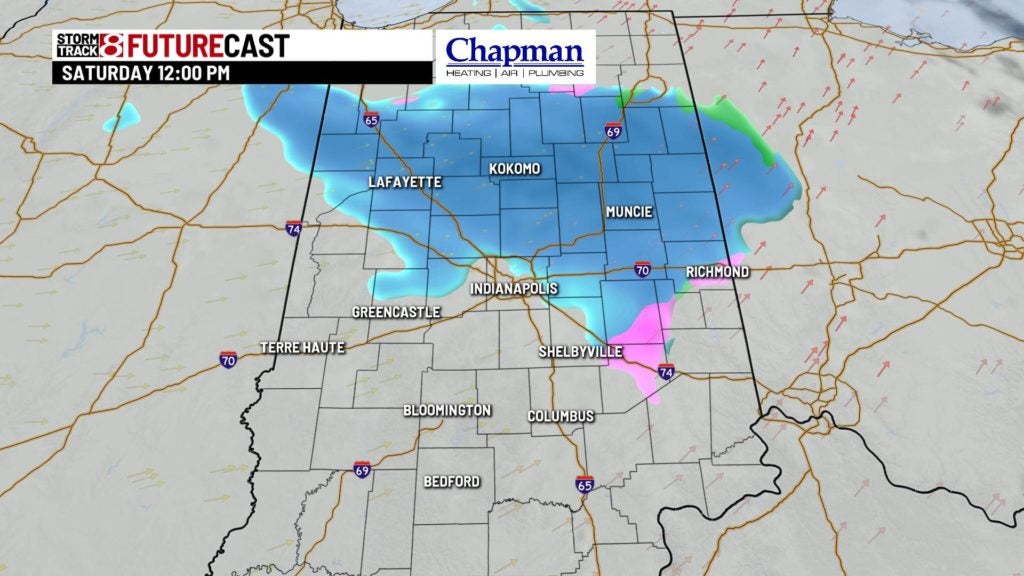
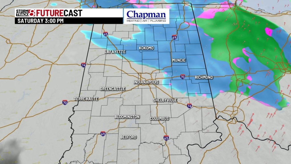

Accumulations should be light, with around an inch or two for far northern counties. Closer to Indy, less than 1″ is expected, with no accumulation south of I-70. With temperatures hovering just above freezing at the surface for most of the day, travel impacts should be minimal, if any, with the snow Saturday.

Temperatures will hold steady in the lower/middle 30s Saturday afternoon.

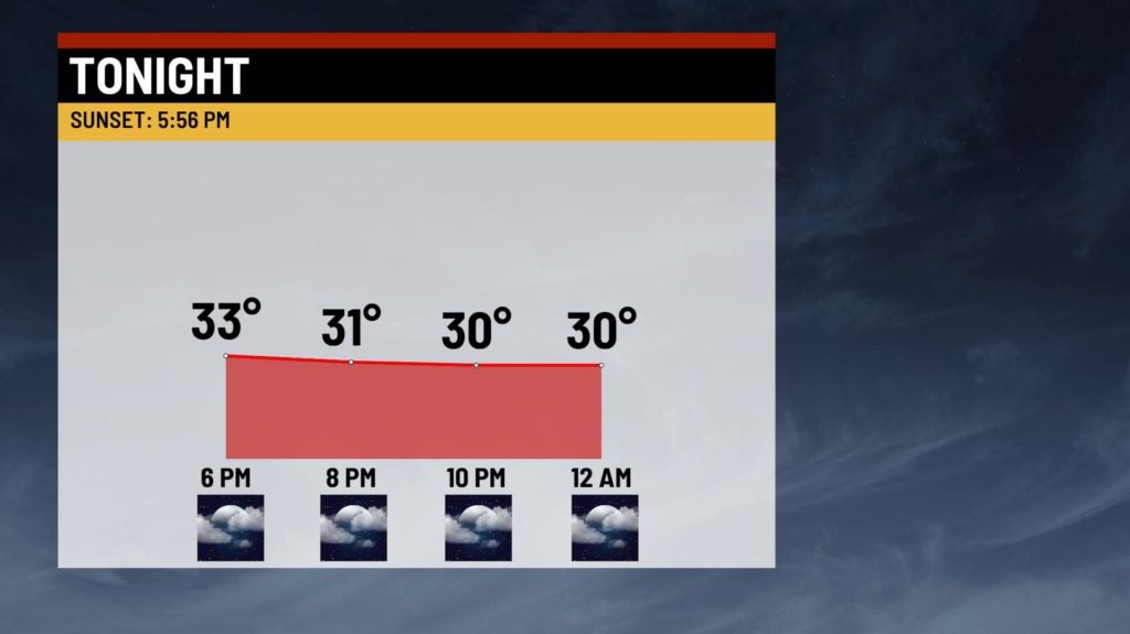
Saturday Night:
Snow showers will wind down in our eastern counties, leaving us cloudy and quiet. Lows only fall to around 30°.
Sunday:
Cloudy, but quiet and a seasonable day across the area. Highs will top out in the middle 30s.

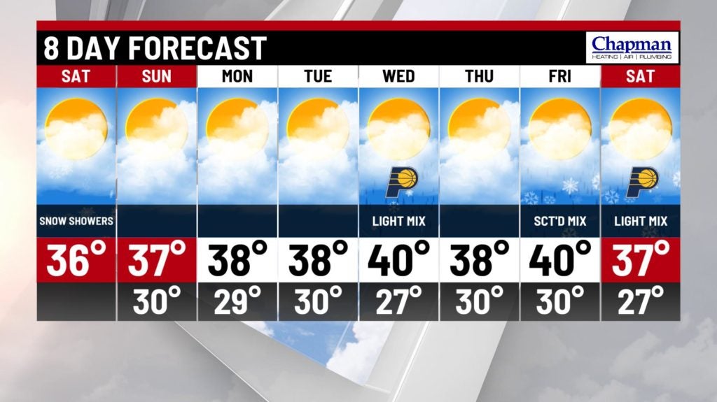
8-Day Forecast:
It will be a quiet start to the week as high pressure settles in, with mostly cloudy conditions expected for Monday and Tuesday. There is a possibility of a weak system bringing a light mix on Wednesday. The best chance of precipitation will move in (again) at the end of the week with a chance of rain and snow Friday into Saturday.