


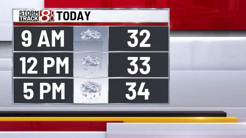
Snowy day
Snow to start off the morning with heavy snow setting up throughout the morning! The drive will be tricky with snow covered roadways with temperatures aroun dthe freezing mark. Snow will be with us through the entire morning and into part of the afternoon. By the end of the day today we could see 4″-8″ in central parts of the state while areas north and soth of central parts of the state could see 1″-4″. Highs will top out in the mid 30s. There could be a few light snow showers around through the afternoon and evening with more drytime than not. Lows will bottom out in the lower 20s.


Thursday we continue to see snow chances with highs in the lower 30s. We’ll close the work week off on a chilly note with highs in the mid 30s with a few flurries around.

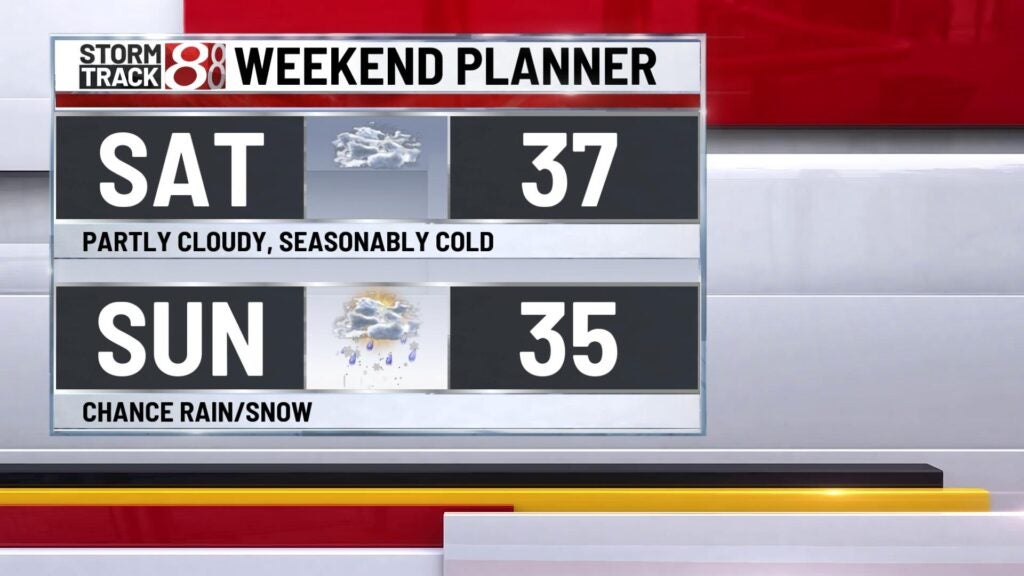
This weekend highs will remain in the upper 30s with some sun and clouds Saturday. Sunday we could see our next weather maker with a rain/snow mix with highs in the mid 30s.
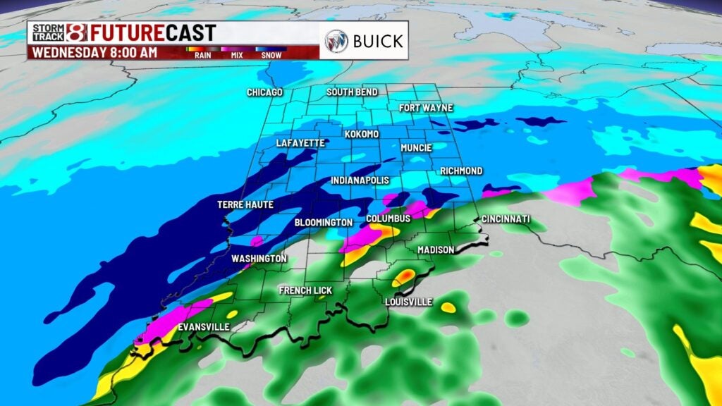
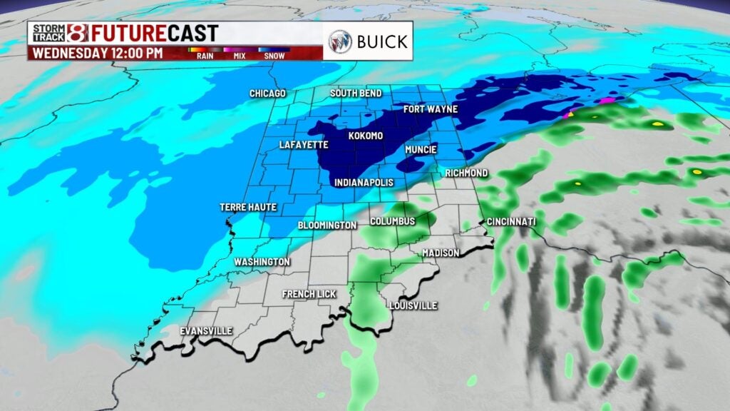
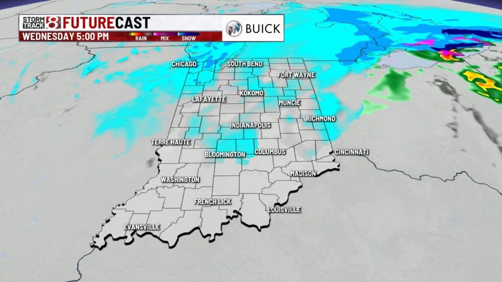
Right behind this system much colder air fills in with highs in the lower 30s through mid week with snow chances Wednesday.
