


Soggy stretch to open the week
INDIANAPOLIS (WISH) – Several rain chances move into to central Indiana over the next few days. Much cooler temperatures move in as we begin the fall season later this week.
Monday:
Scattered showers with a few thunderstorms move in from the south through the morning and early afternoon hours. Potential for some heavy rain at times. Rain should slide northeast of our area by late afternoon/early evening.
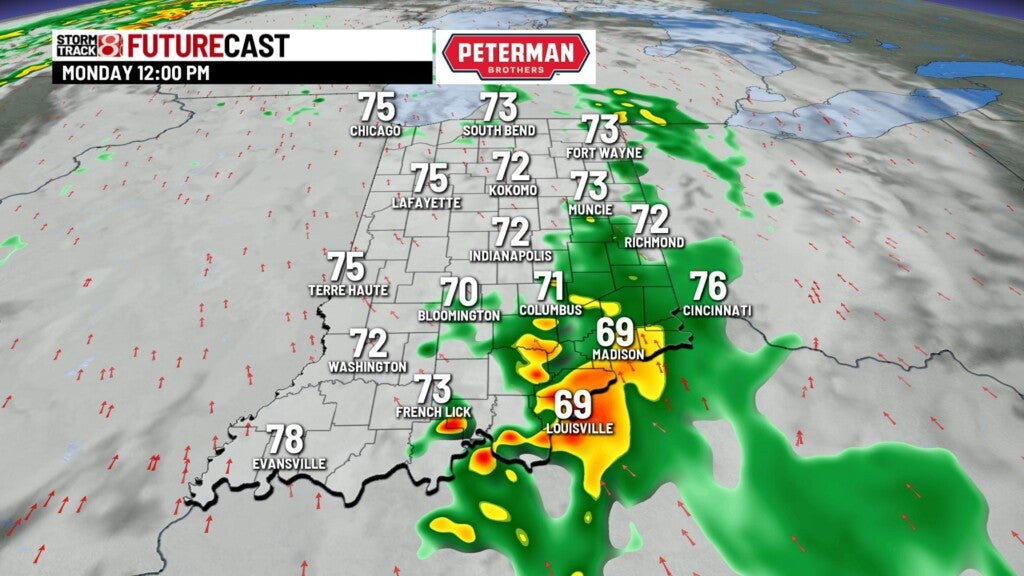
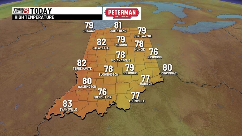
Highs top out in the upper 70s.

Monday night:
We should see a bit of a lull with rain through the late evening and early overnight hours. Showers and storms may start to develop (spotty) as we near daybreak on Tuesday. Lows fall to the upper 60s.

Tuesday:
A cold front moving through the state will again, bring showers and storms to our area for the late morning and afternoon hours. Some gusty winds may be possible with the line of showers/storms, but heavy rain will again be the primary focus.

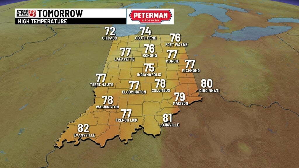
Highs top out in the middle 70s.

8 day forecast:
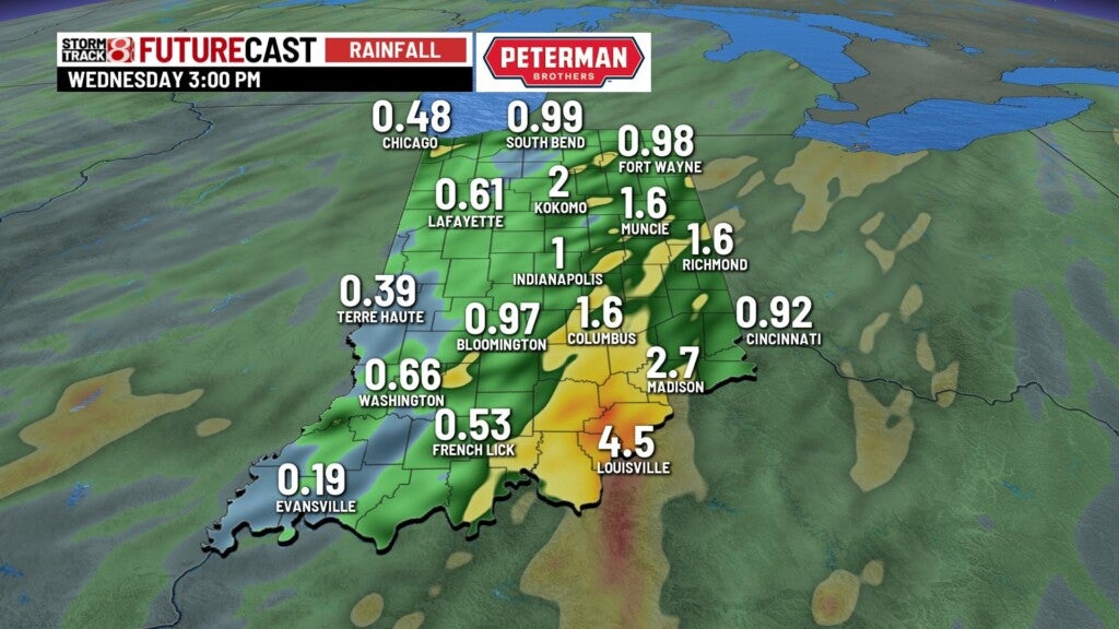
Rain chances likely continue into Wednesday, as a cold front gets hung up just to our east. The best rain chances for Wednesday morning will likely be in eastern parts of the state. Potential upper-level low formation on Wednesday could bring some light and pesky wrap-around showers to the area Thursday.


Much cooler temps for the mid-week following the front. Temps in the middle 60s for highs, with some areas tapping into the 40s for lows. It will definitely have a more Autumn feel. Temps will quickly rebound but remain below average for the weekend.
