


Widespread damage in Whiteland from storm
INDIANAPOLIS (WISH) — Extensive damage has been reported in Whiteland in Johnson County, and also in Morgan and Sullivan counties after multiple tornado warnings were issued Friday night across Indiana.
Here is our blog of the storm through 2 a.m. Saturday.
You can share storm photos and videos you have taken at News 8 at newsdesk@wishtv.com. In the email, include your name so we can credit you for taking and sharing the images, and give us information on how we can contact you.
2:33 a.m.
In Morgan County, storm damage has closed State Road 252 from State Road 37 near Martinsville to State Road 135 in Morgantown “for the next day,” Indiana Department of Transportation tweeted.
2:27 a.m.
News 8’s Andrew Chernoff shared photos from downtown Martinsville, Indiana, of damage to the downtown area being cleaned up after Friday night’s storms.


2:06 a.m.
Sgt. Matt Ames with the Indiana State Police post at Putnamville tweeted, “Sullivan County: Due to serve weather in Sullivan County the 911 dispatch center is currently unable to receive calls. Contact the ISP dispatch center at 765-653-4114 if you need emergency services.”
1:49 a.m.
The Johnson County sheriff sent this email to news media.
“Multiple agencies are working to check on residences and buildings in the WHITELAND area. The town has received a lot of storm damage.
“We are asking people to stay out of WHITELAND, do not come to look at the storm damage. There are live power lines that are down in yards and roadways and is extremely dangerous. There is a shelter set up at the Whiteland High school for those in need. We do not know the extent of damage as we will need to wait until daylight so we can survey the area.
“There are other parts of Johnson County that has also received storm damage and we are tending to those areas. Power companies are working very hard to restore power, allow them to do their jobs. We ask the public to be patient.
“Please stay away from the WHITELAND area if you do not live there. Please avoid the roads around WHITELAND as well.”
Johnson County Sheriff Duane E. Burgess
1:30 a.m.
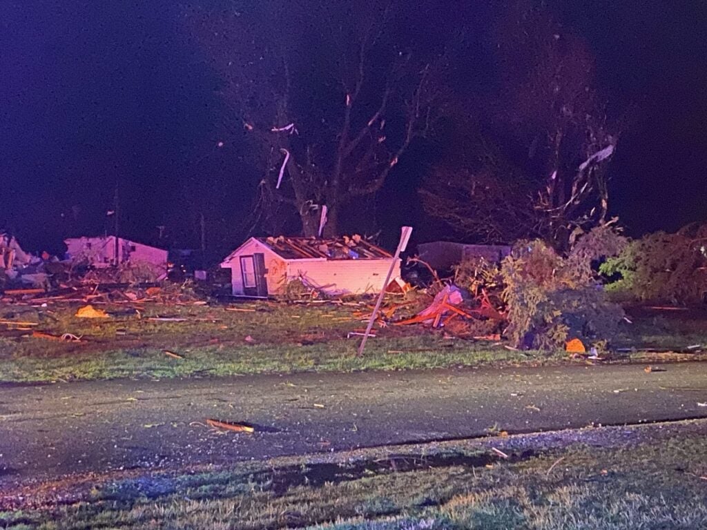
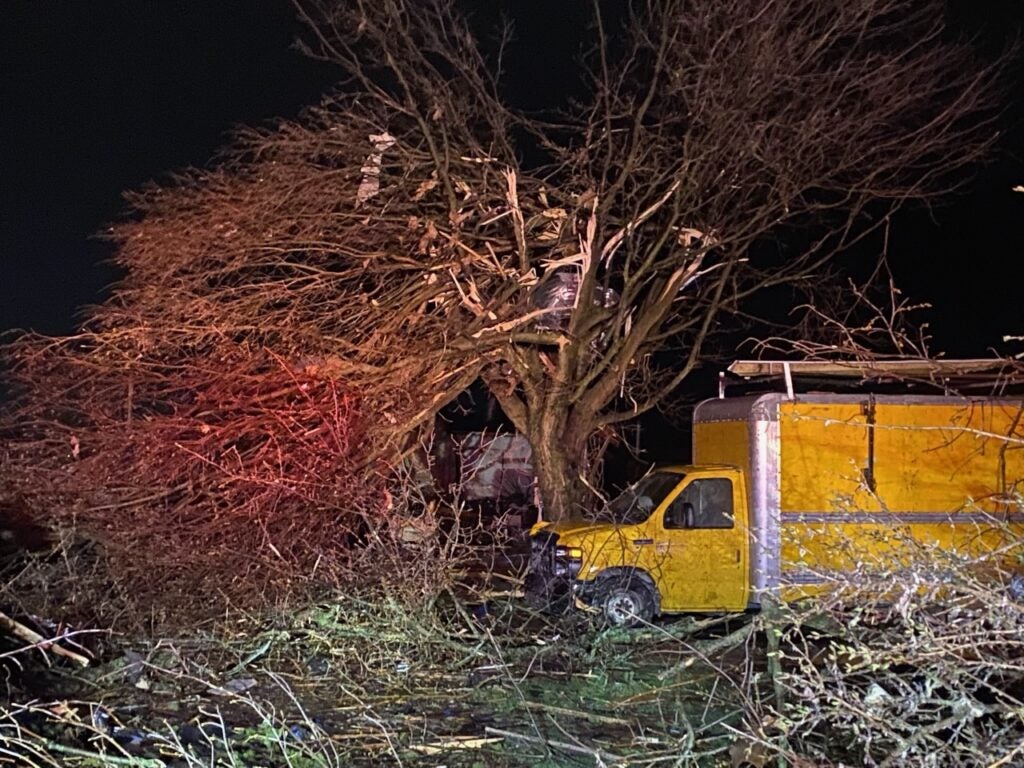
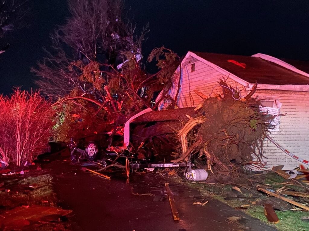
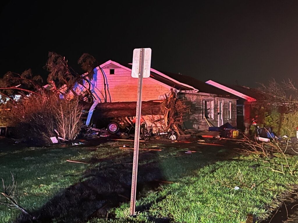
News 8’s Adam Pinsker and Tahj Reeves shared photos of the damage in Whiteland.


1:20 a.m.
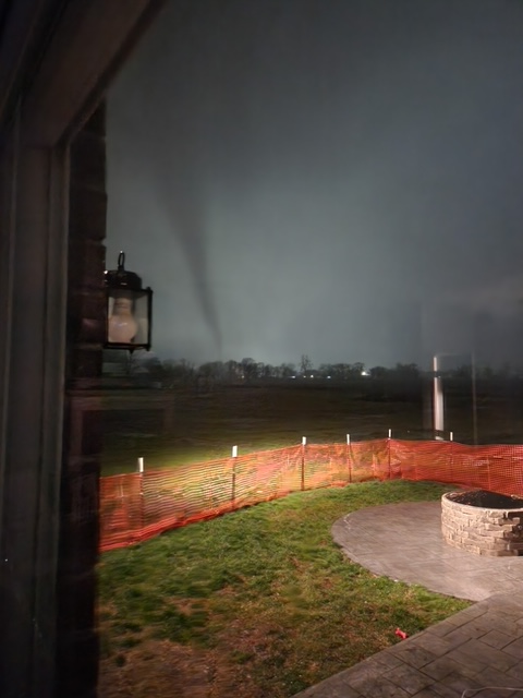
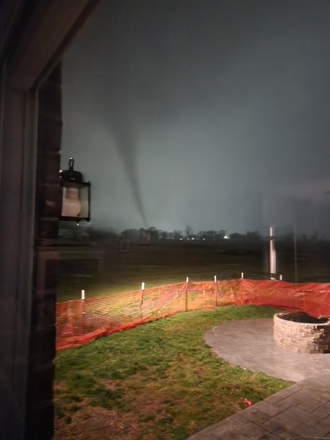
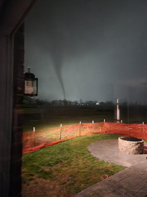
Patrick Hattabaugh shared photos of a tornado moving through Whiteland on Friday night.
1:04 a.m.
Bargersville Fire Department tweeted, “Bargersville Fire working storm damage in the Bargersville and assisting Whiteland. Multiple power lines down, buildings collapsed or damaged. Avoid the area..
12:59 a.m.
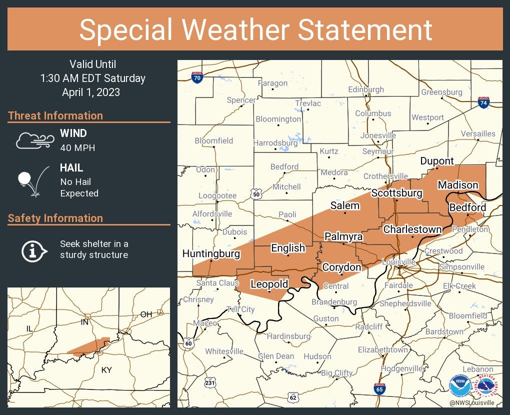
A special weather statement has been issued for Madison, Charlestown and Scottsburg until 1:30 a.m. Eastern.
12:50 a.m.
Whiteland Police Department tweeted, “Unless you’re going to the high school to seek shelter, please stay home. There are way too many people out and about walking around. This is all still active and developing. Live power lines could be down in your backyard.”
12:42 a.m.
Whiteland Police Department tweeted, “We are opening up Whiteland High School as a shelter for anyone that needs to use the restroom and get out of the weather. No specific door number given. Just head that way.”
Later, the department confirmed it’s Door 4 at the high school.
12:31 a.m.
Whiteland Police Department tweeted, “Power lines down everywhere & debris blocking the roadways. We are out in full force. We are asking everyone to please stay home if possible. We have limited roadways still accessible. Please let us do our jobs safely. Do not become a part of the problem. Extended ETA for power.”
12:16 a.m.
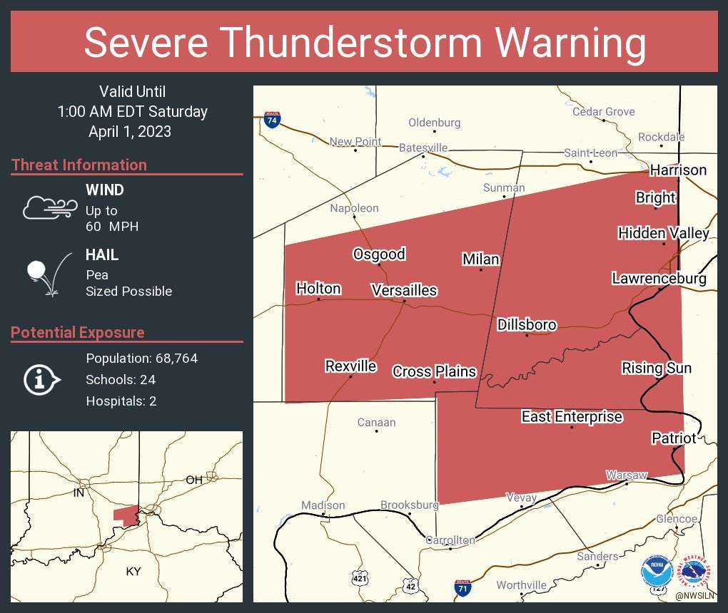
Severe Thunderstorm Warning including Harrison, Bright and Hidden Valley until 1 a.m.
12:12 a.m.
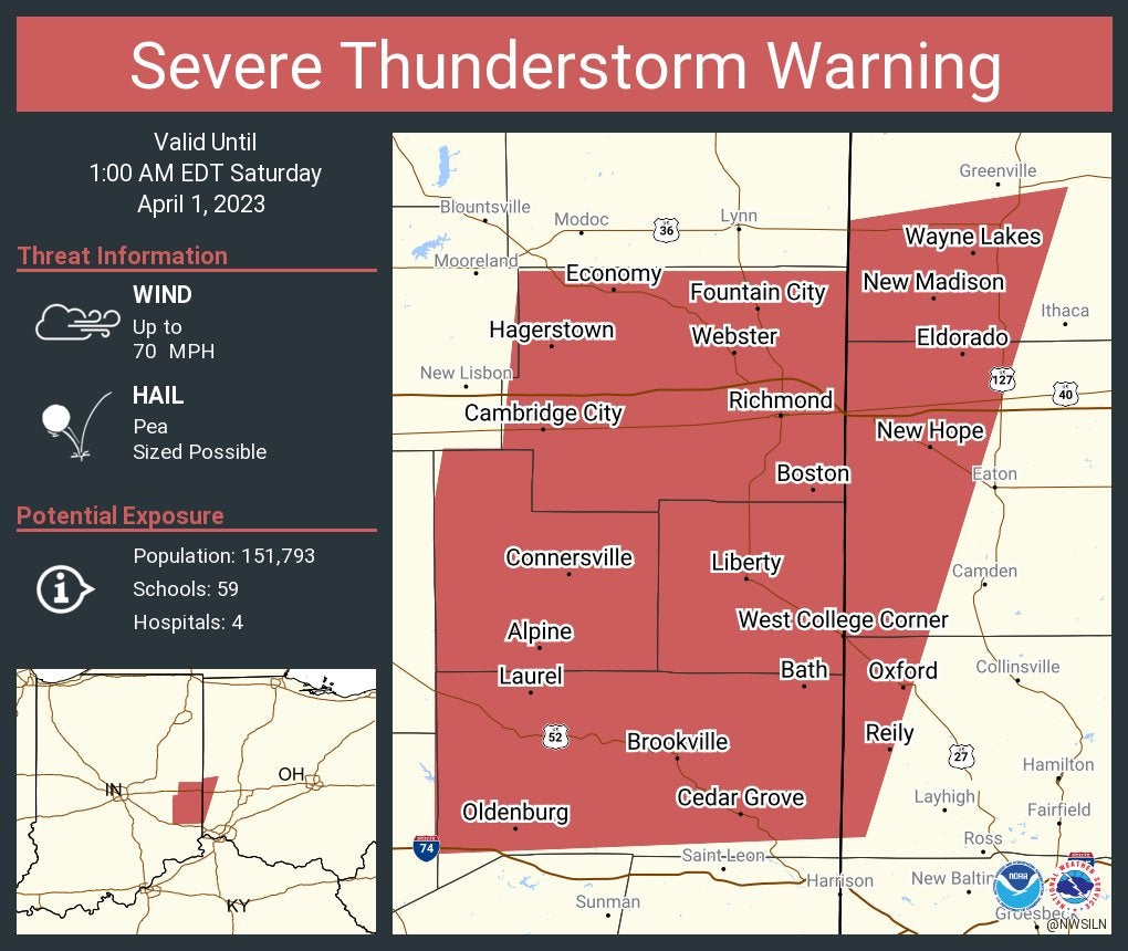
Severe Thunderstorm Warning including Richmond and Connersville, Indiana, and Oxford, Ohio, until 1 a.m. This storm will contain wind gusts to 70 mph.
12:09 a.m.
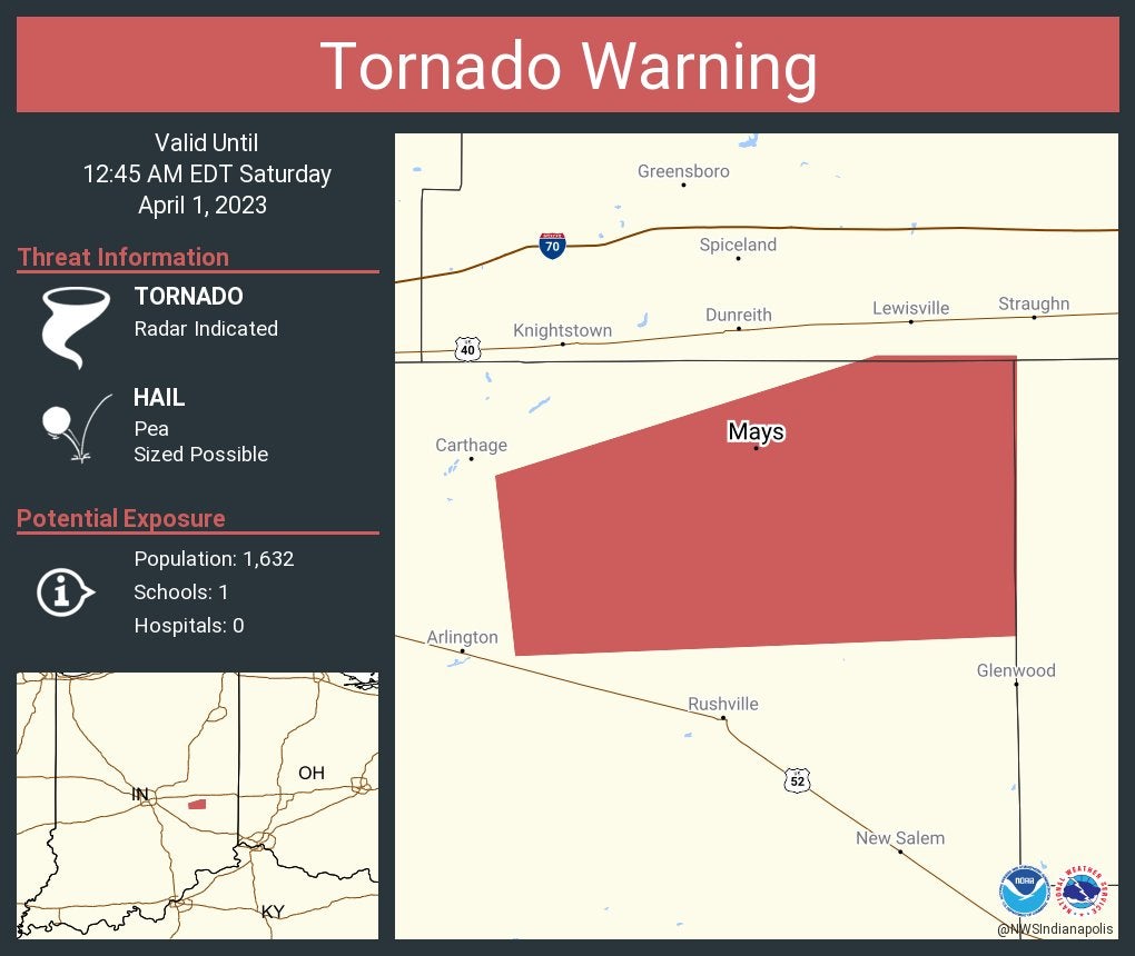
Tornado Warning including Mays until 12:45 a.m. Eastern.
12:07 a.m. Saturday
Whiteland Police Department tweeted, “Preliminary reports indicating the southern part of town took a direct hit. Power and communication are limited. If you need help and can not get out via voice, please utilize the text to 911.”
11:58 p.m. Friday
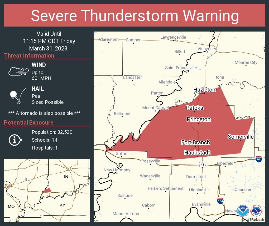
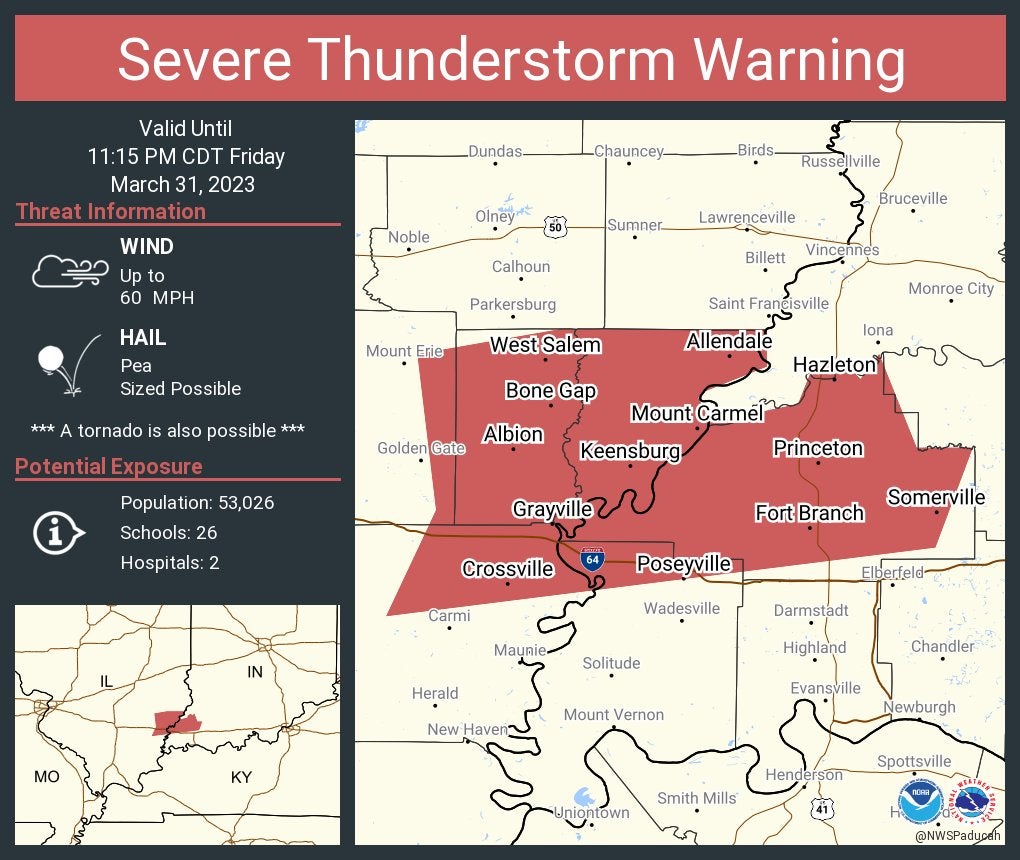
Severe Thunderstorm Warning continues for Princeton, Fort Branch and Oakland City until 11:15 p.m. CDT.
11:57 p.m.
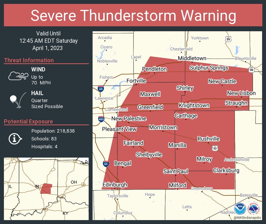
Severe Thunderstorm Warning including Greenfield, Shelbyville and New Castle until 12:45 a.m. This storm will contain wind gusts to 70 mph.

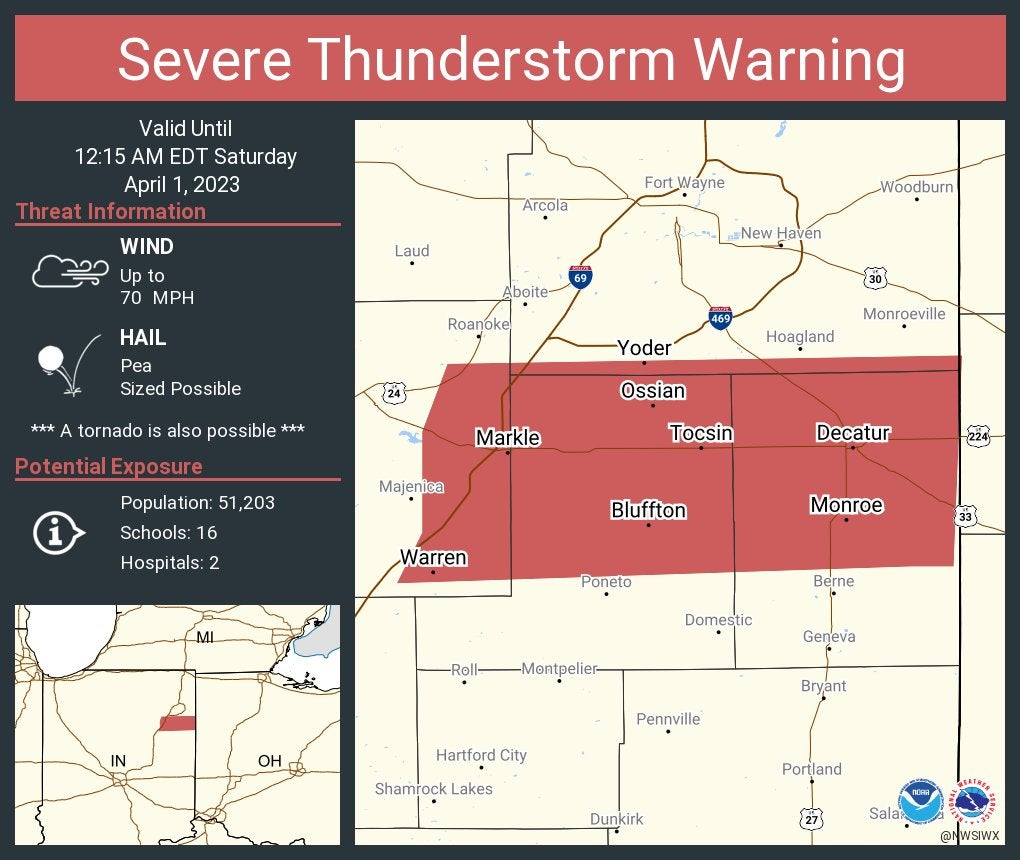
Severe Thunderstorm Warning continues for Bluffton, Decatur and Ossian until 12:15 a.m. This storm will contain wind gusts to 70 mph.
11:55 p.m.
Severe Thunderstorm Warning including Greenfield, Shelbyville and New Castle until 12:45 a.m. This storm will contain wind gusts to 70 mph.
11:43 p.m.
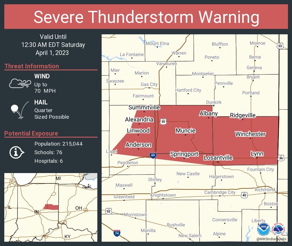
Severe Thunderstorm Warning including Muncie, Anderson and Yorktown until 12:30 a.m. This storm will contain wind gusts to 70 mph.
11:41 p.m.
Severe Thunderstorm Warning including Portland, Hartford City and Berne until 12:15 a.m.

11:38 p.m.
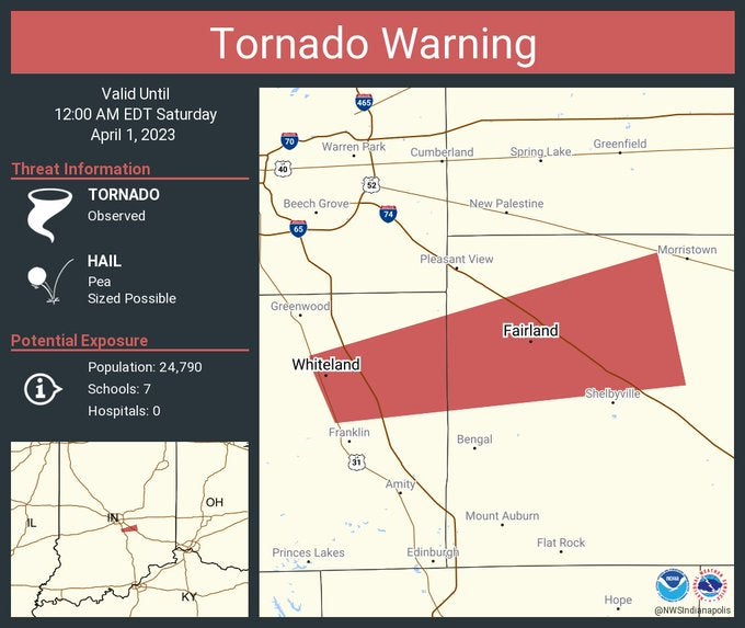
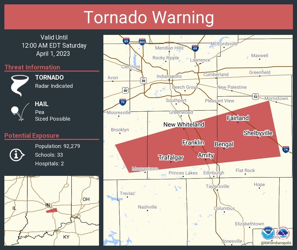
Tornado Warning continues for Whiteland and Fairland until midnight.
11:37 p.m.
Severe Thunderstorm Warning including Princeton and Fort Branch, Indiana, and Mount Carmel, Illinois, until 11:15 p.m. Central.
11:33 p.m.
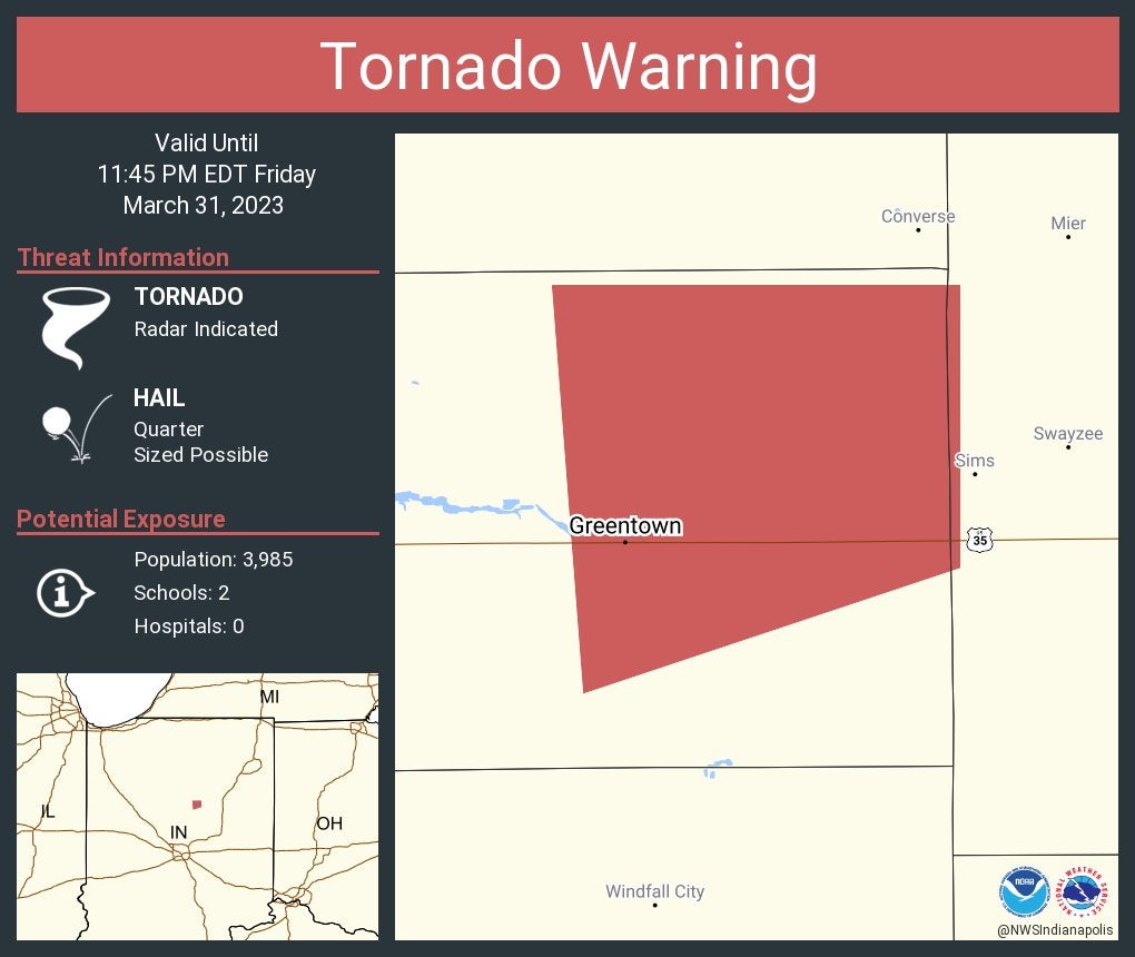
Tornado Warning continues for Greentown until 11:45 p.m.
11:31 p.m.
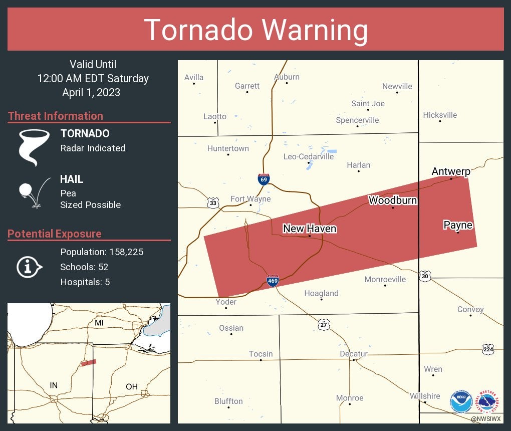
Tornado Warning including New Haven and Woodburn, Indiana, and Antwerp, Ohio, until midnight Eastern.
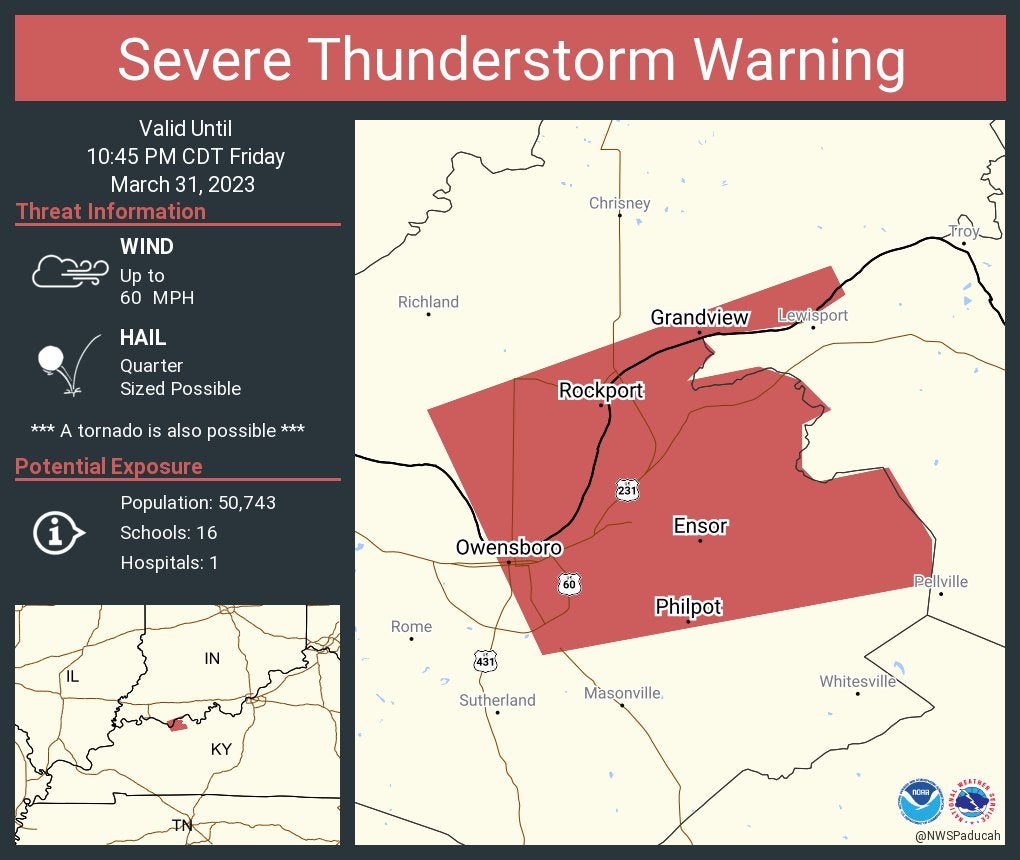
Severe Thunderstorm Warning including Rockport and Grandview, Indiana, and Owensboro, Kentucky, until 10:45 p.m. Central.
11:25 p.m.
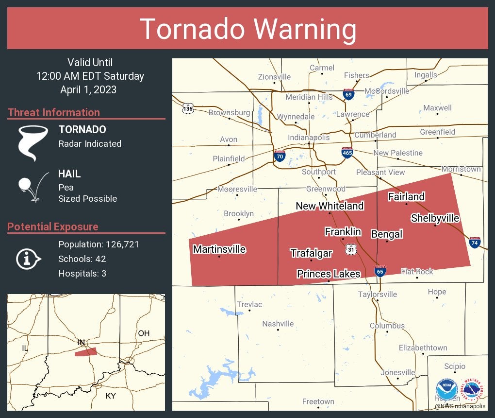
Tornado Warning continues for Franklin, Shelbyville and New Whiteland until midnight.
11:24 p.m.
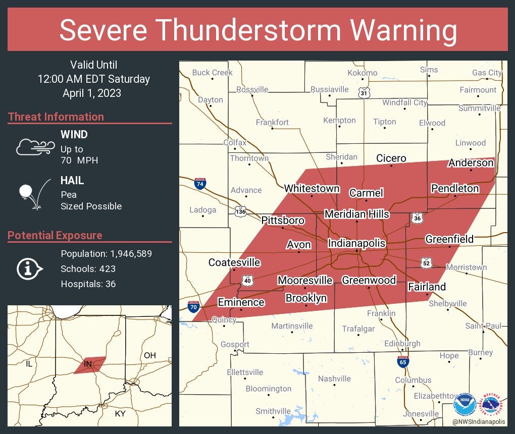
Severe Thunderstorm Warning including Indianapolis, Carmel and Fishers until midnight. This storm will contain wind gusts to 70 mph.
11:23 p.m.
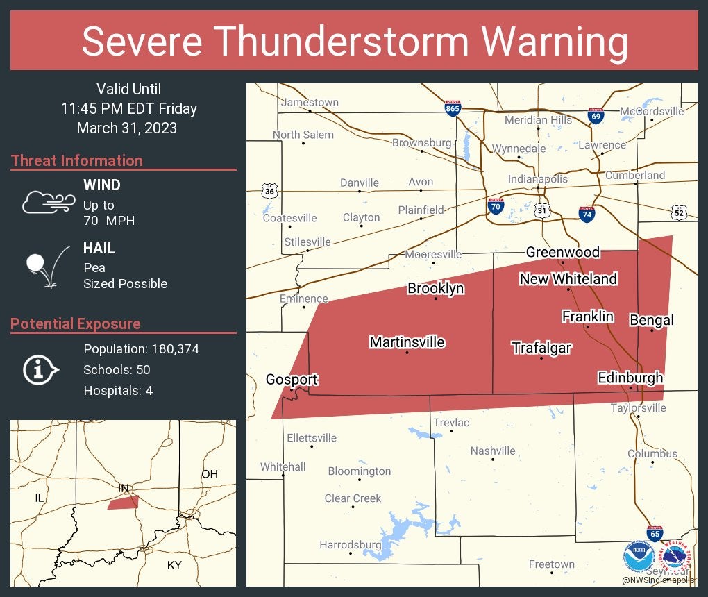
Severe Thunderstorm Warning including Greenwood, Franklin and Martinsville until 11:45 p.m. EDT. This storm will contain wind gusts to 70 mph.
11:21 p.m.
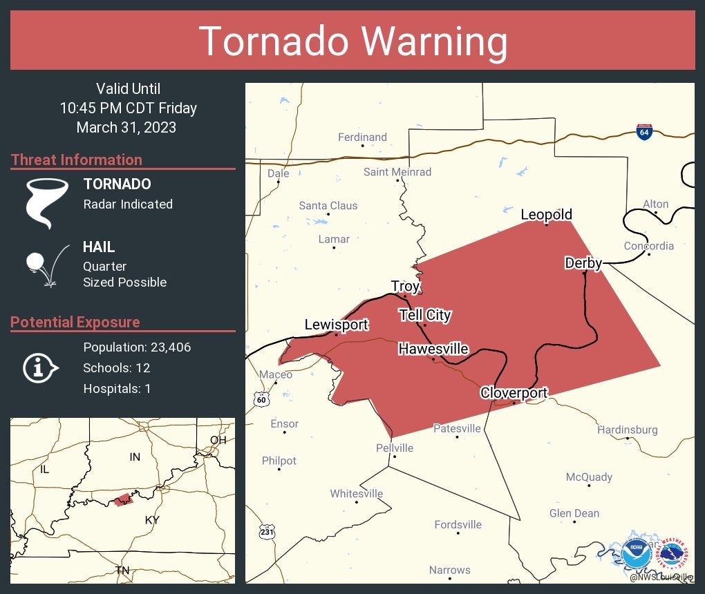
Tornado Warning including Tell City and Cannelton, Indiana, and Lewisport, Kentucky, until 10:45 p.m. Central.
11:20 p.m.
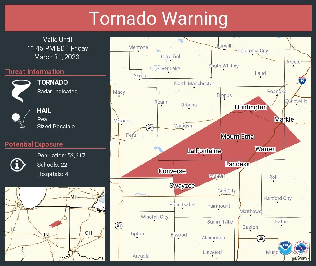
Tornado Warning including Huntington, Converse and Warren until 11:45 p.m.
11:17 p.m.
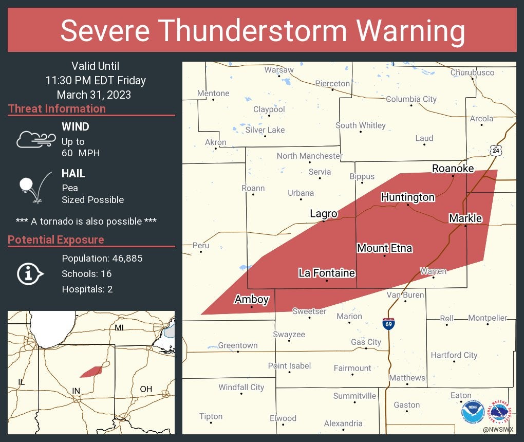
Severe Thunderstorm Warning continues for Huntington, Roanoke and Andrews until 11:30 p.m.
11:16 p.m.
Tornado Warning including Franklin, Shelbyville and Martinsville until midnight.
11:13 p.m.
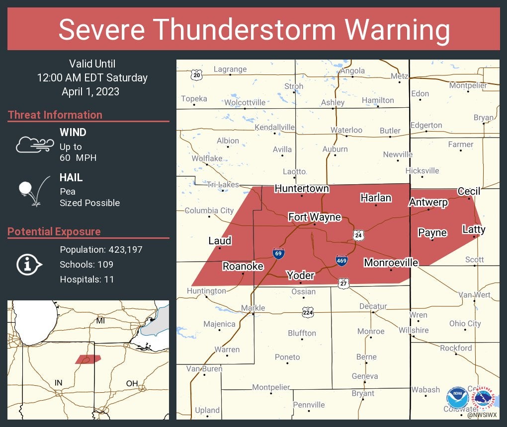
Severe Thunderstorm Warning including Fort Wayne, New Haven and Huntertown until midnight.
11:12 p.m.
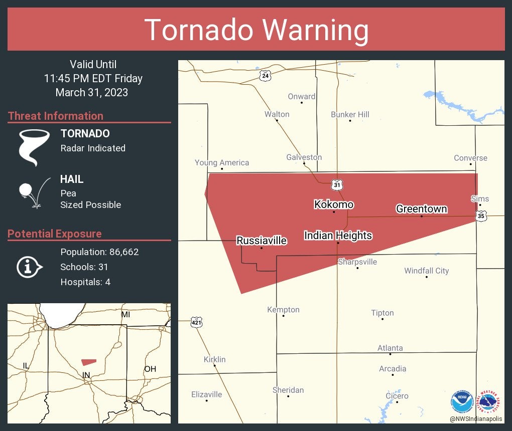
Tornado Warning including Kokomo, Indian Heights and Greentown until 11:45 p.m. Eastern.
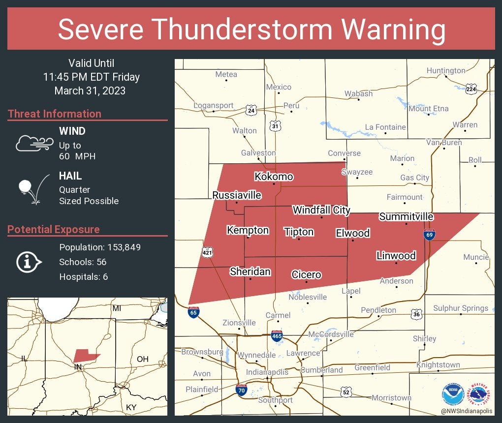
Severe Thunderstorm Warning including Kokomo, Elwood and Alexandria until 11:45 p.m. Eastern.
11:10 p.m.
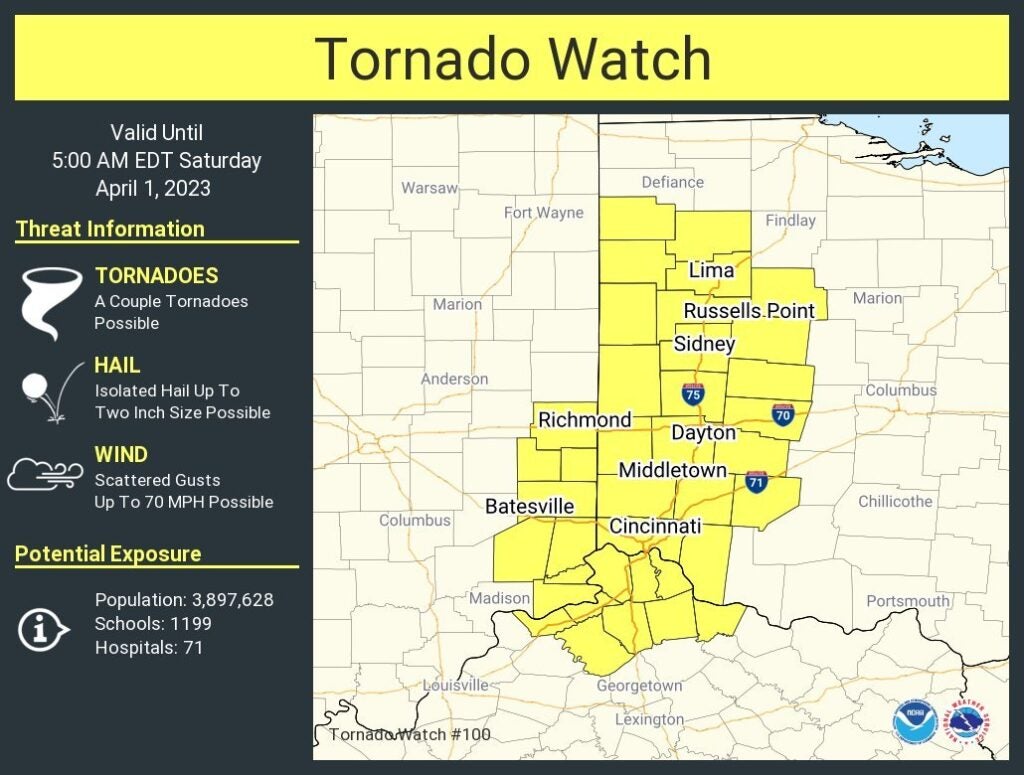
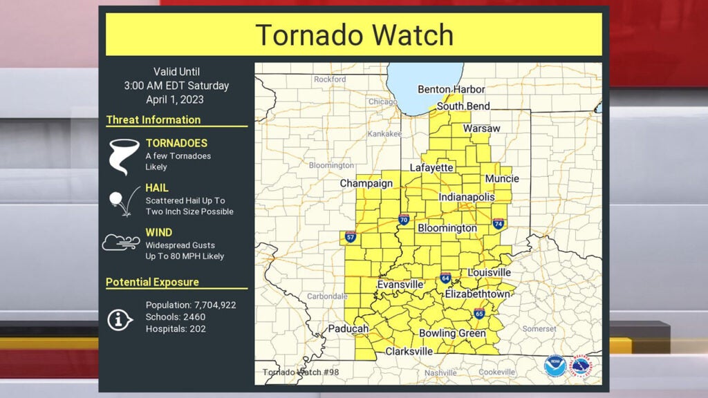
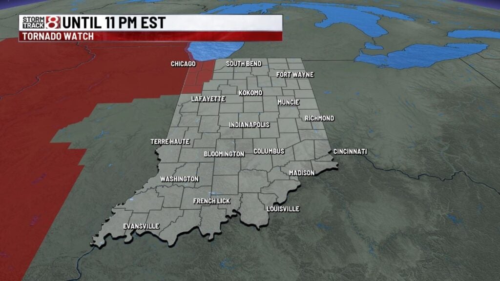
A tornado watch has been issued for parts of Indiana until 5 a.m.
11:08 p.m.
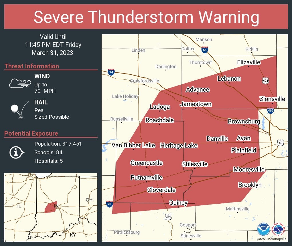
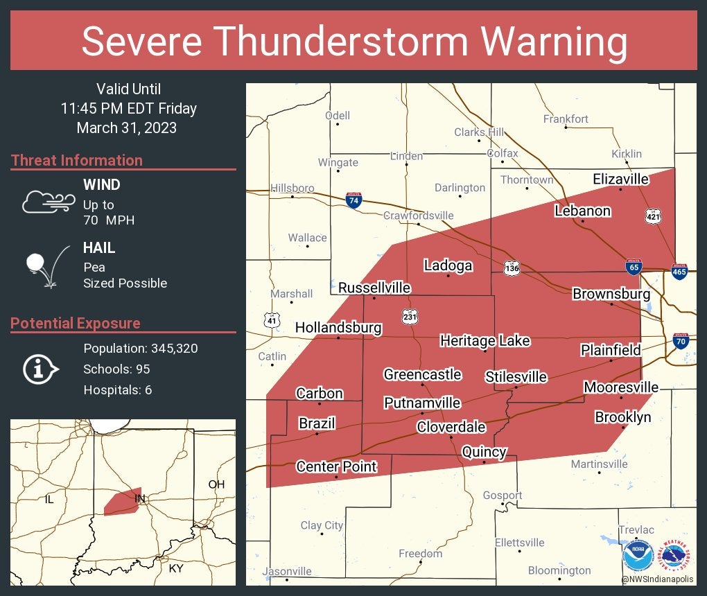
Severe Thunderstorm Warning continues for Plainfield, Brownsburg and Lebanon until 11:45 p.m. Eastern. This storm will contain wind gusts to 70 mph.
11:06 p.m.
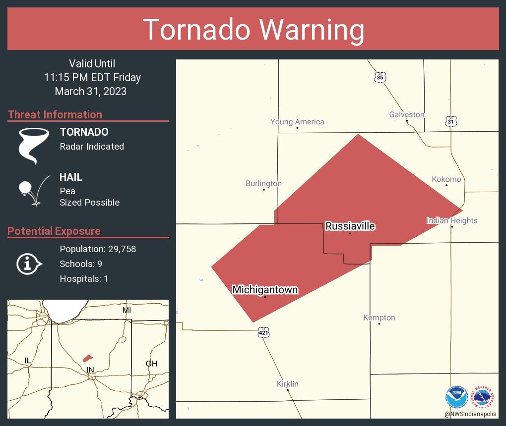
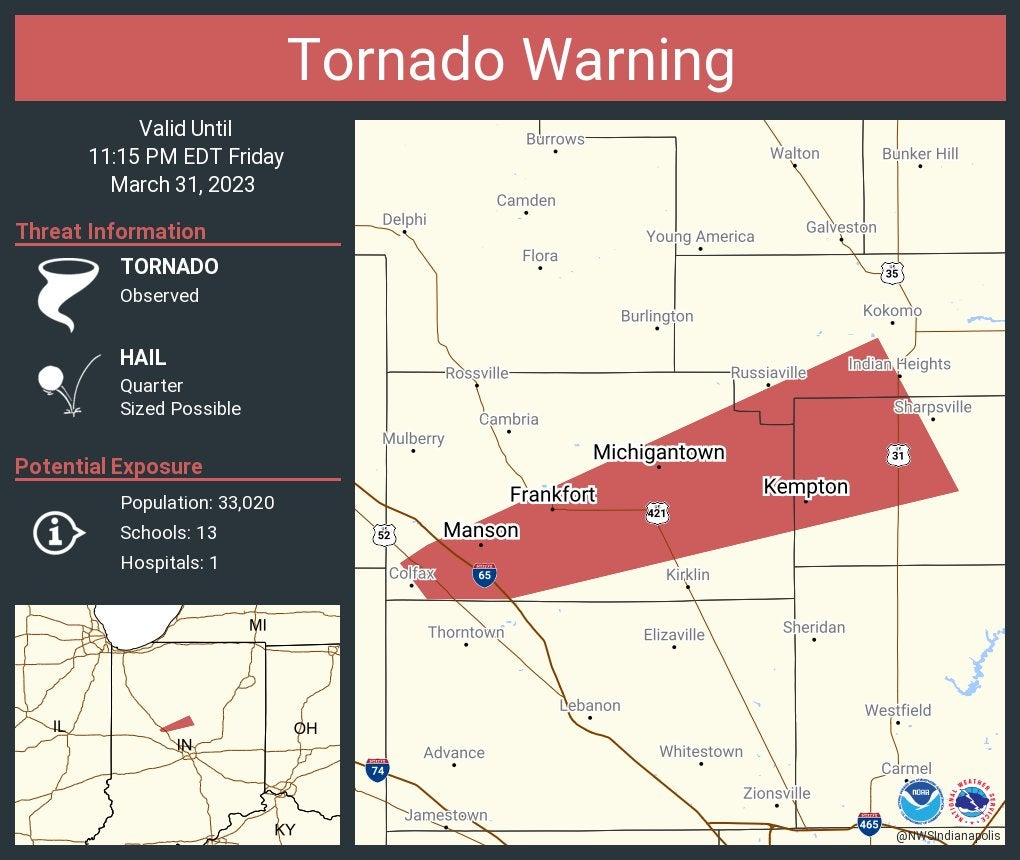
Tornado Warning continues for Russiaville and Michigantown until 11:15 p.m. Eastern.
A tornado watch has been issued for parts of Indiana, Kentucky and Ohio until 5 a.m. Eastern.

11:05 p.m.
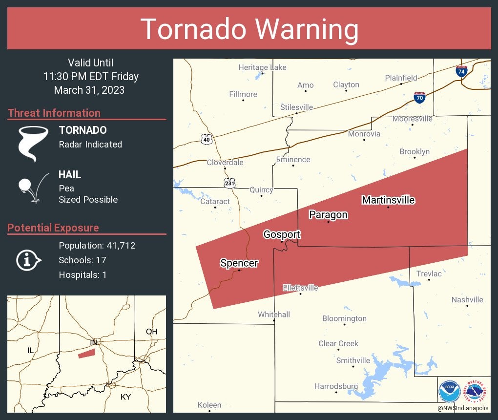
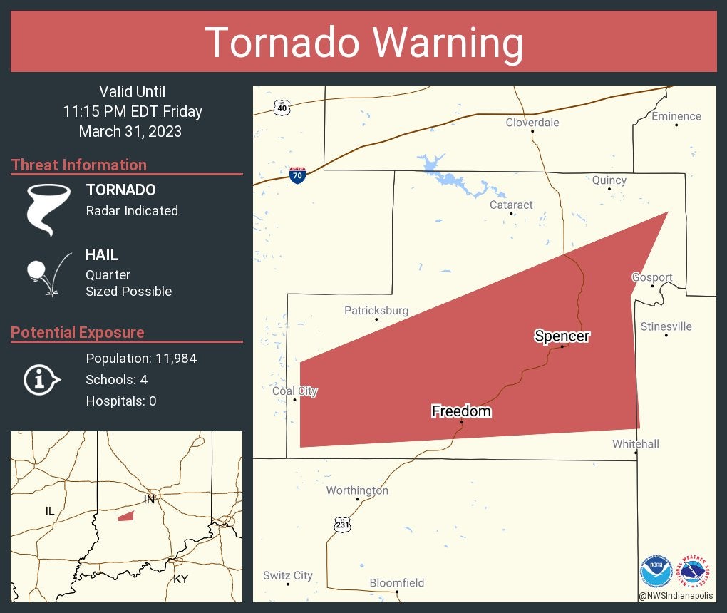
Tornado Warning continues for Martinsville, Morgantown and Gosport until 11:30 p.m. Eastern.

11:04 p.m.
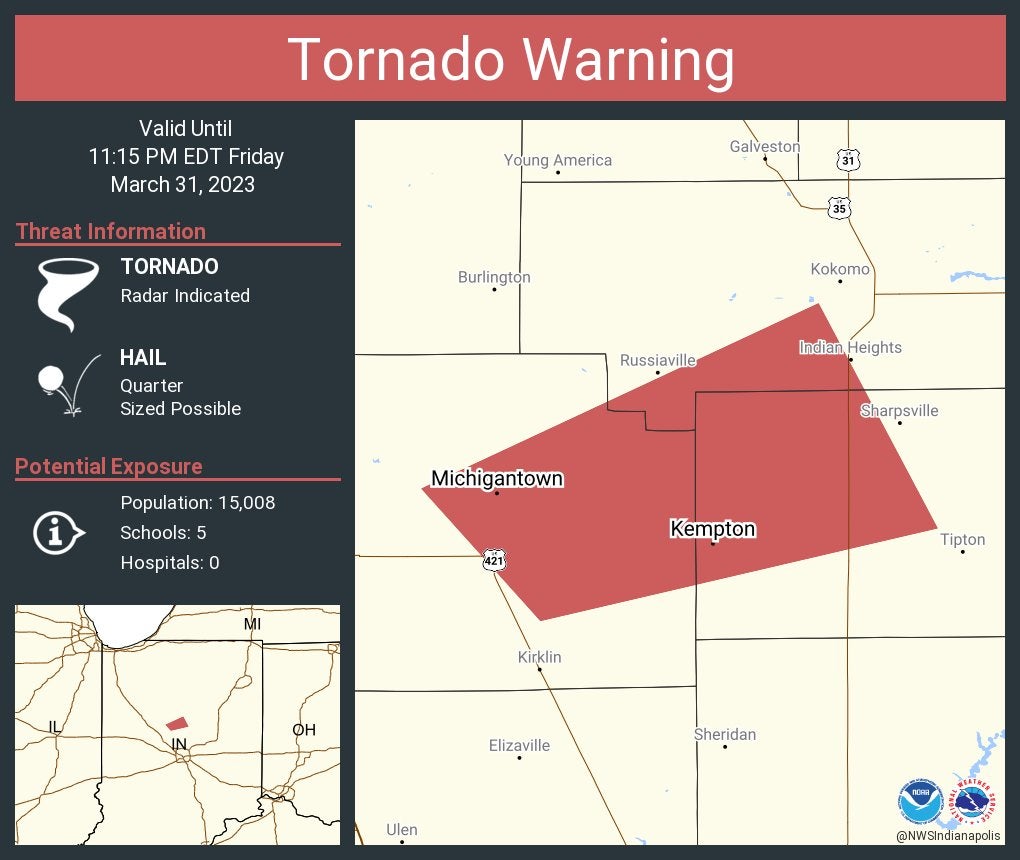
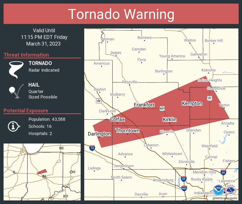
Tornado Warning continues for Michigantown and Kempton until 11:15 p.m.
11 p.m.
Tornado Warning including Martinsville, Spencer and Morgantown until 11:30 p.m.
10:57 p.m.
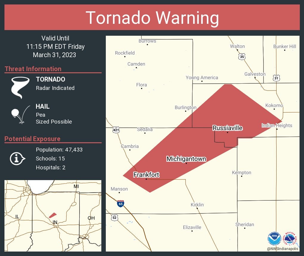
Tornado Warning including Frankfort, Russiaville and Michigantown until 11:15 p.m. Eastern.
10:56 p.m.
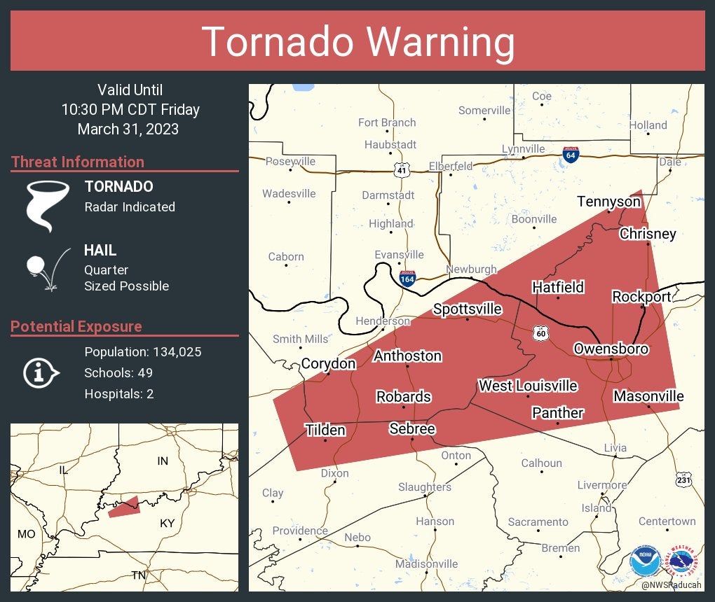
Tornado Warning including Owensboro and Sebree, Kentucky, and Rockport, Indiana, until 10:30 p.m. Central.
10:55 p.m.
Severe Thunderstorm Warning including Plainfield, Brownsburg and Lebanon until 11:45 p.m. This storm will contain wind gusts to 70 mph.
10:50 p.m.
Tornado Warning continues for Frankfort, Michigantown and Kempton until 11:15 p.m. Eastern.
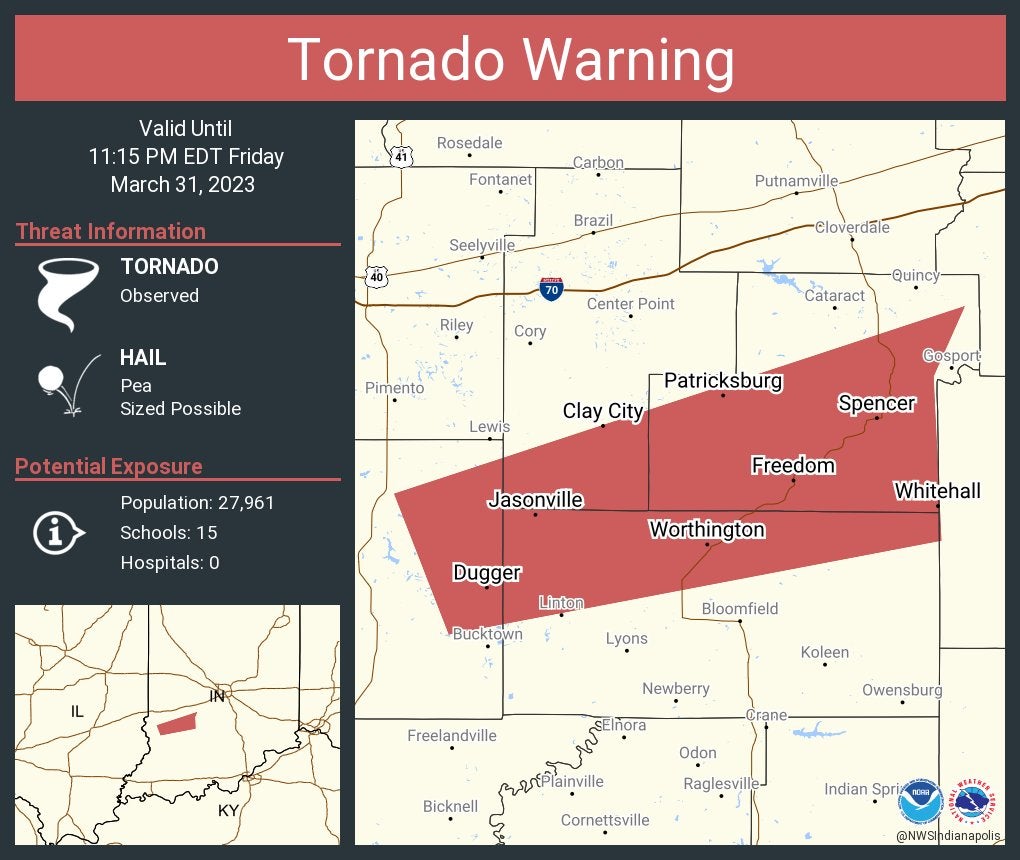
Tornado Warning continues for Spencer and Freedom until 11:15 p.m. Eastern.
10:47 p.m.
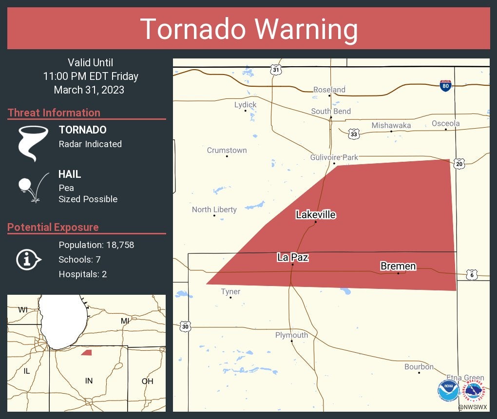
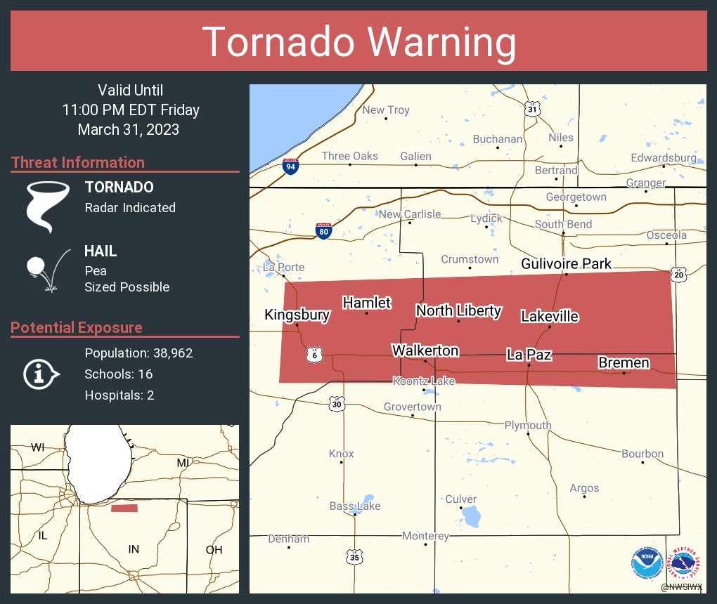
Tornado Warning continues for Bremen, Lakeville and La Paz until 11 p.m. Eastern.
10:46 p.m.
Tornado Warning continues for Frankfort, Thorntown and Darlington until 11:15 p.m. Eastern.

10:45 p.m.
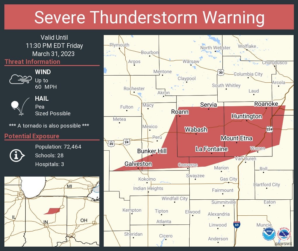
Severe Thunderstorm Warning including Huntington, Wabash and Roanoke until 11:30 p.m. Eastern.
10:44 p.m.
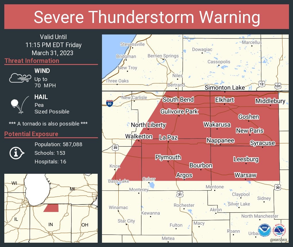
Severe Thunderstorm Warning including South Bend, Elkhart and Mishawaka until 11:15 p.m. Eastern. This storm will contain wind gusts to 70 mph.
10:43 p.m.
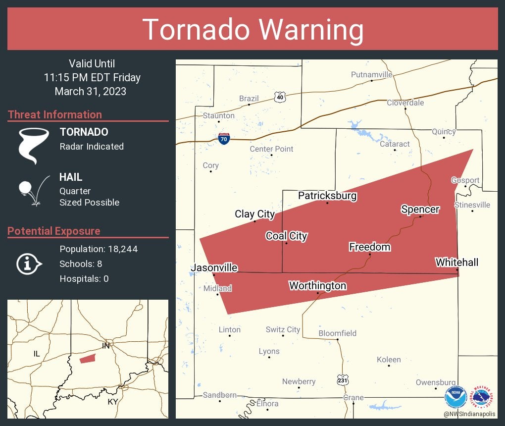
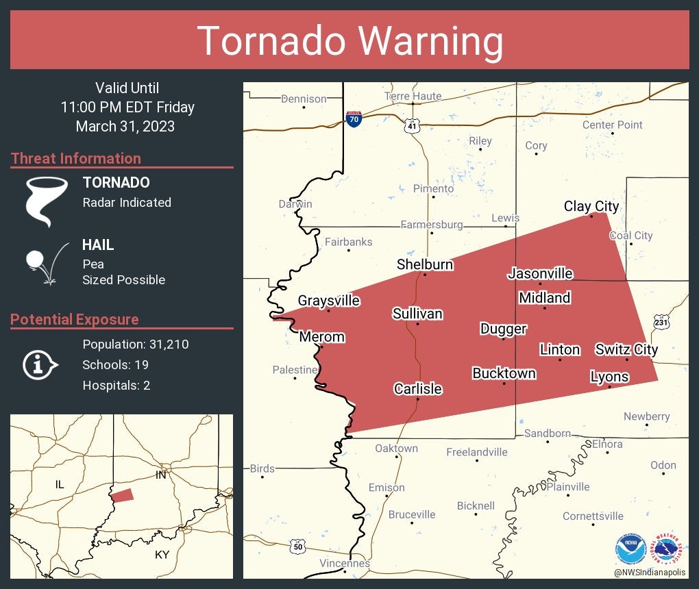
Tornado Warning continues for Jasonville, Spencer and Worthington until 11:15 p.m.
10:40 p.m.
Severe Thunderstorm Warning including Frankfort, Tipton and Cicero until 11:15 p.m.
10:38 p.m.
Severe Thunderstorm Warning including Linton, Sullivan and Jasonville until 11 p.m. Eastern.
10:37 p.m.
Tornado Warning including Jasonville, Spencer and Worthington until 11:15 p.m. Eastern.
Tornado Warning including Henderson, Kentucky, and Newburgh and Hatfield, Indiana, until 10 p.m. Central.
10:29 p.m.
Tornado Warning including Bremen, Walkerton and North Liberty until 11 p.m. Eastern.
10:28 p.m.
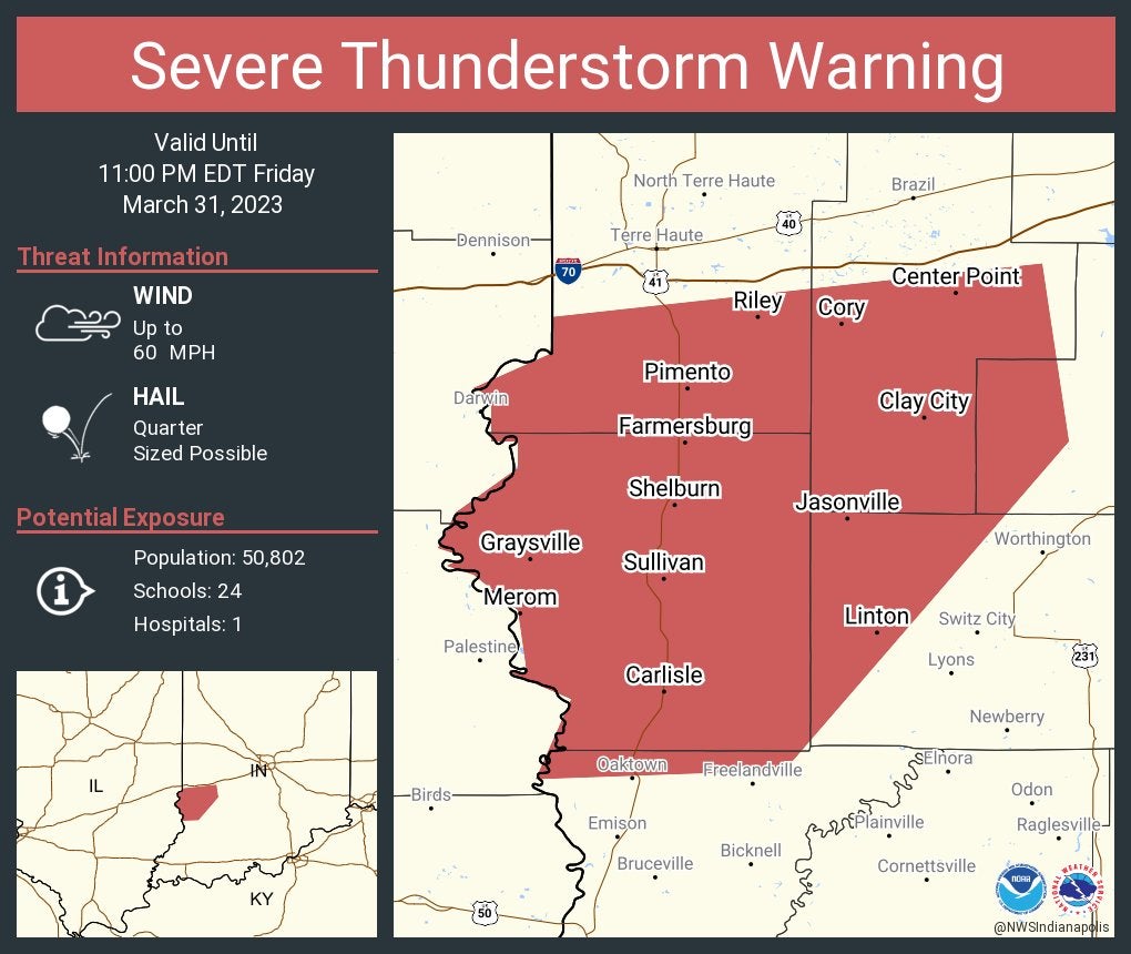
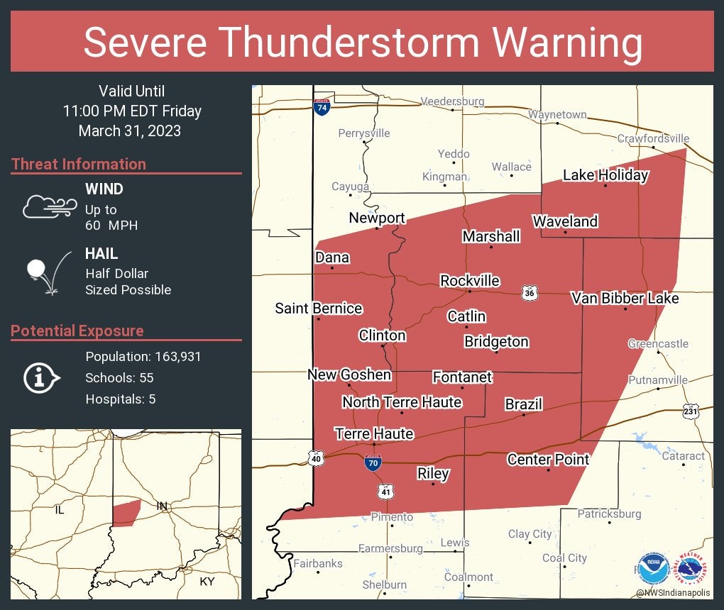
Severe Thunderstorm Warning including Terre Haute, Brazil and Clinton until 11 p.m. Eastern.
10:23 p.m.
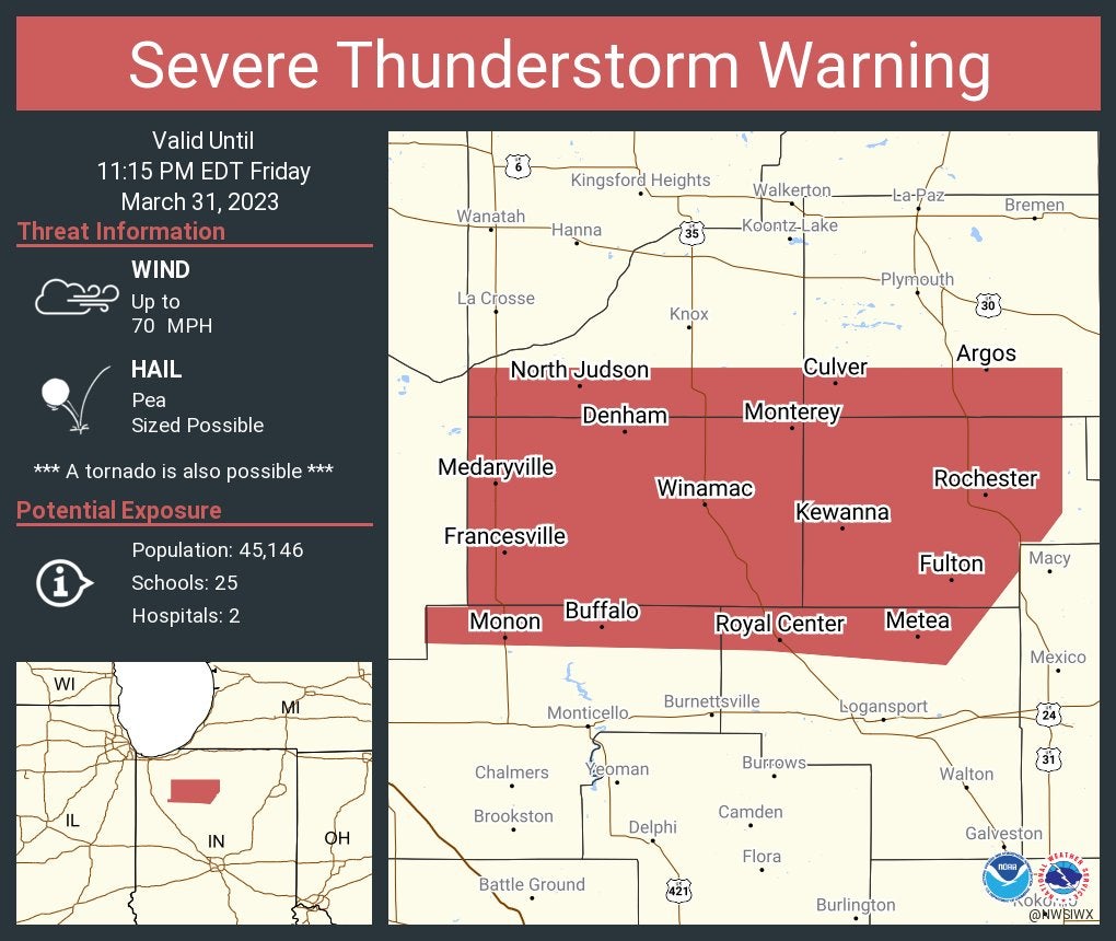
Severe Thunderstorm Warning including Rochester, Winamac and Monon until 11:15 p.m. Eastern. This storm will contain wind gusts to 70 mph.
10:19 p.m.
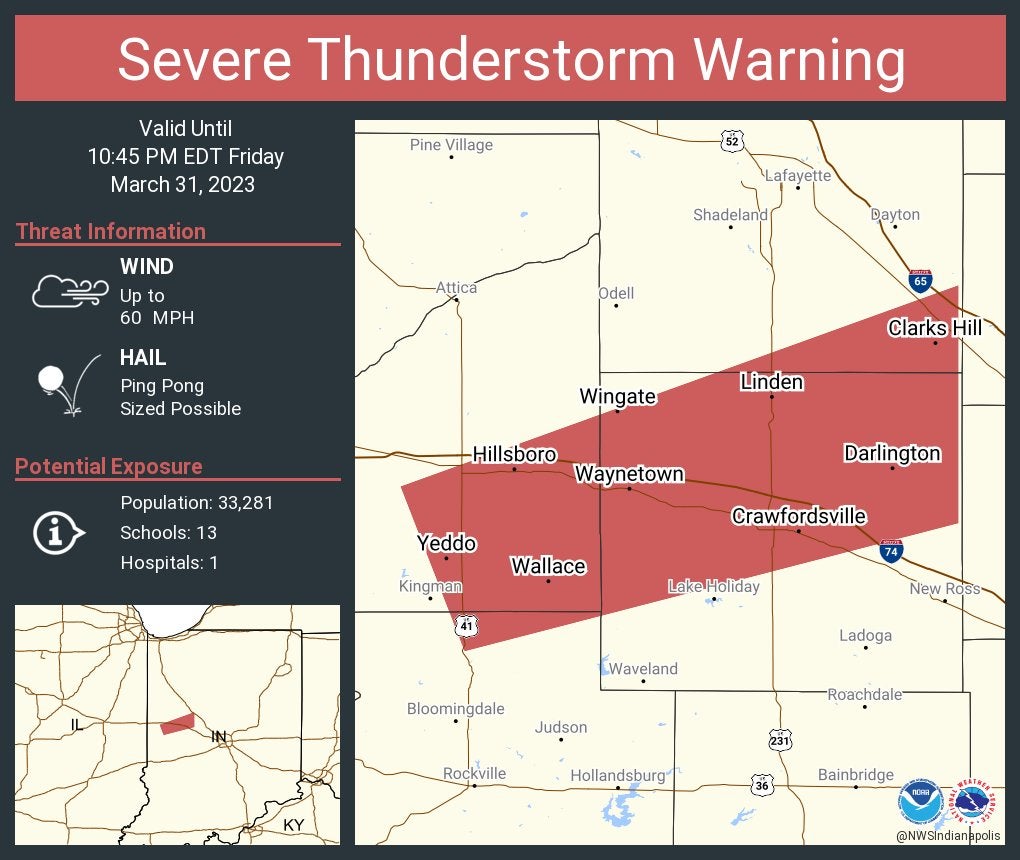
Severe Thunderstorm Warning including Crawfordsville, Waynetown and Darlington until 10:45 p.m. Eastern.
10:12 p.m.
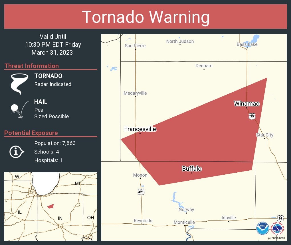
Tornado Warning continues for Winamac, Francesville and Buffalo until 10:30 p.m. Eastern.
Sgt. Glen Fifield of Indiana State Police’s Lowell district reports multiple semis have been blown over on I-65 between the Remington and Lowell exits.
10:09 p.m.
Tornado Warning including Linton, Sullivan and Jasonville until 11 p.m. Eastern.
10:06 p.m.
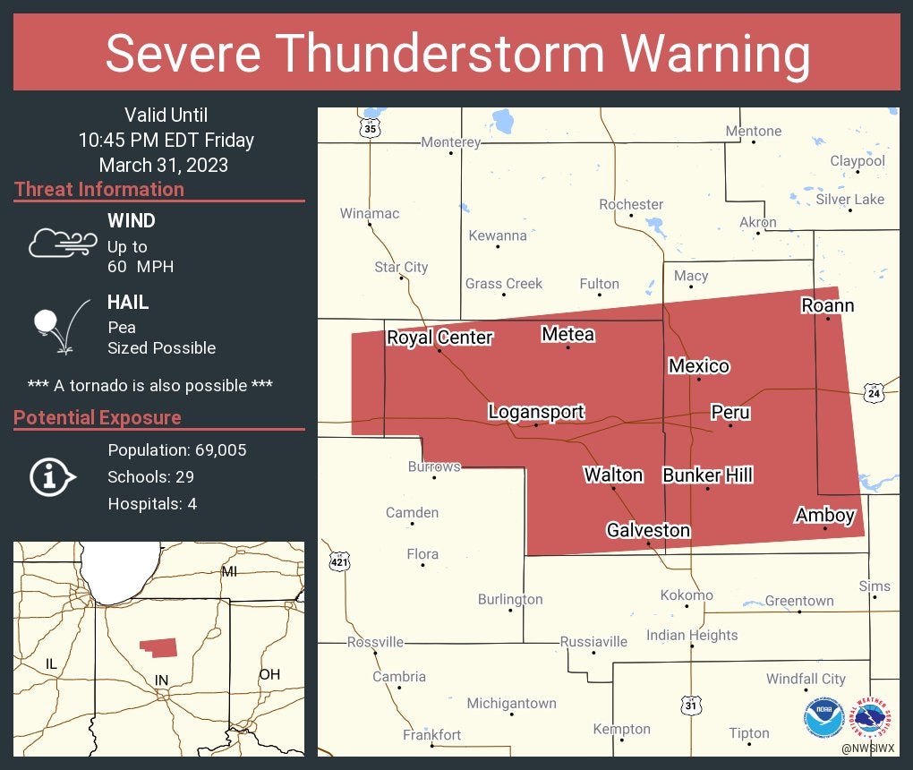
Severe Thunderstorm Warning including Logansport, Peru and Galveston until 10:45 p.m. Eastern.
10:01 p.m.
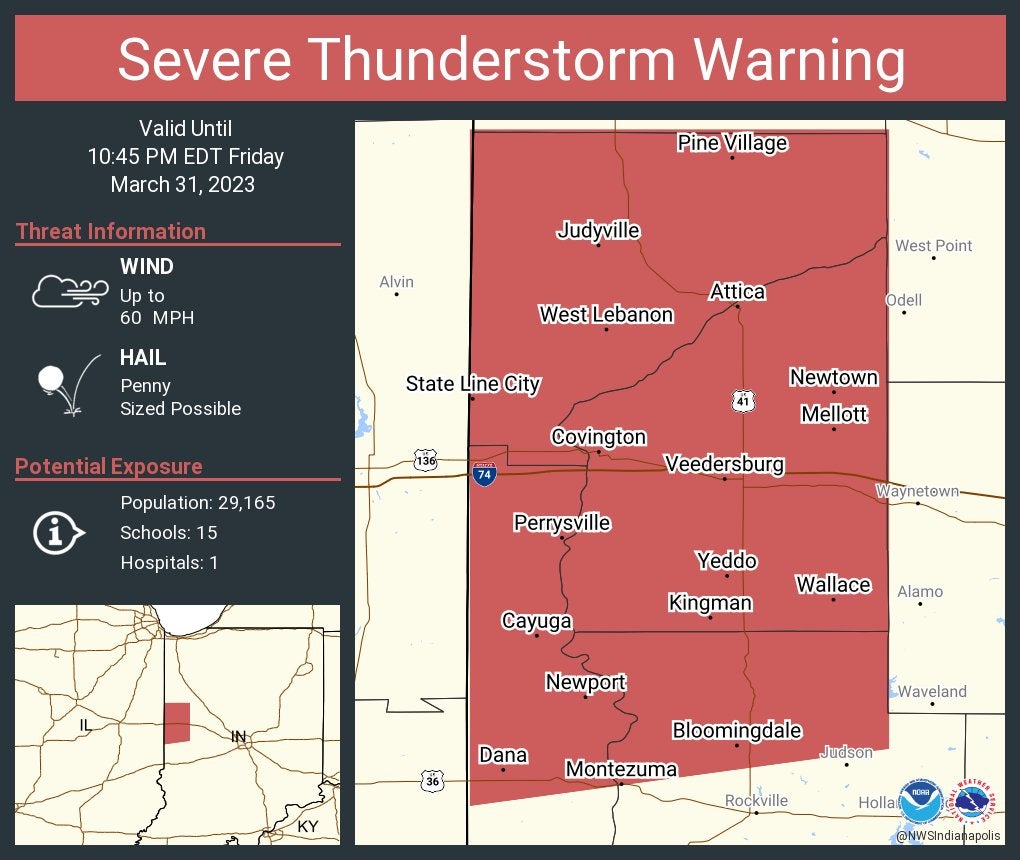
Severe Thunderstorm Warning including Attica, Covington and Veedersburg until 10:45 p.m. Eastern.
10 p.m.
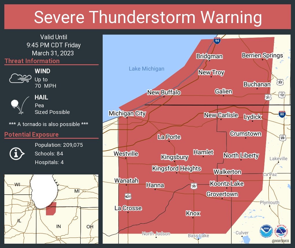
Severe Thunderstorm Warning including Michigan City, La Porte and Westville until 9:45 p.m. Central. This storm will contain wind gusts to 70 mph.
9:58 p.m.
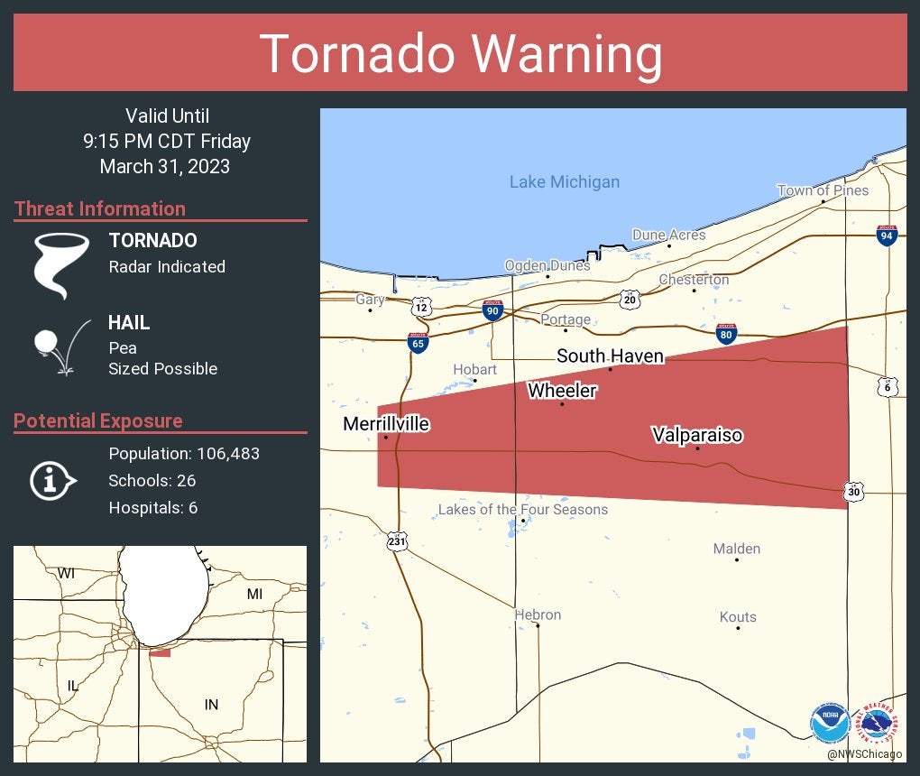
Tornado Warning including Merrillville, Valparaiso and South Haven until 9:15 p.m. Central.
9:42 p.m.
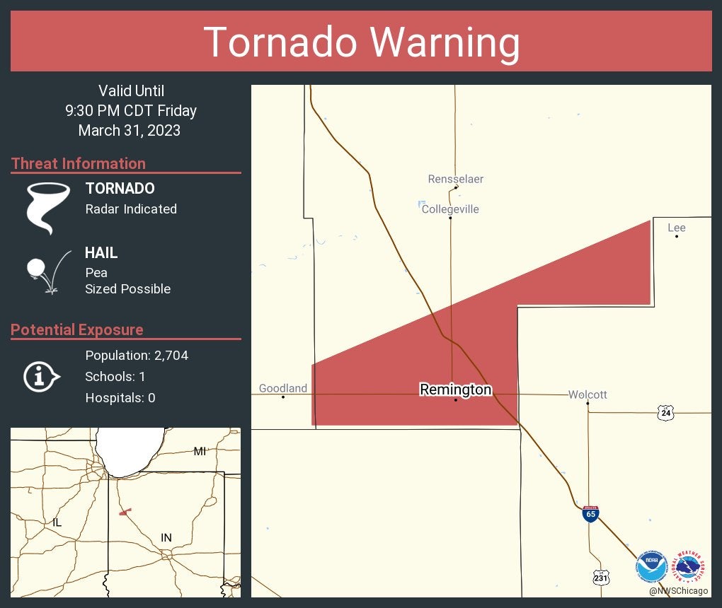
Tornado Warning including Remington IN until 9:30 PM CDT
9:40 p.m.
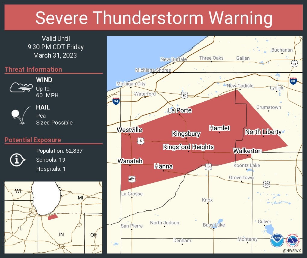
Severe Thunderstorm Warning including La Porte, Westville and Walkerton until 9:30 p.m. Central.
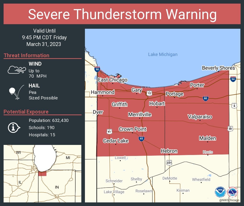
Severe Thunderstorm Warning including Hammond, Gary and Portage until 9:45 p.m. Central. This storm will contain wind gusts to 70 mph.
9:38 p.m.
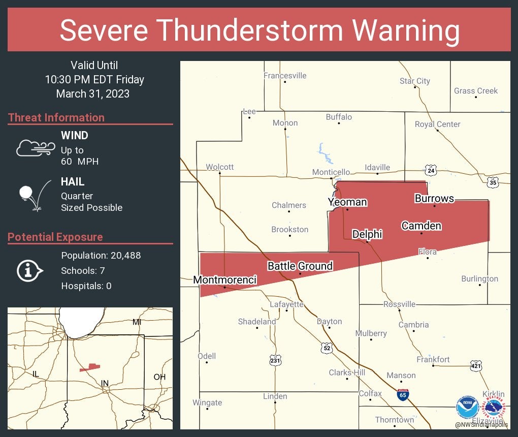
Severe Thunderstorm Warning including Delphi, Battle Ground and Camden until 10:30 p.m. Eastern.
9:33 p.m.
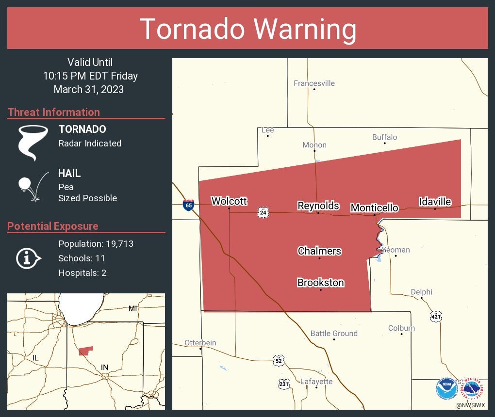
Tornado Warning including Monticello, Brookston and Wolcott until 10:15 p.m. Eastern.
9:23 p.m.
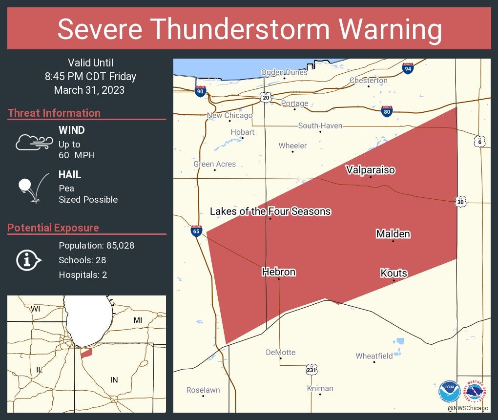
Severe Thunderstorm Warning including Valparaiso, Lakes of the Four Seasons and Winfield until 8:45 p.m. Central.
9:16 p.m.
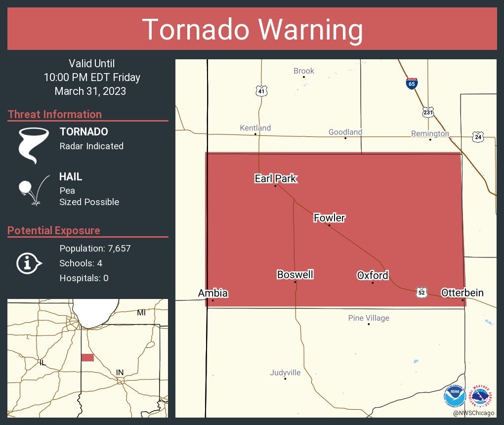
Watch live report: Tornado Warning including Fowler, Otterbein and Oxford until 10 p.m. Eastern.
9:15 p.m.
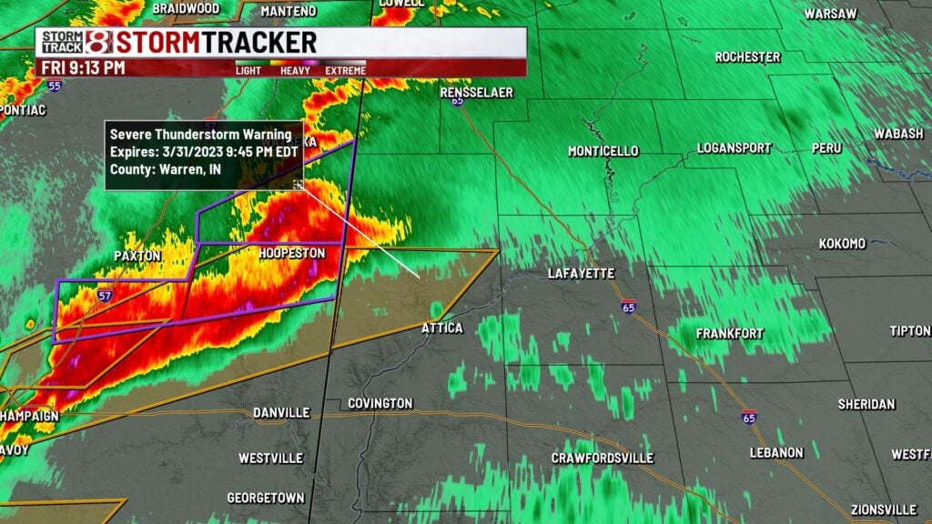
A severe thunderstorm warning has been issued for Warren County until 9:45 p.m. Wind gusts up to 60 mph will be possible.
8:55 p.m.
Storm Track 8’s Stephanie Mead tweeted, “Severe line in Illinois is headed our way between 10-11pm! Wind gusts 70+mph, tornadoes possible!”
8:48 p.m.
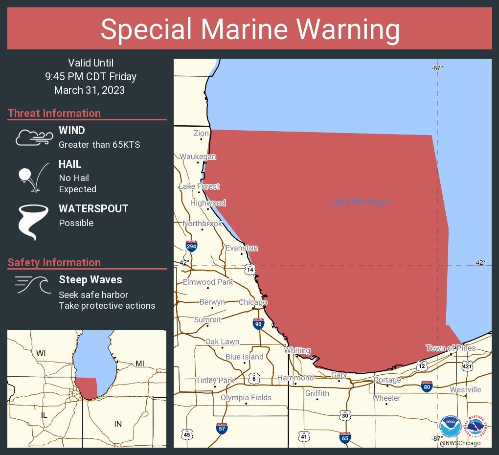
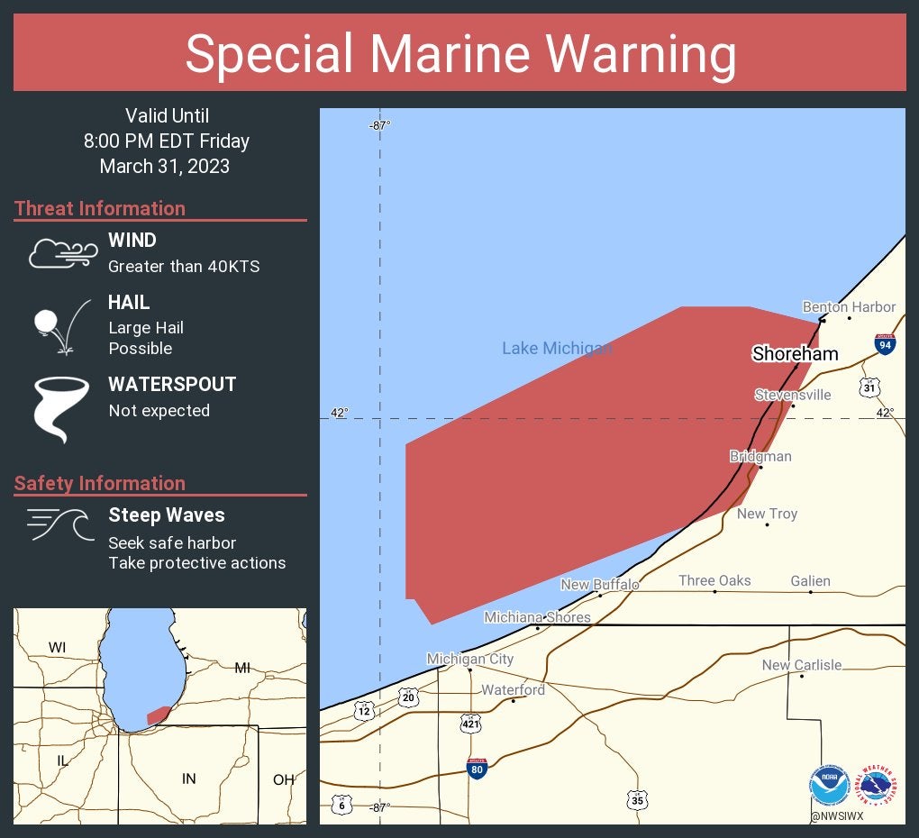
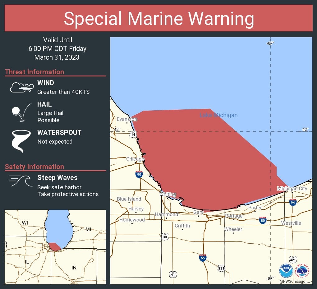
A special marine warning is issued for Lake Michigan until 9:45 p.m. Central.
8:43 p.m.
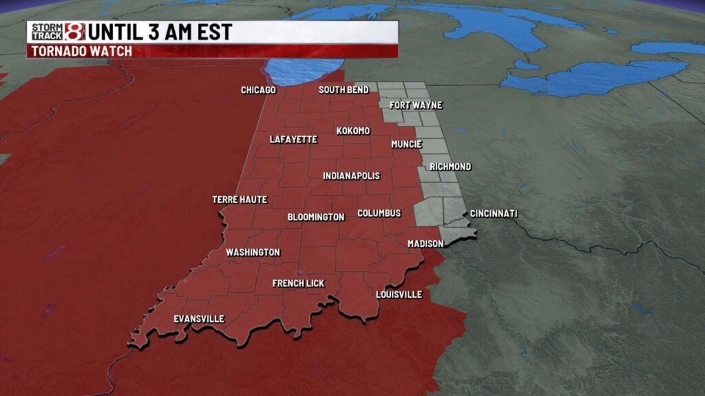
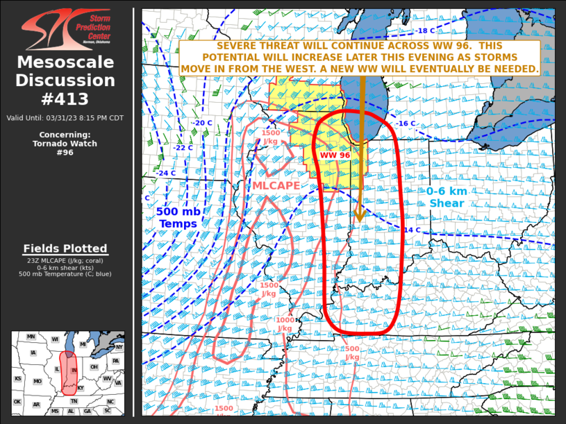
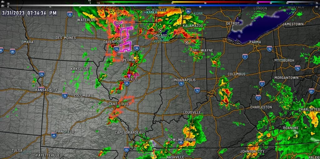
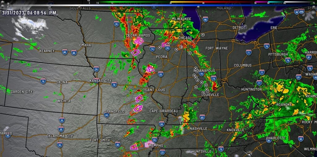
Long line of severe storms was moving into eastern Illinois. The line should arrive into western Indiana between 9-10 p.m. Friday. Tornado watch in effect until 3 a.m. Saturday.
7:58 p.m.
A tornado watch has been issued for parts of Illinois, Indiana, Kentucky and Michigan — including the Indianapolis metro area — until 3 a.m. Saturday Eastern.
7:37 p.m.
Storm Track 8’s Marcus Bailey says the National Weather Service’s Storm Prediction Center will be issuing a watch for much of Indiana over the next hour or two. Storms in central Illinois will continue to progress eastward and will arrive in western Indiana between 8-9 p.m. Friday.
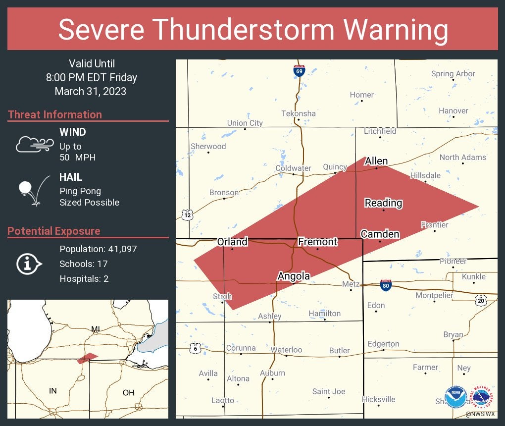
Severe Thunderstorm Warning including Angola and Fremont, Indiana, and Reading, Michigan, until 8 p.m.
7:25 p.m.
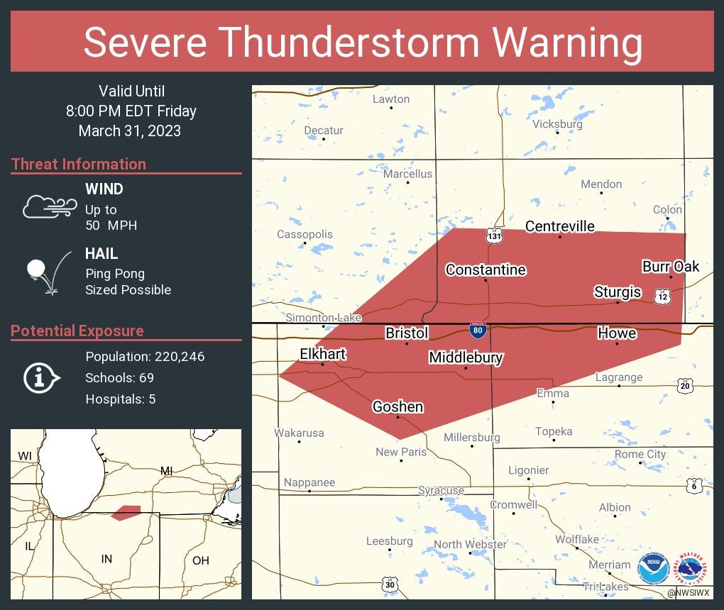
Severe Thunderstorm Warning including Elkhart and Goshen, Indiana, and Sturgis, Michigan, until 8 p.m. Eastern.
7:14 p.m.
On Facebook Live, Storm Track 8’s Ryan Morse is answering questions on the storms along with the latest timing.
7:01 p.m.
A special marine warning for Lake Michigan was issued until 8 p.m. Eastern.
6:52 p.m.
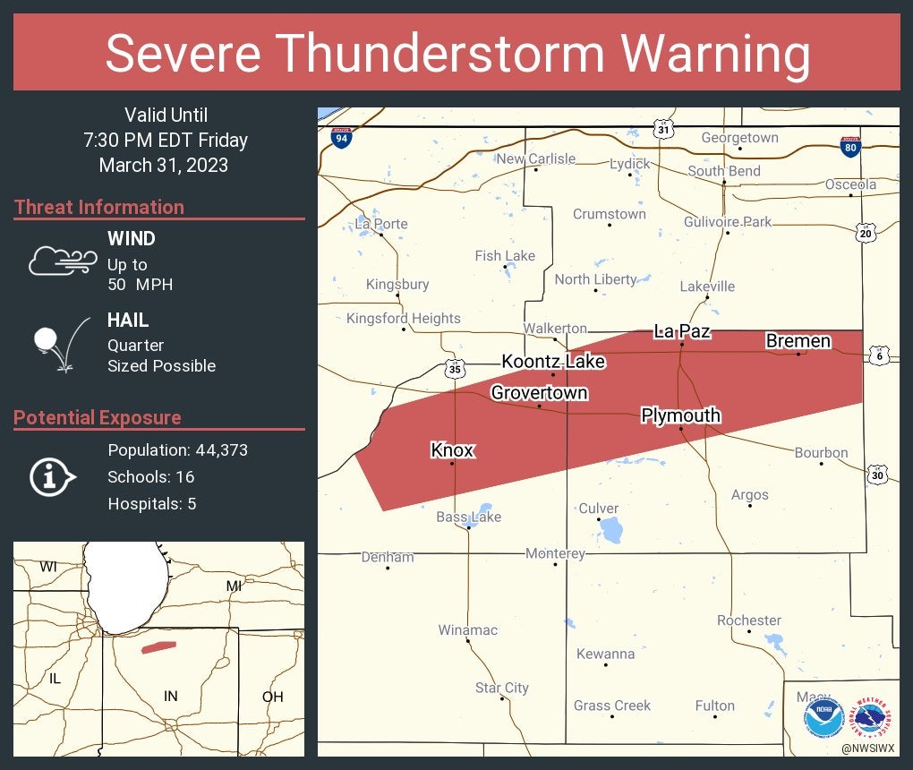
Severe Thunderstorm Warning including Plymouth, Bremen and Knox until 7:30 p.m. Eastern.
6:26 p.m.
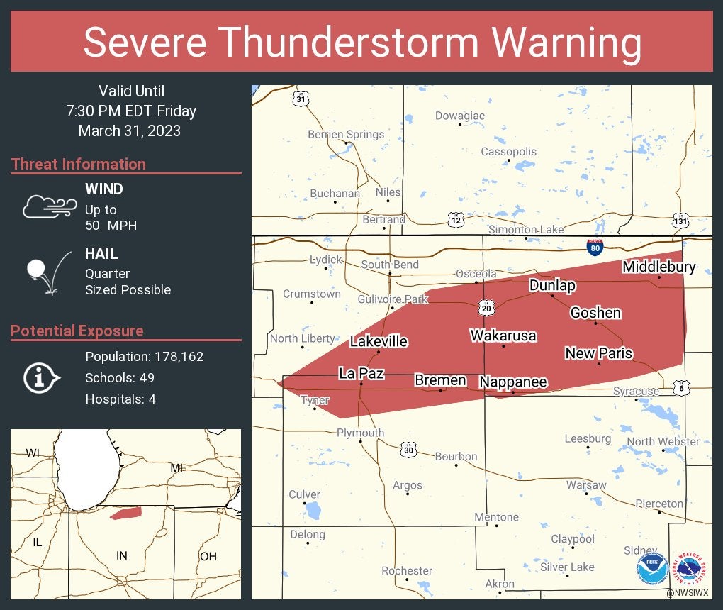
Severe Thunderstorm Warning including Goshen, Nappanee and Dunlap until 7:30 p.m. Eastern.
6:10 p.m.
Storm Track 8’s Marcus Bailey reports nonsevere storms are moving through Indiana. A line of severe storms is starting to take shape along and west of the Mississippi River. The line is expected to arrive in western Indiana from 8-9 p.m.
6:06 p.m.
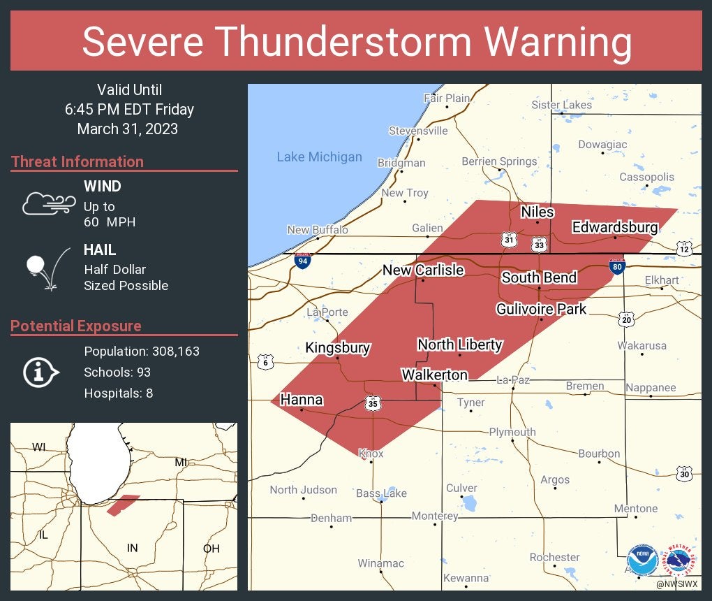
Severe Thunderstorm Warning including South Bend; Mishawaka; and Niles, Michigan, until 6:45 p.m. Eastern.
5:50 p.m.
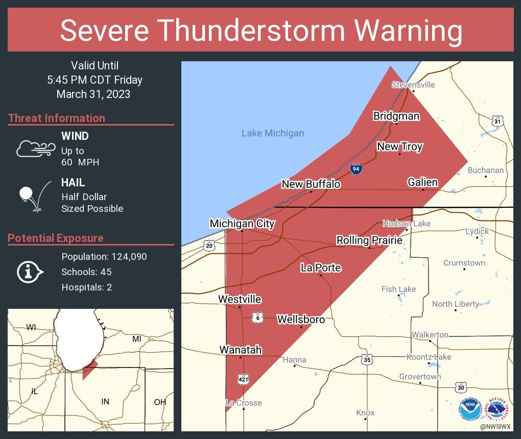
Severe Thunderstorm Warning including Michigan City, La Porte and Westville until 5:45 p.m. Central.
5:34 p.m.
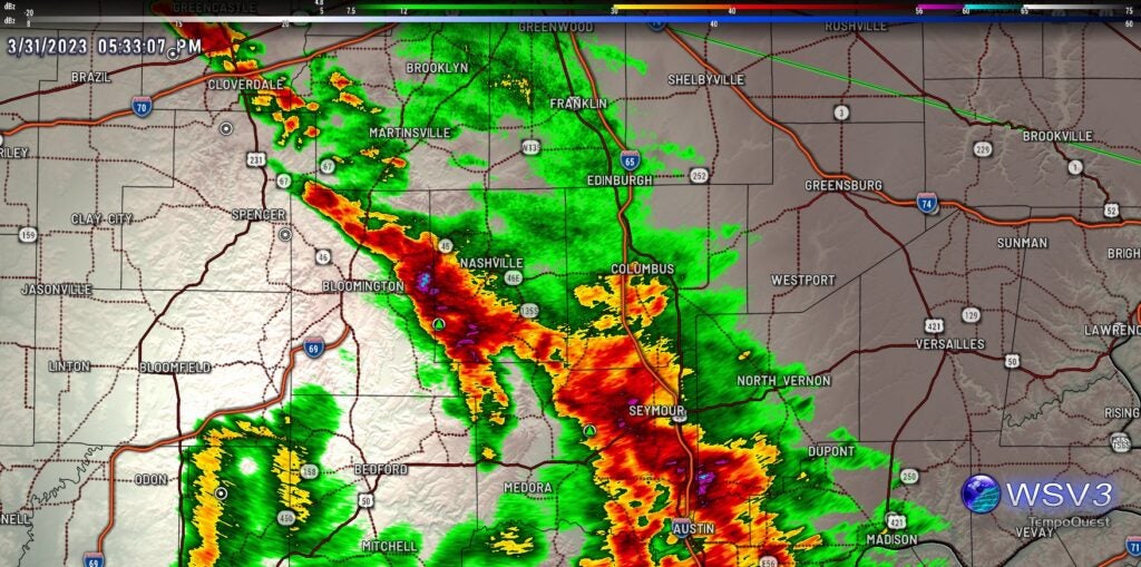
Storm Track 8’s Marcus Bailey reports a strong storm below severe limits moving through Brown, Monroe, Bartholomew and Jackson counties. Expect 40 mph winds and pea-sized hail. Moving northeast at 60 mph.
5:33 p.m.
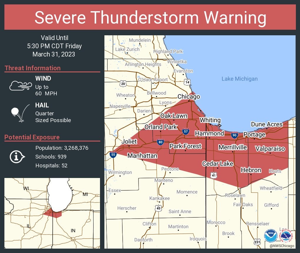
Severe Thunderstorm Warning including Chicago; Joliet, Illinois, and Hammond, Indiana, until 5:30 p.m. Central.
5:31 p.m.
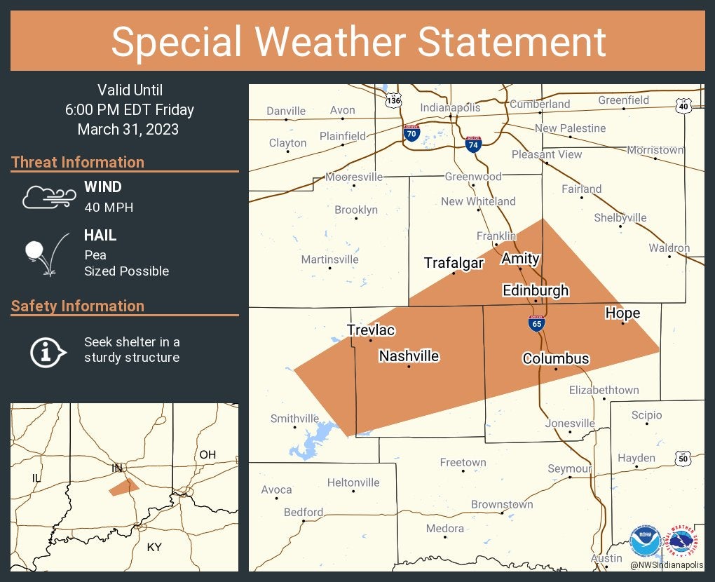
A special weather statement has been issued for Columbus, Edinburgh and Hope until 6 p.m.
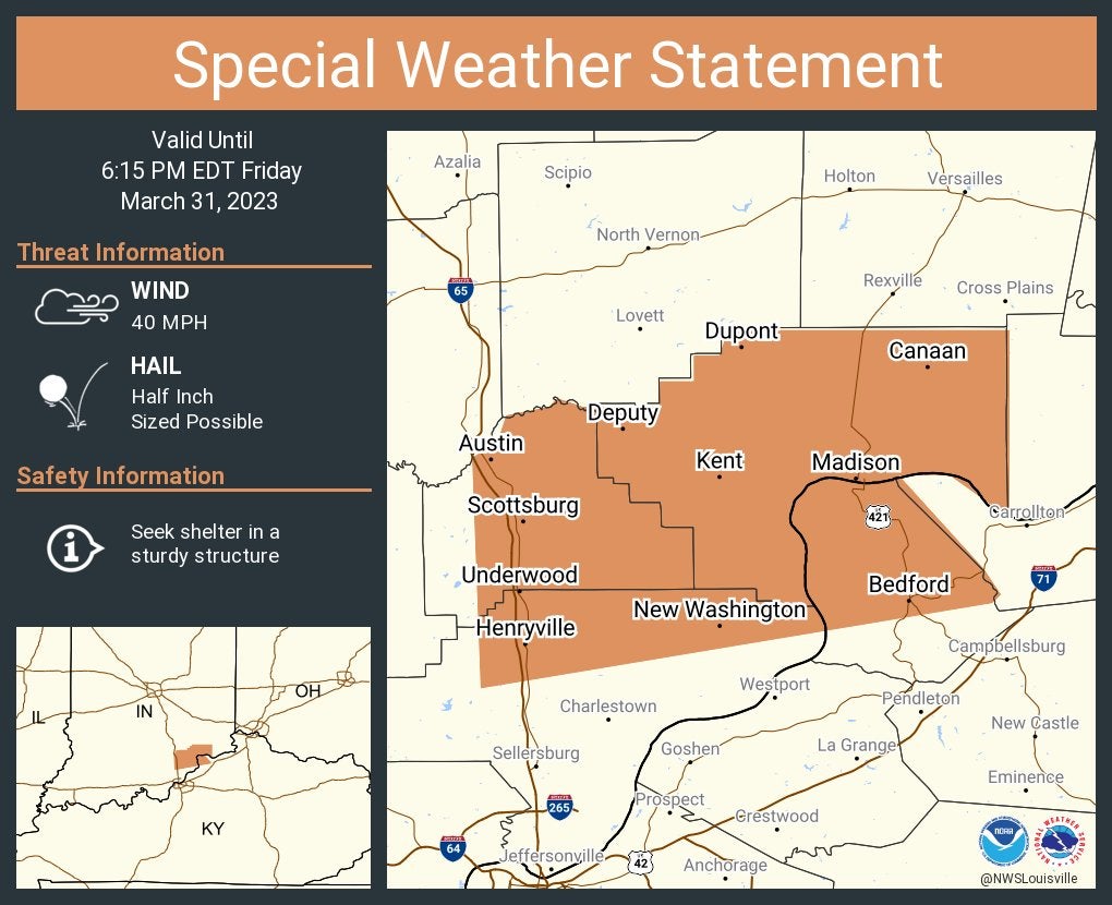
A special weather statement has been issued for Madison, Scottsburg and Austin until 6:15 p.m. Eastern.
5:28 p.m.
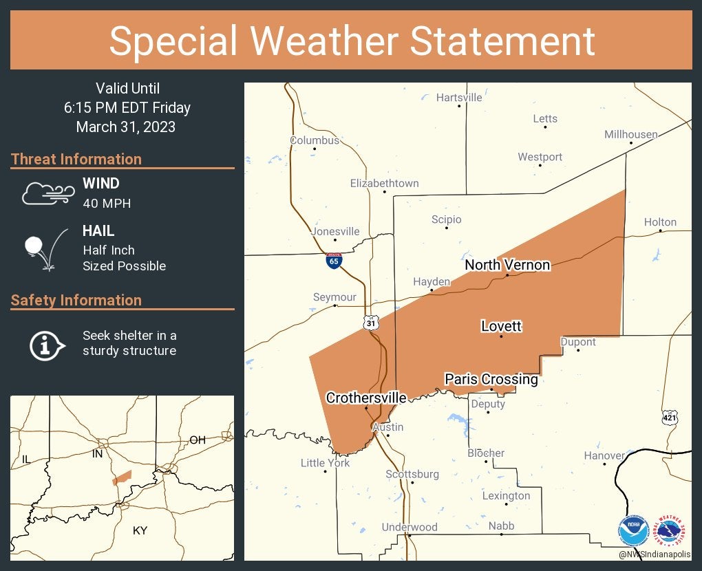
A special weather statement has been issued for North Vernon, Crothersville and Vernon until 6:15 p.m. Eastern.
5:23 p.m.
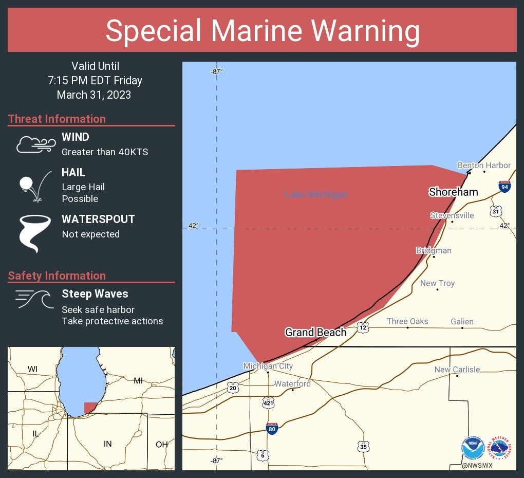
A special marine warning for Lake Michigan until 7:15 p.m. Eastern.
5:22 p.m.
A special marine warning for Lake Michigan was issued until 6 p.m. Central.
5:11 p.m.
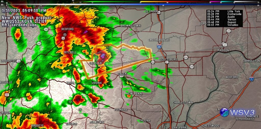
Storm Track 8’s Marcus Bailey reports severe thunderstorm warning for Orange and Washington counties in southern Indiana until 5:30 p.m. Quarter-sized hail reported. Moving northeast at 65 mph.
5:05 p.m.
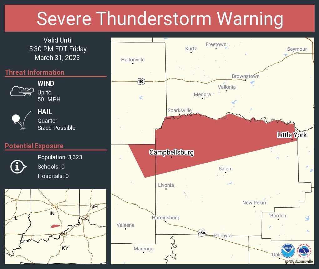
Severe Thunderstorm Warning including the Indiana communities of Campbellsburg, Little York and Saltillo until 5:30 p.m. Eastern.
5:02 p.m.
Nonsevere storms are working through southwestern Indiana. All eyes out, though, are to the west. Numerous warnings from Iowa, Illinois, Missouri and Arkansas. Line of storms moves into western Indiana from 8-9 p.m.
4:57 p.m.
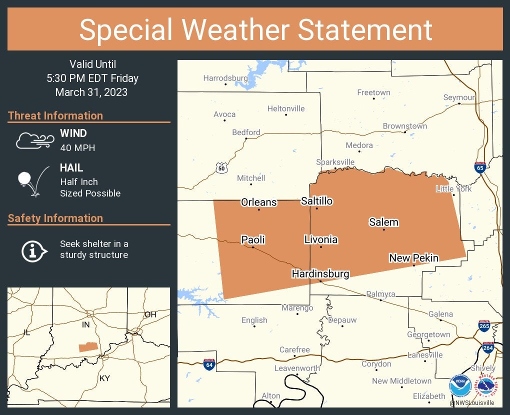
A special weather statement has been issued for Salem, Paoli and Orleans until 5:30 p.m. Eastern.
4:54 p.m.
Storm Track 8 is seeing a lot of action on radar to our west. Multiple tornado watches are in place. For central Indiana, the main line of strong storms arrives in Indiana close to 10 p.m. with spotty storms ahead of it. Damaging wind is still the main threat.
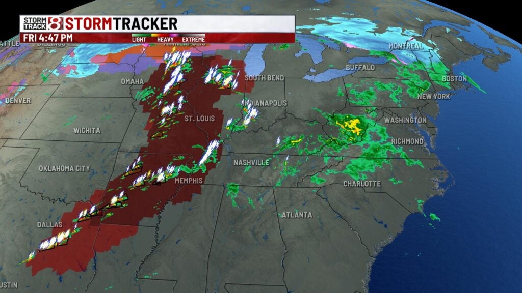
4:44 p.m.
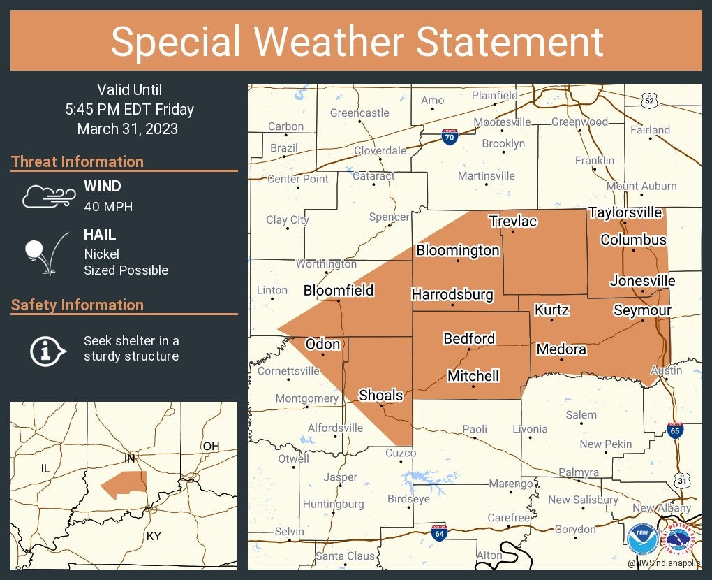
A special weather statement has been issued for the communities of Bloomington, Columbus and Seymour until 5:45 p.m. Eastern.
4:31 p.m.
Storm Track 8’s Stephanie Mead tweets that nonsevere storms are moving into southwest Indiana and quickly moving northeast. She says the storms could pop off, but the main severe risk is still midevening.
4:25 p.m.
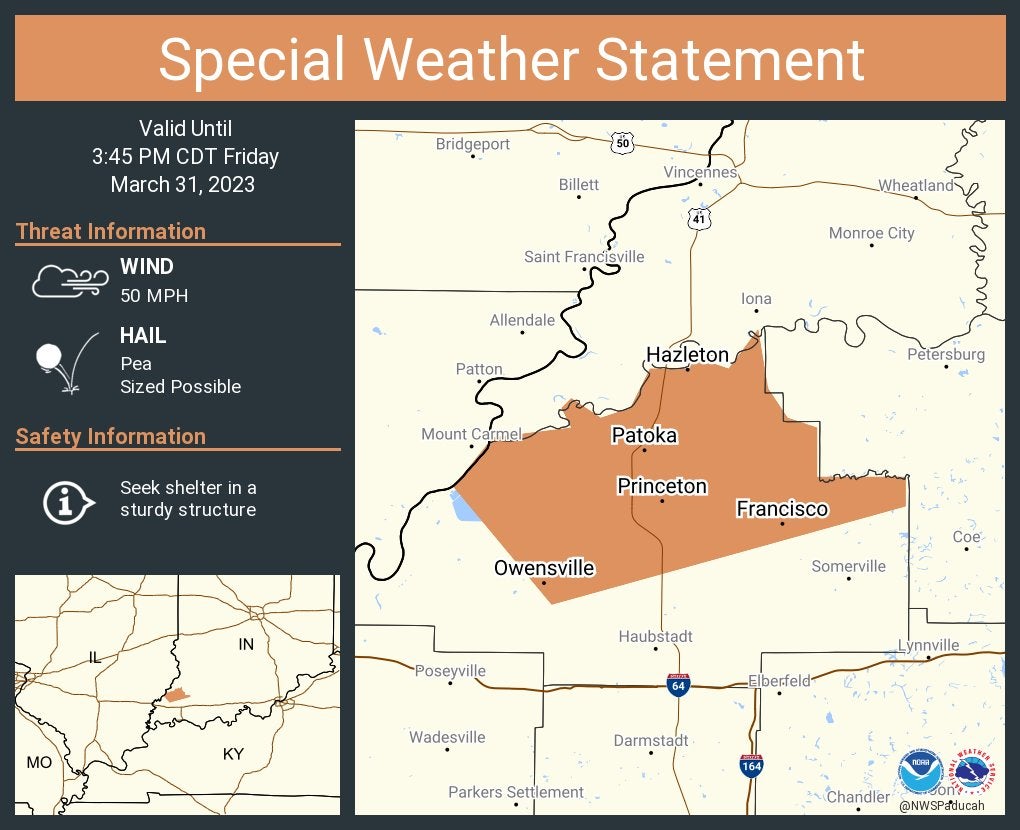
A special weather statement has been issued for the Indiana communities of Princeton, Owensville and Patoka until 3:45 p.m. Central.
4:20 p.m.
Storm Track 8’s Marcus Bailey reports scattered showers and storms are now entering southwestern portions of Indiana. We’ll watch these for some possible severe development, but the main threat still comes in after 8 p.m. Friday from the west.
3:35 p.m.
The National Weather Service at Chicago has issued a tornado watch through 11 p.m. Eastern/10 p.m. Central that includes these Indiana counties: Benton, Jasper, Lake, Newton and Porter.
2:42 p.m.
Storm Track 8 meteorologist Marcus Bailey presents specifics on the storm ahead during a Facebook Live.
2:23 p.m.
Here’s James’ forecast:
Friday night: Showers and Storms moving through between 8pm and Midnight. Then windy and cooler. Low 40.
Saturday: Chance for a few rain showers and windy. West winds gusting to 45 mph through the afternoon. High 48.
Sunday: Mostly sunny and dry and less windy. Chilly in the morning Low 29. High 58 on Sunday afternoon.
Monday-Saturday: Springlike temperatures in the 70s Monday, Tuesday and Wednesday. Also, there’s a chance for scattered showers each day. Cooler and dry Thursday, Friday and Saturday. Highs in the upper 50s.