


Storms to kick off the week
INDIANAPOLIS (WISH) — Active weather pattern sets up across the state, bringing several rounds of needed rain to central Indiana for much of the week.
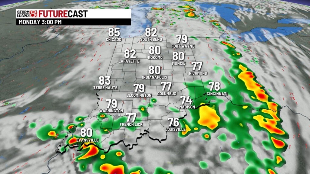
Monday:
Upper level trough is digging just to our west, sparking showers and storms along the Mississippi River. Expect these storms to arrive by mid to late morning. Outside shot of a few strong storms, containing gusty winds and larger hail. Storm complex likely pulls away from the state by early afternoon.


The rest of the day should be a bit cooler, with the assist from rain-cooled air and cloud cover. Can’t rule out a spotty thunderstorm later Monday afternoon. Highs top out in the middle 80s.


Monday night:
Much of the overnight should be quiet and muggy. We’ll have to watch for another line of storms developing over northern Illinois, which could progress southeast into northeastern portions of the state deep into the overnight hours.

Lows fall to the lower 70s.
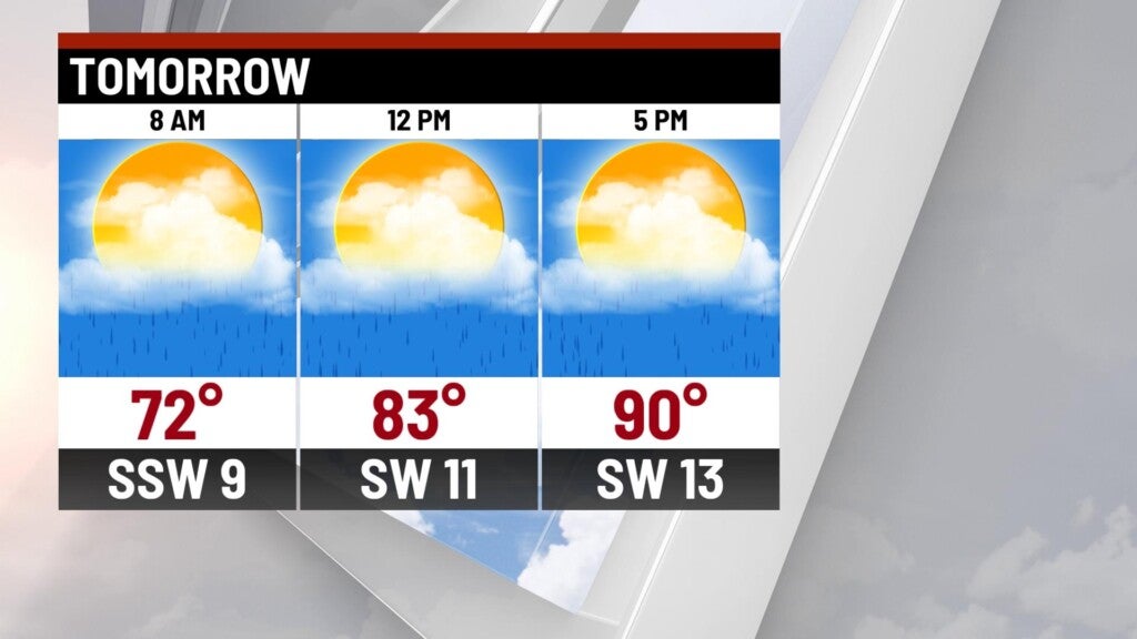
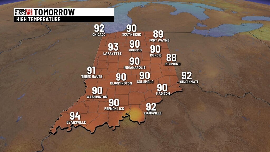
Tuesday:
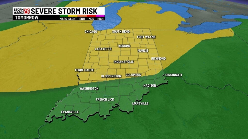
Hot and humid conditions through the day, with isolated thunderstorm chances in the afternoon. Chance for a strong storm or two in the afternoon. Highs top out in the upper 80s and lower 90s.
Possibility of stronger storms developing in the wake of a system moving to our north during the overnight hours, but will be dependent on how well those storms hold together as they move closer to northern portions of the state. While the highest severe threat will likely be to our northwest overnight, there may be enough shear and instability to help a few storms reach severe limits.

Wednesday:
Expect widely scattered showers and storms across the state. Highs top out in the upper 80s.

8-day forecast:
One last shot for isolated showers and storms on Thursday before we quiet down the pattern, and cool the temperatures down. Highs hold in the lower 80s starting Friday and should continue into the weekend.
