


Tracking Wednesday’s storms
INDIANAPOLIS (WISH) — More rain chances and possibly even a few storms are on the way for our Wednesday, which will impact last minute Thanksgiving travels.
Tuesday night: We will keep mainly cloudy skies around the area ahead of our next weather system. Rain will move in shortly after midnight Wednesday, quickly becoming widespread in coverage.

Lows will only fall into the mid 40s.

Wednesday: A soggy day is ahead for central Indiana with winds becoming breezy. As we work our way through the afternoon hours, a few storms are possible. Isolated strong to severe storms are not out of the question.

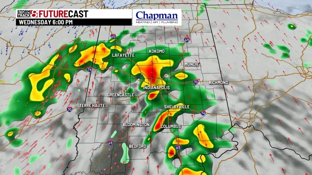
A Marginal Risk for severe weather is in place for nearly the southern two-thirds of the state. The main threat will be damaging winds, but an isolated tornado cannot be ruled out for areas along and south of interstate 70. Isolated flooding may become a concern as well.


Highs will rise into the mid 50s.
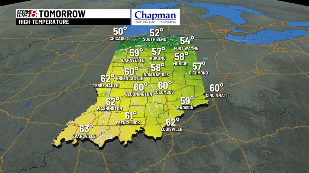
Thanksgiving Day: A great turn-around in the forecast will come just in time for Thanksgiving Day. Enjoy a dry and calm Thanksgiving with some peeks of sunshine. Highs will remain above average for this time of the year as we will top out in the low to mid 50s.

8 Day Forecast: The fantastic weather trend will continue to end the workweek with plenty of sunshine. A cooldown will move in for the weekend with highs in the 40s. By the new workweek next week, an even bigger cooldown will knock our high temperatures into the 30s with the chance for rain and snow showers in the first half of next week.

