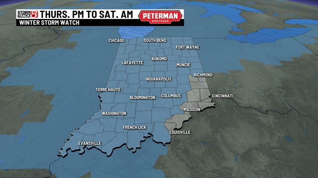
Winter storm warnings for snow, dangerously cold temperatures in Indiana
Winter storm warnings have been issued for much of Indiana from 3 p.m. Thursday until 7 p.m. Friday.
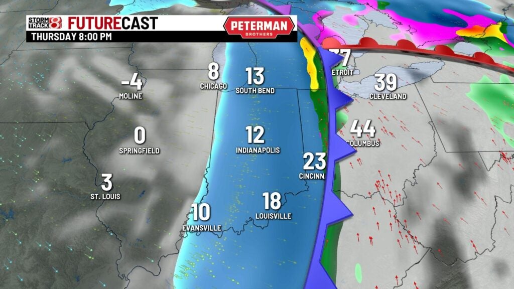
The current model trends bring the rain-snow transition slightly at sunset Thursday. The heaviest snow will fall Thursday night.
A blizzard warning will be issued Thursday a few northern counties near Lake Michigan including South Bend.
Wind chill warnings will be issued for the southern tip of the state.
Precipitation is set to develop as a light mix overnight into Thursday. Expect mainly scattered light rain Thursday. Temperatures will drop quickly Thursday causing a flash freeze. As colder air sinks into the state rain will transition to snow Thursday at sunset. Most of the snow will fall in the metro area Thursday evening.
We’re still tracking three main hazards dangerous cold, high winds and accumulating snow. Additional hazards include a flash freeze and blowing snow.
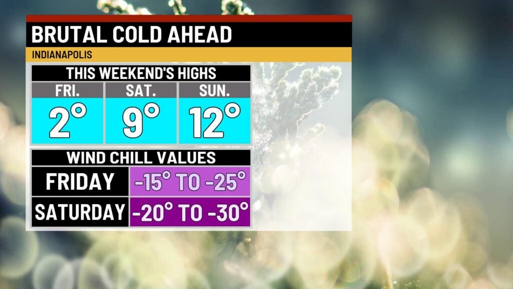
COLD: The coldest nights in Indianapolis will be Thursday, 3 below zero, and Friday night, 4 below zero. Dangerously cold wind chills are expected Thursday night through Saturday morning in Indiana with wind chills as low as 20 below zero to 30 below zero
SNOW: The track of the heaviest snow looks to be northwest of Lafayette and north seeing 6 inches or more of snow. Most locations along and just north of I-70 will see from 3 to 6 inches of snow with slightly lower amounts south of a line from Bloomington to Columbus.
WIND: Winds will pick up Thursday afternoon peaking from 40-50 mph Thursday afternoon through Friday night. Winds from 30-35 mph are expected for much of Saturday during the day. Gusty winds will cause blowing and drifting snow and make travel difficult.
FLASH FREEZE: It’s possible Thursday early evening as temperatures fall more than 30 degrees in a few hours and make wet pavement slick.
BLOWING SNOW: Friday and Saturday blowing snow will cause low visibility and make travel difficult.
— From Storm Track 8 Chief Meteorologist Ashley Brown

Forecast from ‘Daybreak’
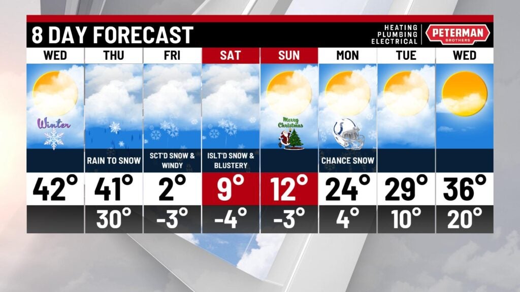
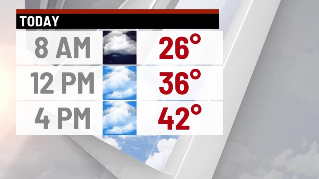
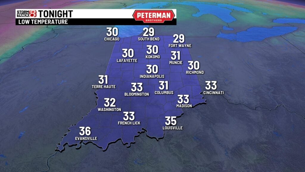
Wednesday has been another quiet and mild day with highs in the lower 40s with a mix of sun and clouds through the afternoon. Lows will fall to the lower 30s.

Winter storm timeline
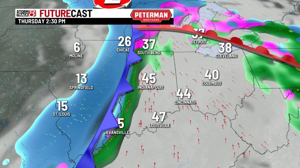
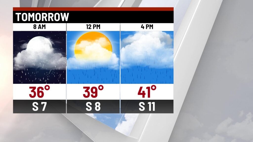
Thursday: The storm will start as rain through the morning. We could see a little mixing of rain and freezing precipitation through the morning. Temperatures will warm through the late morning and very early afternoon with most spots in the lower 40s.
The area of low pressure and cold front generating the snow and much colder temperatures will swing through mid-afternoon which will rapidly drop out temperatures in a span of a few hours.
Roads will be wet from the rain and will quickly freeze, causing a flash freeze and making roads icy. Rain will also quickly transition over to snow and we could see periods of very heavy snow.
Winds will also pick up as well, with winds from 40-50 mph creating blowing snow and limited visibility. Travel will be dangerous from late Thursday through mid-day Friday.
Lows will plummet to -3° with feel-like temperatures from 15 below zero to 20 below zero Friday morning.
Snow accumulation will vary on location with most spots in the central parts of the state from 3-6 inches of snow with heavier amounts north. Northwest Indiana should be get from 6-8 inches while areas along Lake Michigan could see around 1 foot of snow by mid-early Friday morning.


Friday: Most of the heavy snow should come to an end, with a few light snow showers here and there through the late morning and early afternoon.
Winds will still be howling with gusts from 40-50 mph. Frigid temperatures will follow the snow with highs struggling Friday. We’ll only warm to 2 with feel-like temperatures from 15 below zero to 25 below zero. We’ll see blowing and drifting snow with gusty winds through the day.
Christmas Weekend: Saturday, Christmas Eve, will be brutally cold with temperatures starting off below zero Saturday morning. Feel-like temperatures will range from 15 below zero to 25 below zero. There could be a stray snow shower chance but most of the day will be dry and mostly cloudy with highs in the single digits.
Christmas Day on Sunday will be frigid, with highs nearing 12 with some sunshine.
We’ll trend a little warmer next week with spots rebounding to the mid-20s with a chance of a few snow showers through the day. Highs will continue to warm to the upper 20s and lower 30s through midweek next week with some clouds and sunshine.