


Warming this weekend
INDIANAPOLIS (WISH) — We’re out of the freezer as we wrap up the holiday weekend. Rain chances return by Sunday night.
Saturday:
Northwest flow responsible for very cold temperatures on Christmas Day will break down, allowing the temperature to modify a bit starting today. Expect mostly sunny skies, with highs in the middle to upper 30s this afternoon.


Saturday night:
Clear, quiet and seasonably chilly overnight. Lows fall to the middle 20s.

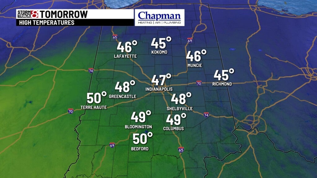
Sunday:
Warmer day on tap ahead of our next system rolling through. Clouds will gradually increase through the day, with highs in the middle 40s.

Very light showers arrive by mid evening across the state, and should move out around or just after midnight.

8 day forecast:
Quiet and colder weather on tap for Monday and Tuesday, with highs in the middle 30s. The next system moves in Wednesday night. Ahead of the system, we will see temperatures flirt with 50 before rain showers arrive for the second half of the day. Colder air behind the system will allow for a changeover from rain to snow on Thursday, with light snow accumulations possible to wrap up the year. Cold temperatures slide in for Friday into next weekend.
