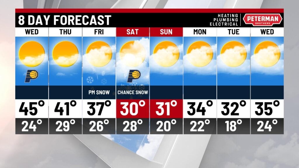
Above average Wednesday, snow chances to follow
INDIANAPOLIS (WISH) — Temperatures made it back into the 30s for our Tuesday due to a breeze out of the south. We are going to continue our warmup going into our Wednesday before snow chances arrive.
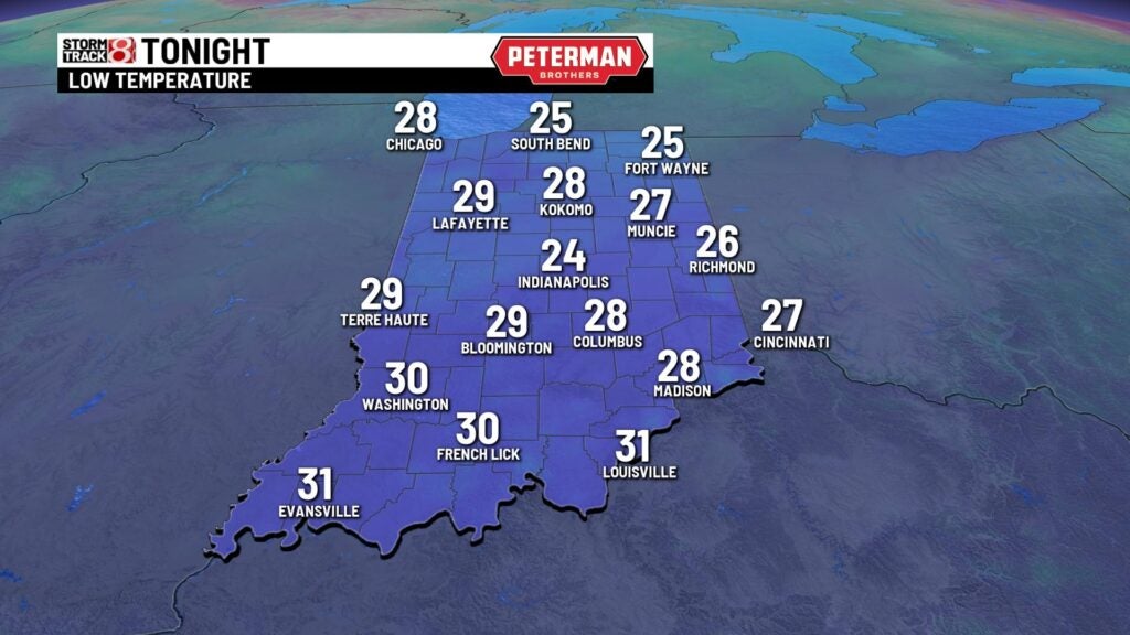
Tuesday night: We will flip the script on the bitter cold by transitioning into a warmer Tuesday night. Although low temps will fall into the mid to upper 20s, it will be breezy.
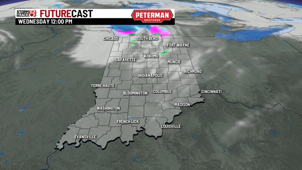
Wednesday: The warming trend continues into our Wednesday as we bounce into the mid 40s. A stray shower or two cannot be ruled out, but better precip chances will reside mainly in the northern third of the state.
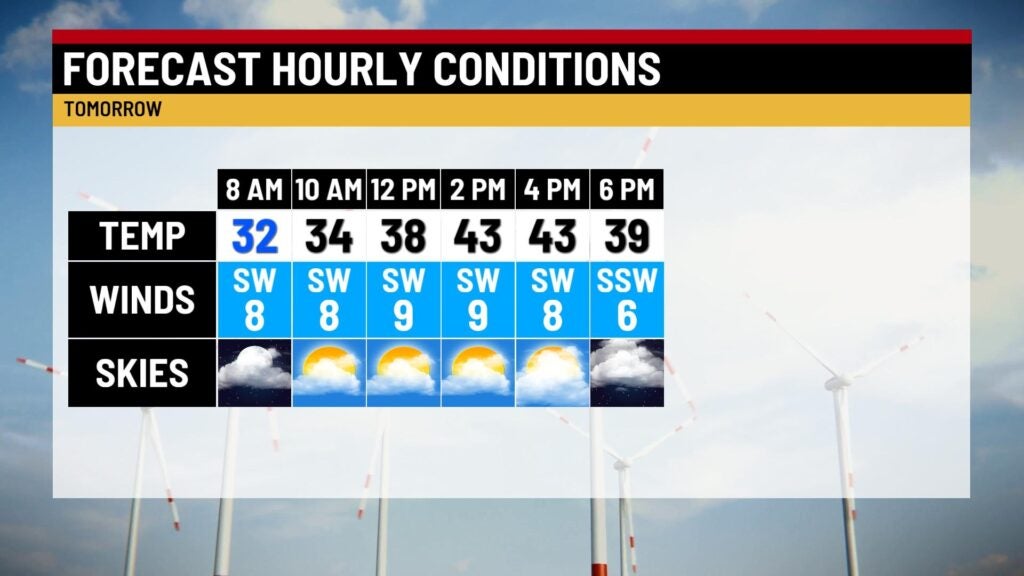
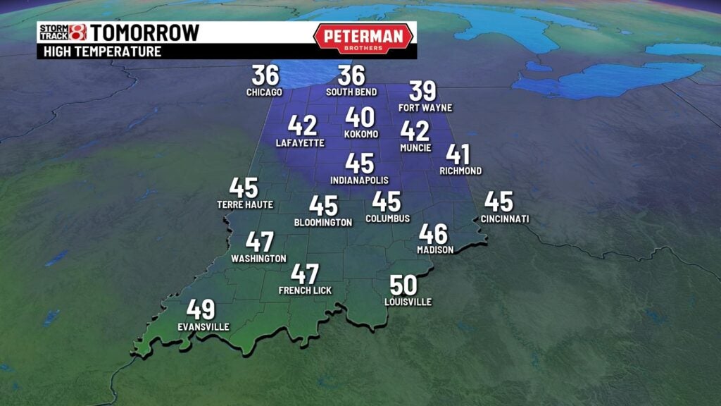
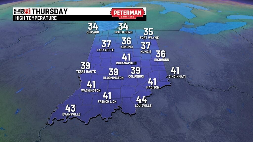
Thursday: Above average temperatures are set to stick around for our Thursday. However, this will lead way for the chance of scattered snow showers for mainly the first half of the day.
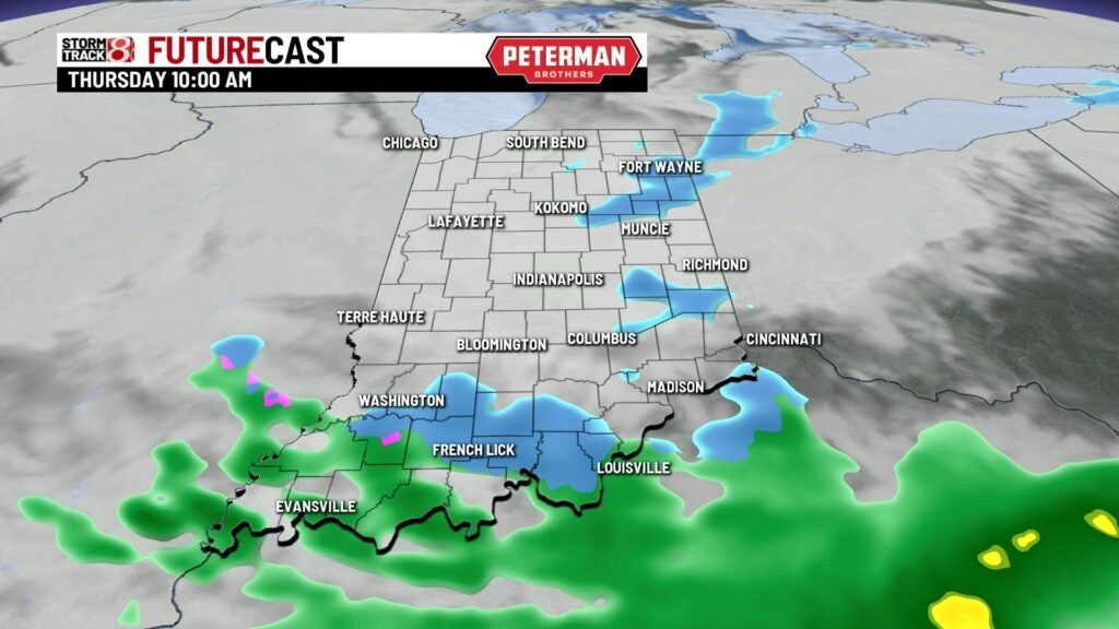
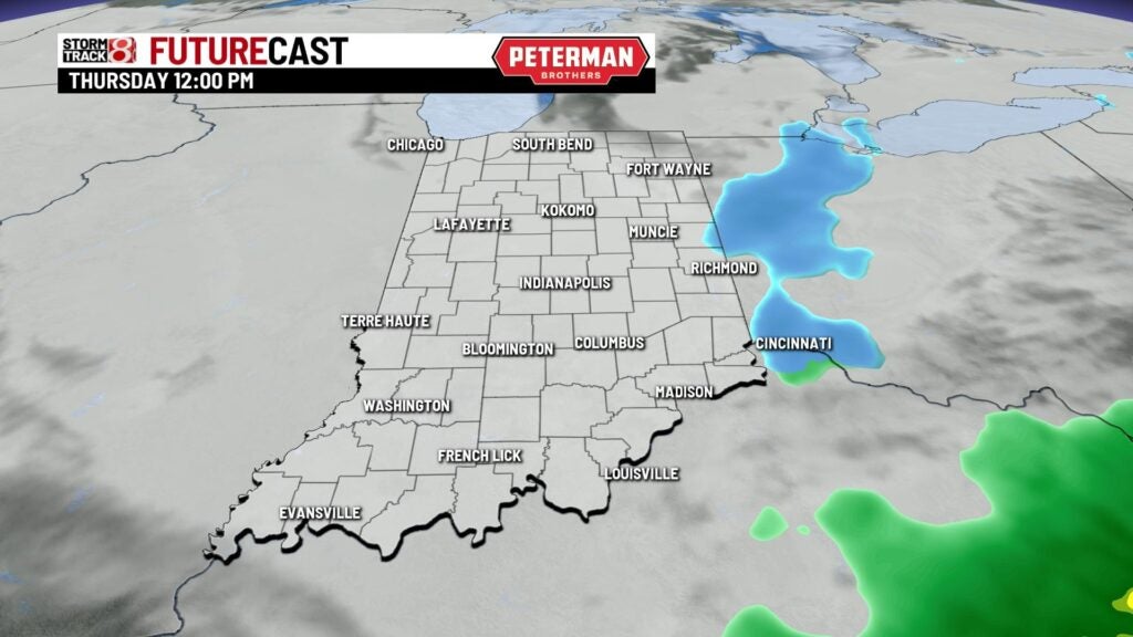
There will not be much sunshine as temperatures only rise into the upper 30s to low 40s.
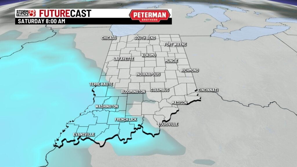
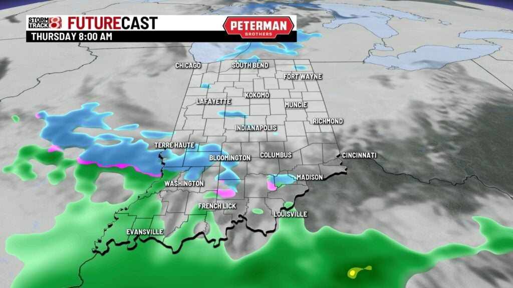
8-Day Forecast: Cooler air will gradually move back into the state as we head into the weekend. A much more potent system looks to swing down into the midwest by late Friday and into Saturday. This will be monitored closely as there is even a shot for our first real accumulating snow of the season. There is also a decent chance we miss out on much of the snow. For now, there is enough confidence to say there is a chance for some snow (two different models shown below to highlight differences). Specifics on totals will become more fine tuned over the next couple of days. Near to below average temps will then stay with us into next week.