


Active weather to return for the weekend
INDIANAPOLIS (WISH) — Although it was very warm this week, we got to enjoy some extended dry time as well. This dry streak, however, will come to an end as returning rain and storm chances are on deck this weekend.
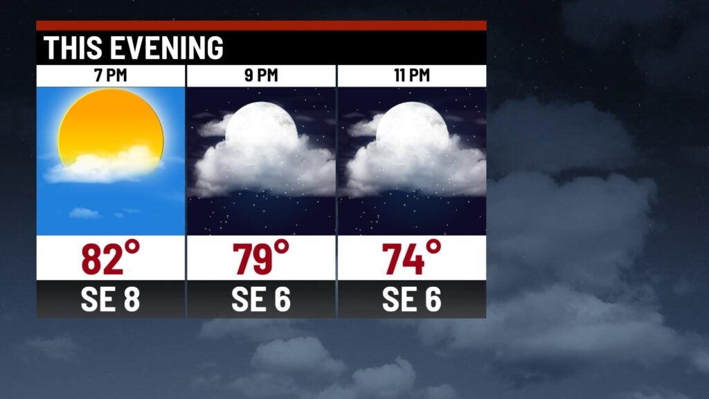
Friday night: The first half of tonight will remain dry. Then, a few showers will become possible after midnight.
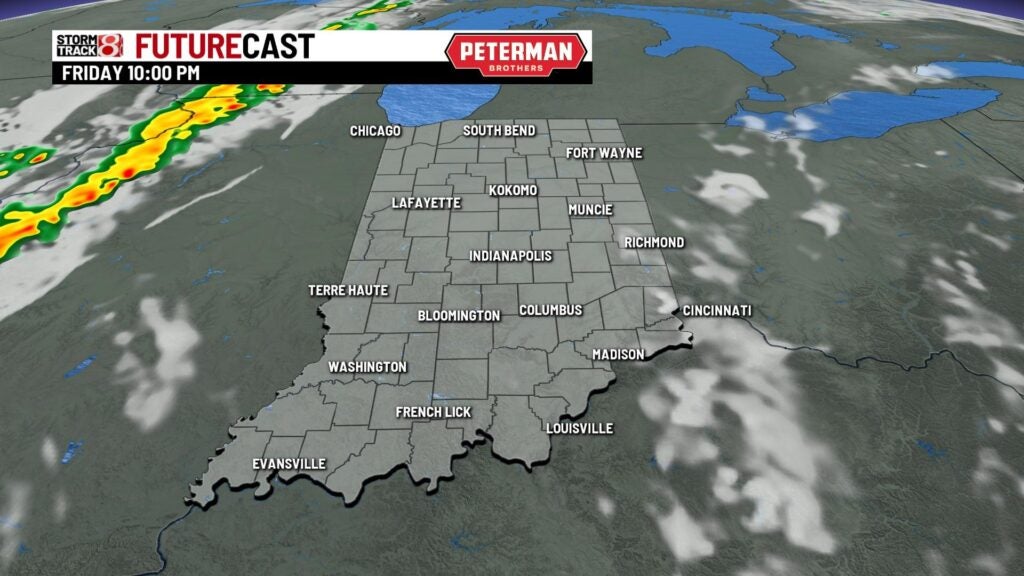

Lows will only fall into the mid 60s.

Saturday: Prepare for an active day with on and off showers and storms throughout much of the day. It is important to note that this activity will be slow moving, so locally heavy rainfall will be in play.
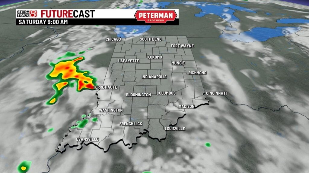


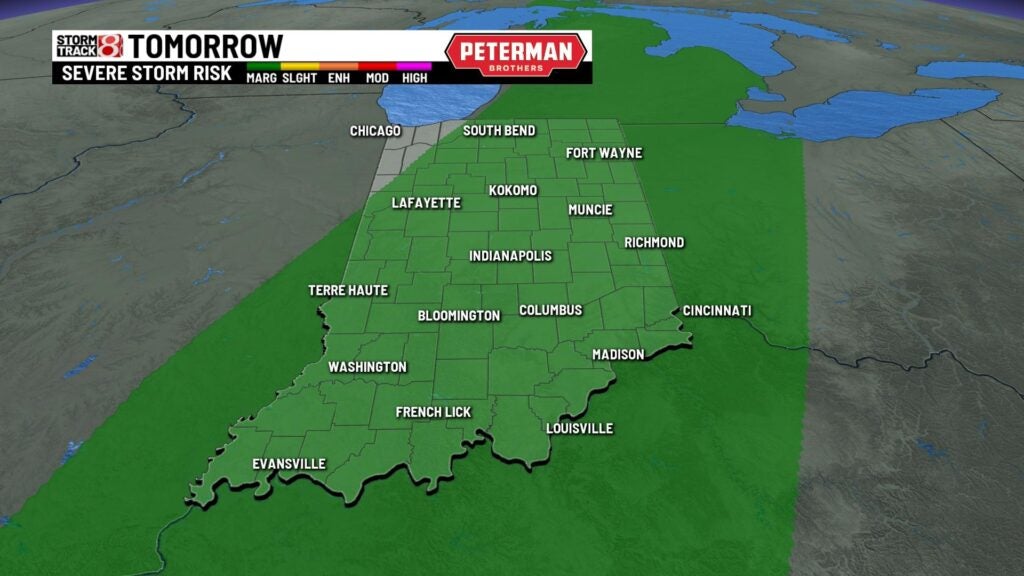
An isolated strong to severe storm or two (Marginal Risk – level 1/5) also cannot be ruled out with damaging wind and hail being the main threats.
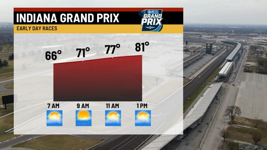
For those going out to IMS, some of the Indiana Grand Prix racing events could be affected by the rain. Highs are set to rise into the low 80s.


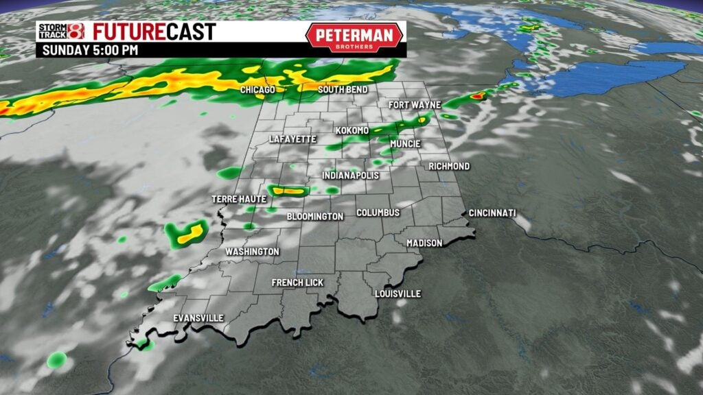
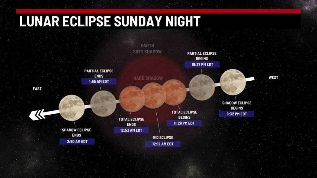
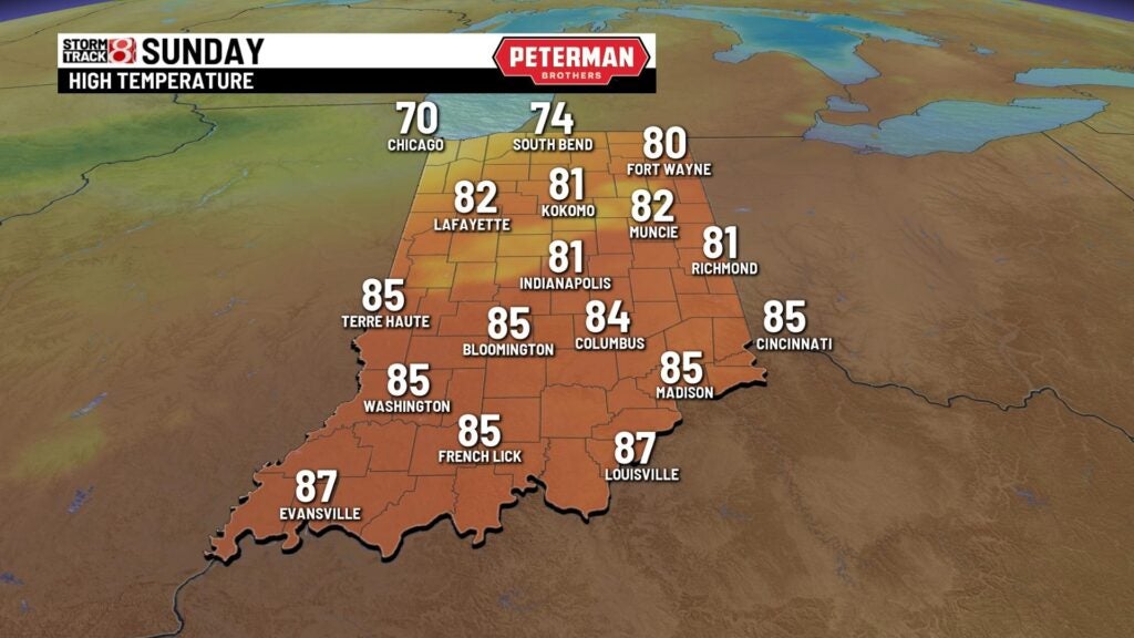
Sunday: Additional scattered shower and storm activity is possible for Sunday afternoon and night. If you are looking forward to seeing the total lunar eclipse late Sunday night, it could be tough to view due to increased cloud cover.


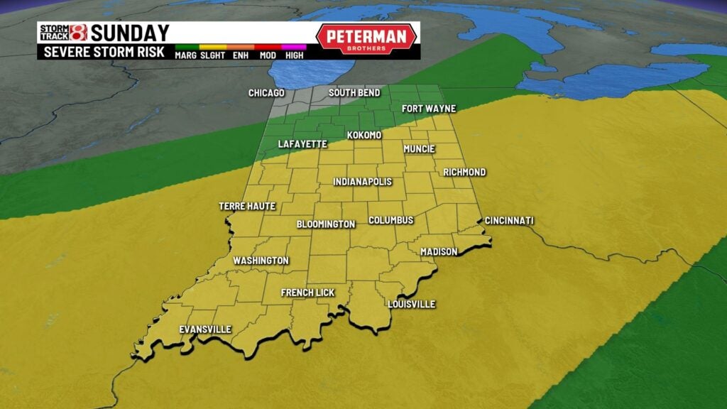
There is the threat for isolated strong to severe storms with a Slight Risk (level 2/5) in place for a good chunk of the state. Damaging winds and hail will once again be the primary threats.
Highs stick around the low 80s.
8-Day Forecast: We dry out for the first half of next week with highs in the mid 70s. More active weather looks to roll in by midweek next week with a warmup. It is too early to determine if severe weather chances will be in play for next Wednesday.
