


Arctic air to return
INDIANAPOLIS (WISH) — We brought out the sunshine and breezy winds en route to what was a much warmer Tuesday statewide. However, this warmer air won’t stick around as we are tracking much colder air to quickly make a comeback.
Tuesday night: Temperatures are set to stay on the mild side overnight with cloud cover locked into place. Winds will remain breezy as we hold steady in the mid to upper 30s.


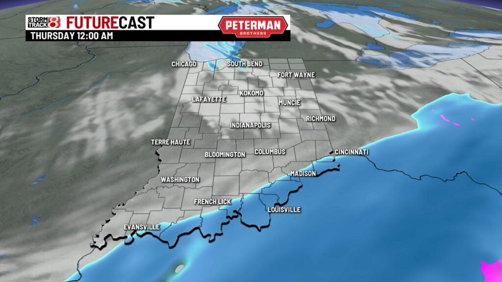
Wednesday: We will begin our Wednesday in the mid to upper 30s before temperatures drop off throughout the day. A system will move just to our south, which is set to bring snow chances for mainly the southern third of the state. There is the chance for areas up to interstate 70 to see some late afternoon flurries.


As we roll into the nighttime hours. Lake effect snow from the north looks to trickle down into portions of northern Indiana.


Highs will occur very early Wednesday.


Thursday: By Thursday morning, we will be sitting quite cold with numbers in the teens. Wind chill values could be below zero in some spots.
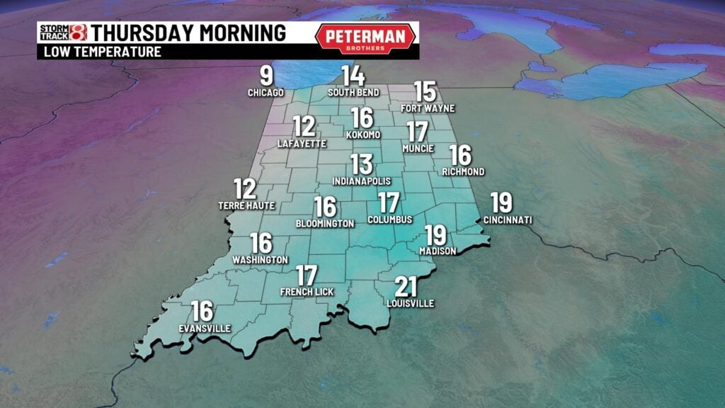

It will be a struggle for us to get into the 20s for our high temperatures.

8-Day Forecast: Below average temps stick with us going into the weekend. We will then make a slight rebound into the 30s for Saturday and Sunday. Snow flurries can’t be ruled out for Sunday and next Tuesday.
