Autumn air finally arrives to central Indiana
INDIANAPOLIS (WISH) — Rain moves out overnight, allowing for a rush of much cooler air to slide into central Indiana for the end of the work week.
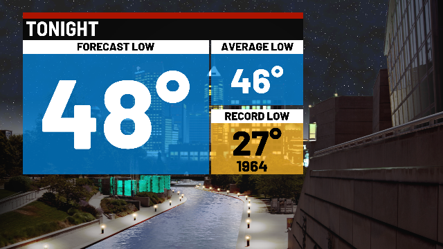
Tonight:
Scattered showers, with a few thunderstorms will continue through the mid to late evening hours. We should start to see the rain pull away shortly after Midnight, as a cold front swings through the state.
Following the front, much cooler air rushes into central Indiana. Under partly cloudy conditions, overnight lows dip to the middle to upper 40s.

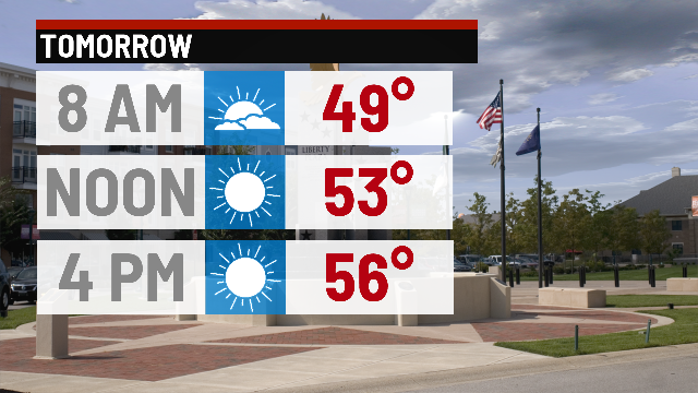
Thursday:
Dry and MUCH cooler day on tap. Partly cloudy to eventually mostly sunny conditions, with highs only in the upper 50s.
Friday:
Overall dry – but could see a few light showers late in the afternoon and evening.

Highs hit the middle 50s.

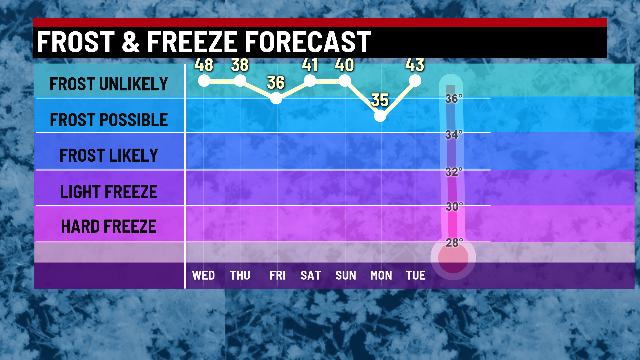
First frost?
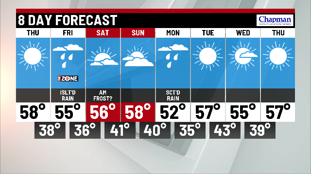
We’ll have a few opportunities for the seasons first frost. Thursday night could possibily get chilly enough in spots – although it may be just a touch too breezy. Next best chance for frost formation will be Friday night – depending on cloud cover if we see rain late Friday. Coldest low temperatures in the 8 day is next Tuesday morning, falling into the middle 30s, making widespread frost a decent possibility.
8-day forecast:
Pattern has now flipped. 50s are here to stay, with chilly overnight lows in the 30s and 40s. Next rain chance comes in on Monday, with drier air moving in for the middle of next week.