


Chilly and breezy to end the workweek
INDIANAPOLIS (WISH) — We began our pattern flip throughout our Thursday with quick moving showers and cooler air beginning to filter in. It was also very windy at times with wind gusts over 35 MPH.
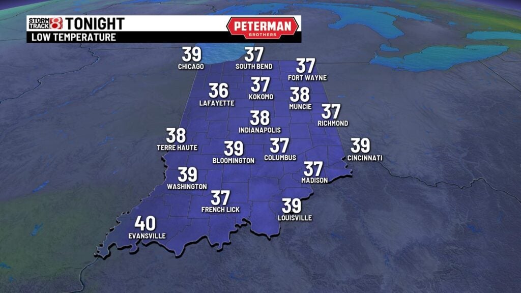
Thursday night: A clear and much cooler night will be on tap statewide. Expect winds to stay breezy as lows dip into the upper 30s.

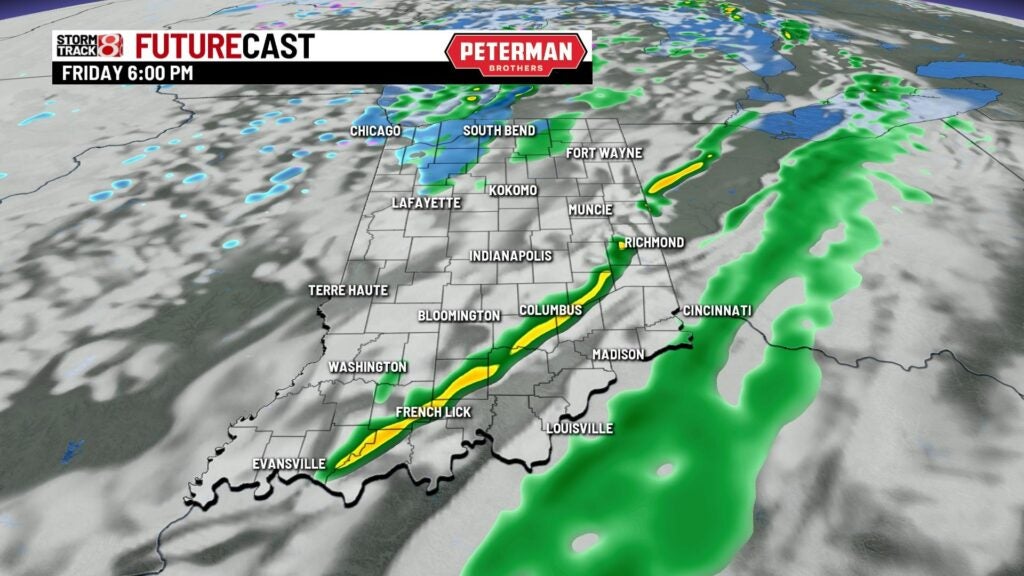
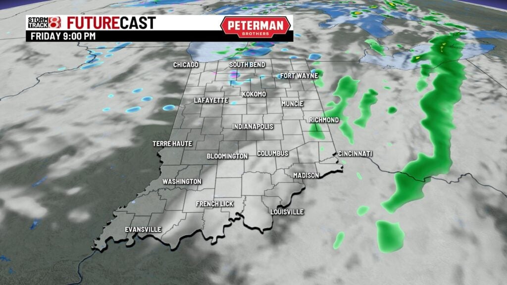
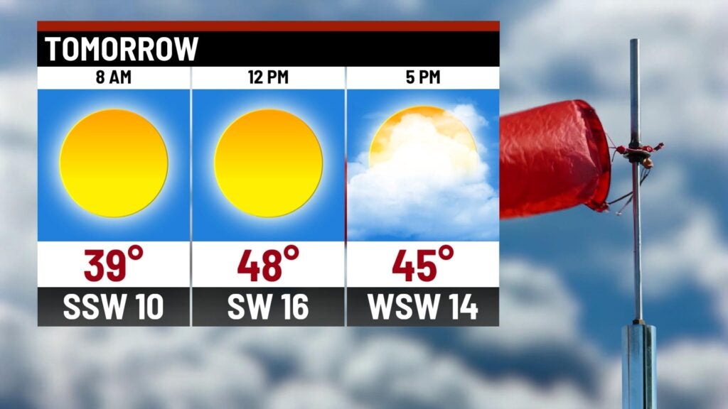
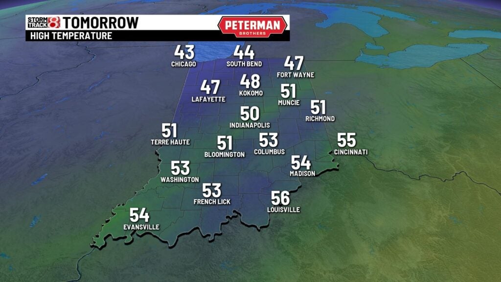
Friday: We will start our Friday off with lots of sunshine before cloud cover gradually builds back in. There is the chance for sporadic showers across the state during the day. Areas mainly north of interstate 70 have the potential to see a few snow showers after sunset.


Highs will only rise into the upper 40s to low 50s. Breezy winds are set to stick around also with gusts over 30 MPH at times.
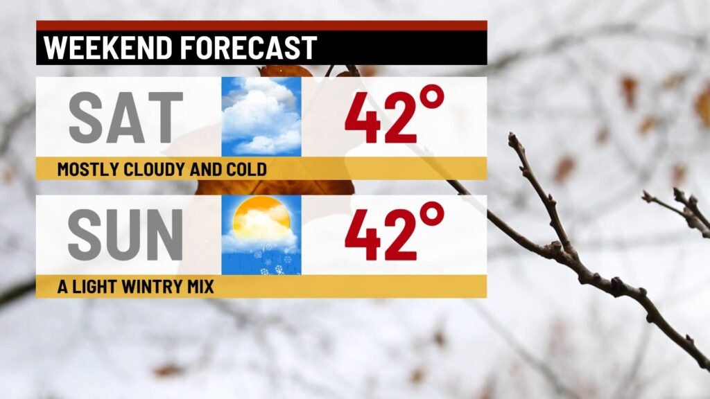
Weekend: You will want to grab the winter coat as we will get off to a cold start to our Saturday. Temperatures look to struggle for much of the day to get out of the 30s. Highs will sneak up just enough into the low 40s. The cold weather pattern continues through our Sunday with the chance for a rain/snow mix.
8-Day Forecast: We look to dry things out to begin the new workweek next week. A quick warmup will then enter the forecast with temperatures sliding back towards the 60s by next Wednesday. This fast warmup will be followed up with additional rain chances.
