


Chilly, cloudy with scattered snow
INDIANAPOLIS (WISH) — Cloudy, cool with snow showers continue for today with another blast of cold air moving in later this week.
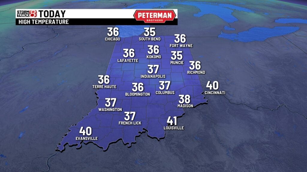
TODAY: It’s going to be a cloudy and chilly day once again across the state. We may see a few scattered snow showers at times during the day. A few of them may be snow squalls or quick bursts of snow that may reduce visibility at times. Areas in northern Indiana may see significant accumulations from lake effect snow showers. There’s a Winter Storm Warning in place for areas near South Bend where they may see 5-10″ of snowfall. Highs today will stay in the middle and upper 30s which is well below or normal high in the 50s. It’s going to be a breezy day with winds gusting at times near 20 mph.


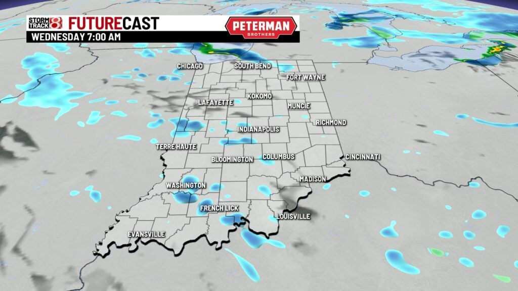


TONIGHT: A few scattered snow showers are possible heading into the evening hours. It will be cloudy and cold. Lows fall into the 20s once again.


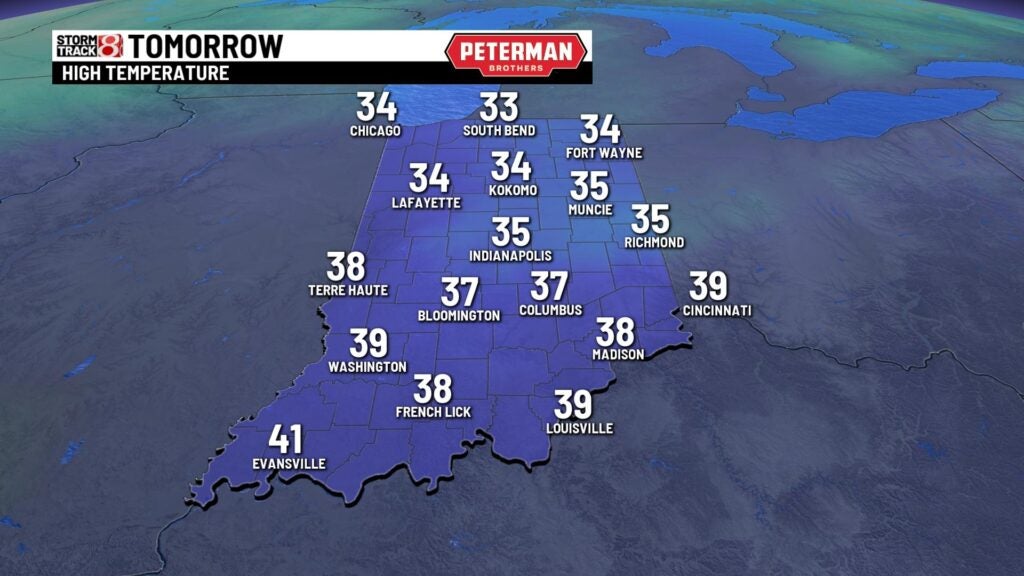
THURSDAY: It doesn’t look like we’re going to see much sunshine Thursday. Another cloudy and chilly day is on tap with highs staying in the low and middle 30s.

FRIDAY: A blast of cold air moves into the Great Lakes for the end of the workweek. Early Friday morning wind chill values will likely be in the single digits at times. The mercury really doesn’t rise all that much for the afternoon. Highs stay in the middle 20s for Friday afternoon under partly cloudy skies.
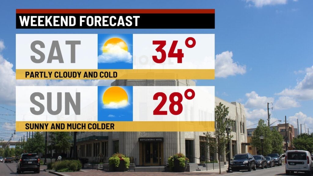
8DAY FORECAST: Cold air sticks around through the weekend. Lows in the morning will likely fall into the teens both Saturday and Sunday morning. It stays in the 20s for the end of the weekend. It will be dry for the Colts home game but cold for tailgating and game time. Highs will only be only in the 20s. We begin to warm back up for the middle of next week. Highs get much closer to normal for this time of the year right before the Thanksgiving holiday.
