Chilly to start February, warmer air ahead in the longer-term forecast
INDIANAPLIS (WISH) — We concluded the ninth warmest January on record with the coldest day of the month. The coldest night of the year is ahead for our Tuesday night before we eventually make a path towards the return of above average temperatures.


Tuesday night: Bundle up if you’re heading out tonight as we’re in for a frigid night with lows dropping into the single digits and teens. Wind chill values are going to fall below zero for some locations by Wednesday morning.
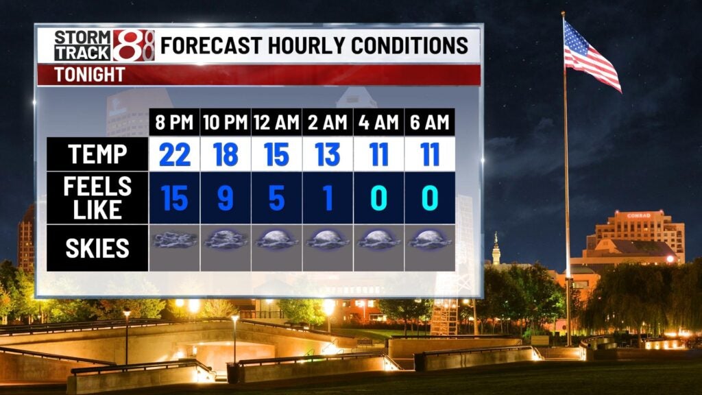

Wednesday: Be ready for a bitter start to February, which will be quite the difference to how mild we were to begin January. Although we will have some sunshine on deck, it won’t be much warmer than our Tuesday was. Highs will only rise into the upper 20s to low 30s.


Thursday: We look to get back toward average temperatures for our Thursday. Light winds out of the southwest and plentiful sunshine will be just enough to push highs into the upper 30s.

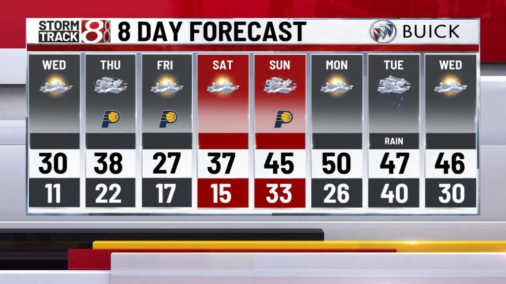
8-Day Forecast: There will be a brief temperature setback on Friday with highs only in the mid to upper 20s. Through the first weekend of February, we’ll work in a nice warmup with highs streaming back into the 40s by Sunday. As we get into next week, we’ll push close to the 50s before rain chances return by next Tuesday.