Cold and blustery Saturday; several precip chances next week
INDIANAPOLIS (WISH) — We worked in a windy and mild Friday with highs pushing into the mid to upper 50s. This warmer air will not stick around as we are looking at much colder air for the upcoming weekend. By next week, we’ll be tracking multiple chances for precipitation.
Wind advisories remain in effect until 7 AM EST Saturday morning for much of central Indiana.

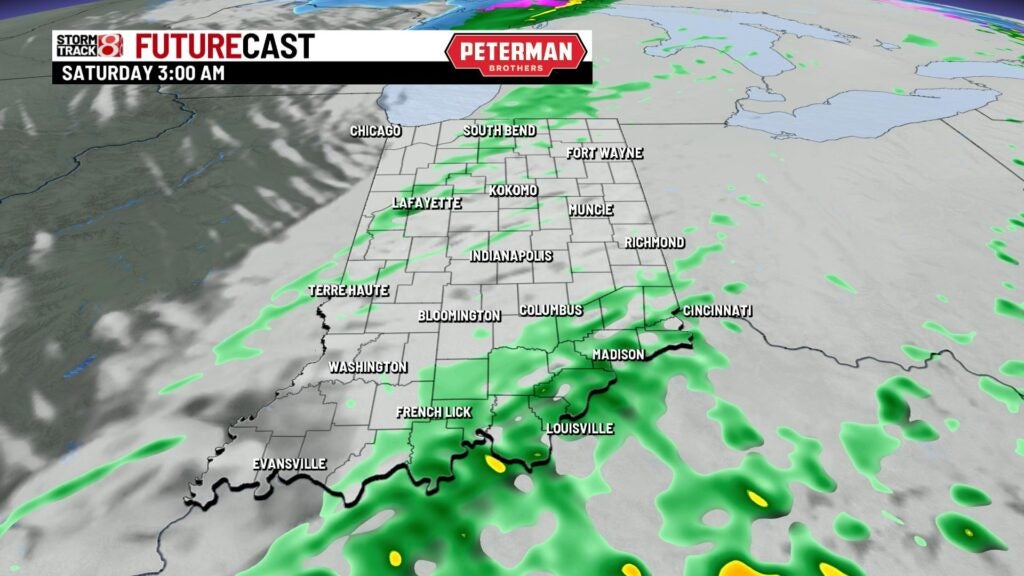
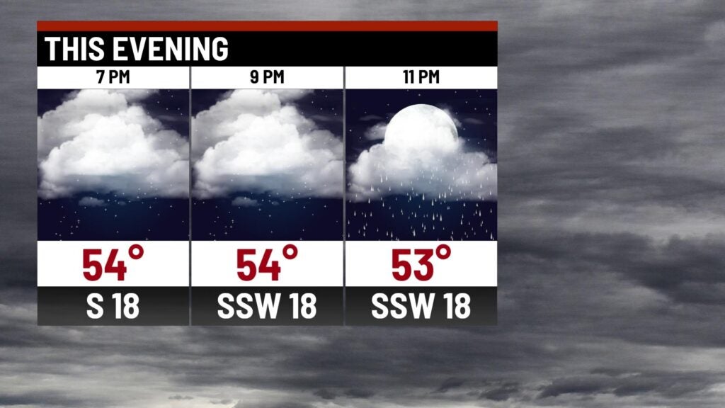
Friday night: Scattered showers will be possible tonight, but we aren’t talking much in the way of rain totals. Expect rain to mainly be on the light side. Along with the rain, winds will continue to be strong with sustained speeds of 15-30 MPH and gusts up to 45-50 MPH.

Temperatures will stay mild through much of tonight in the 50s before we begin to tumble towards colder air.

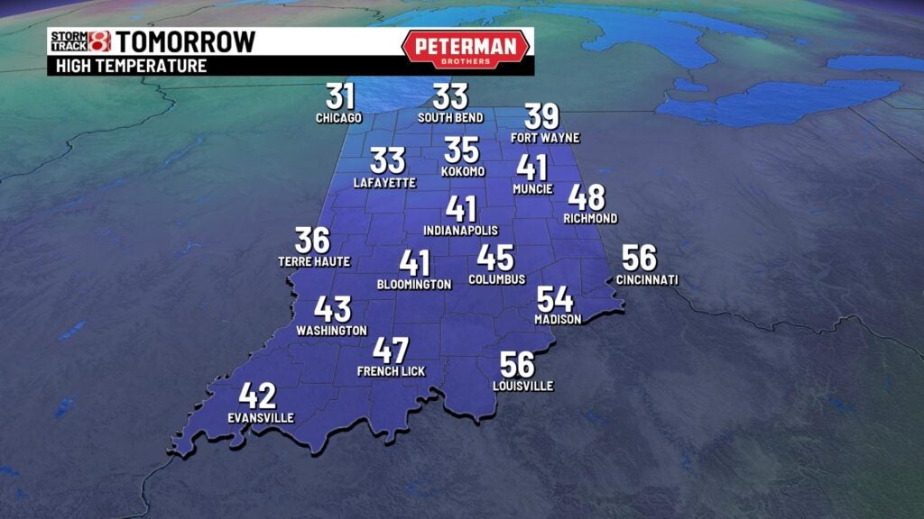
Saturday: You will want to have the coat on hand as we expect temperatures to fall into the 30s by daybreak Saturday. Despite mainly sunny skies, we’ll hover in the mid 30s through the afternoon hours before we dip into the 20s by Saturday night. Breezy winds with gusts up to 30-35 MPH will make the wind chill values sit in the 20s. Winds are expected to die down by sunset.

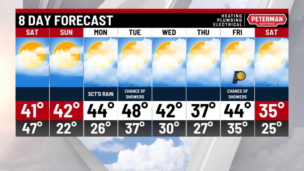
Sunday: Sunshine and dry weather remains with us through Sunday. Highs look to rebound into the low 40s by Sunday afternoon in what will be a near-normal early December day.

8-Day Forecast: The warming trend continues into the first half of next week with highs nearing 50° Tuesday before another cooldown ensues due to several chances for precipitation. Rain chances are in place for much of next week, and there could even be some snow mixed in.