


Cold Friday, warmer air to quickly return
INDIANAPOLIS (WISH) — It has been a wet Thursday with periodic showers and wintry precipitation mixing into the picture. We will continue to track activity for our Thursday night before a brisk Friday heads our way.
Winter Storm Warnings (pink) and Advisories (purple) remain in effect until midnight EST Friday morning.
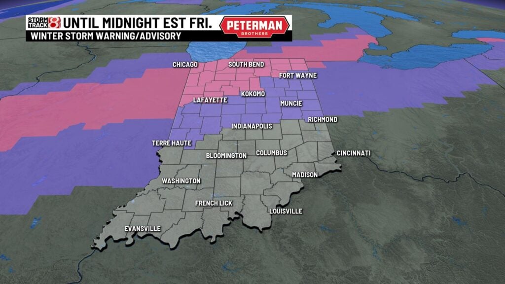
Thursday night: Rain is expected to continue changing over to a wintry mix/snow. There is a concern for slick spots on the roads tonight as a “flash freeze” will take place. This means that temperatures will drop fairly quickly, and in turn water on the roads will quickly freeze.


In terms of snow accumulation thinking, a majority of the heavier snow will stay in the northern third of the state. There is also the possibility of light icing from the freezing rain/sleet.

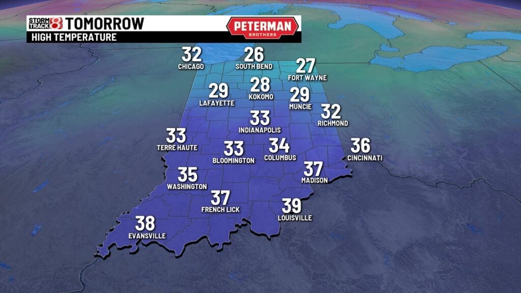
Speaking of temperatures, we are set to plummet into the teens by Friday morning. Wind chill values are expected to be in the single digits for some locations.


Friday: Keep the heavy winter coat on hand as we end the workweek on a rather chilly note. Highs will only rise into the upper 20s to mid 30s.

Weekend: Even colder air is set to settle in for our Saturday with highs not quite able to get out of the 20s. This cold spell will not last as Sunday features quite the temperature rebound. Highs are expected to jump back into the 50s for Sunday afternoon with lots of sunshine.

8-Day Forecast: The new workweek opens up on a mild note with highs eventually making a run near 60° by next Tuesday. This warmup will bring back rain chances for next Tuesday with colder air spilling into the region by the latter half of next week.
