


Cold weekend with snow chances
INDIANAPOLIS (WISH) — We worked in a gloomy but seasonable end to the week as highs managed to get into the mid to upper 30s. Colder air is set to make a return for our upcoming weekend with chances for snow.
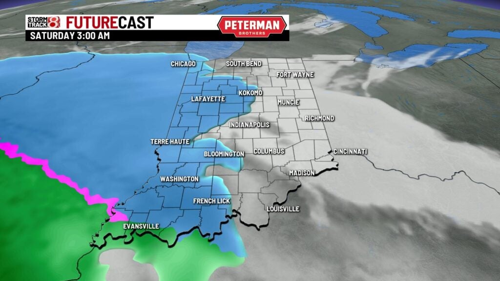
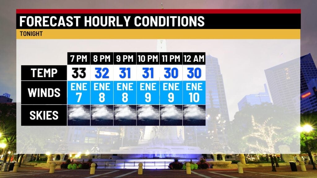
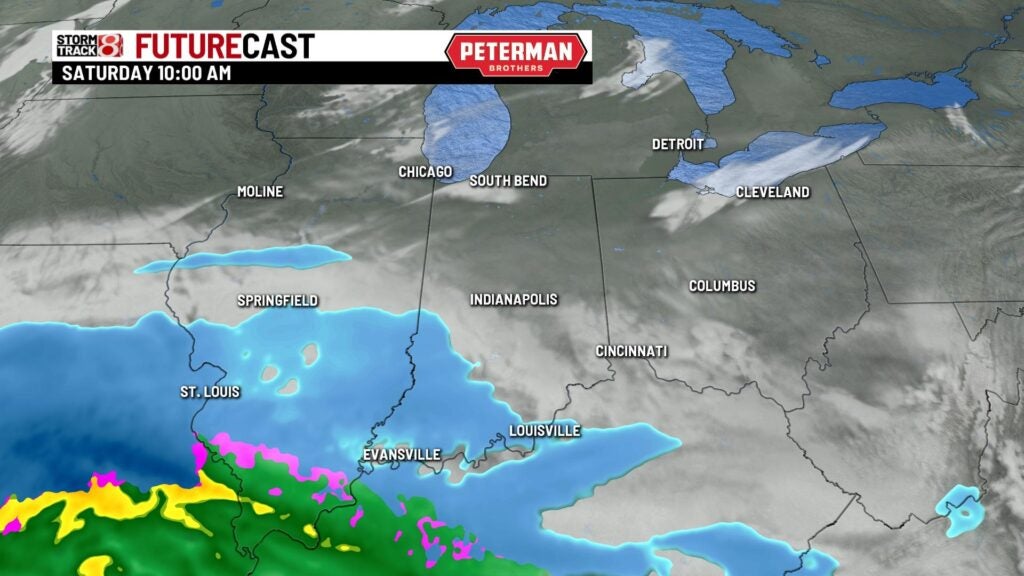
Friday night: We will be monitoring a system that will be swinging down closer to our state by tonight. There is a possibility for some snow showers in the overnight hours.

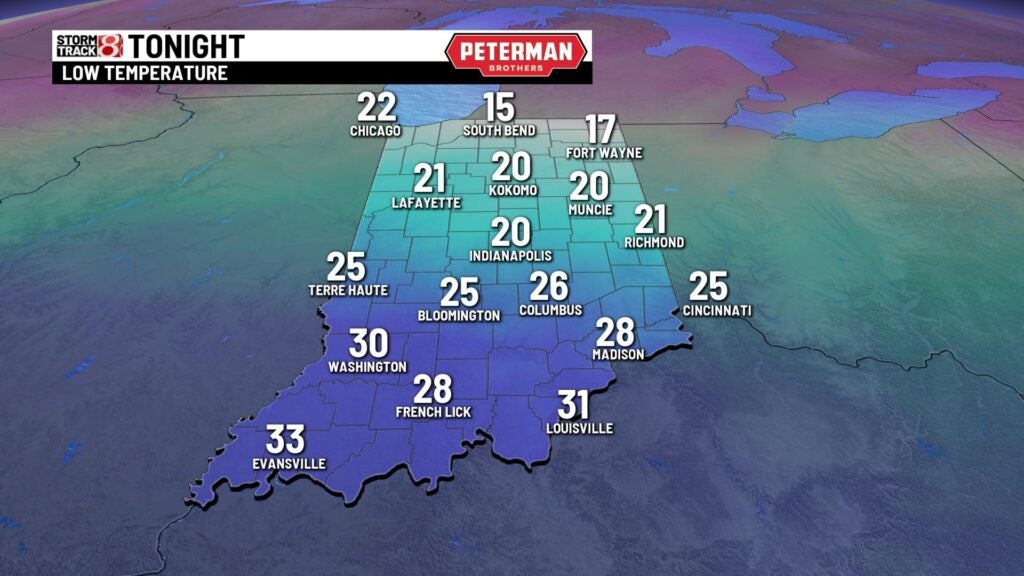
Lows will fall into the upper teens to mid 20s.
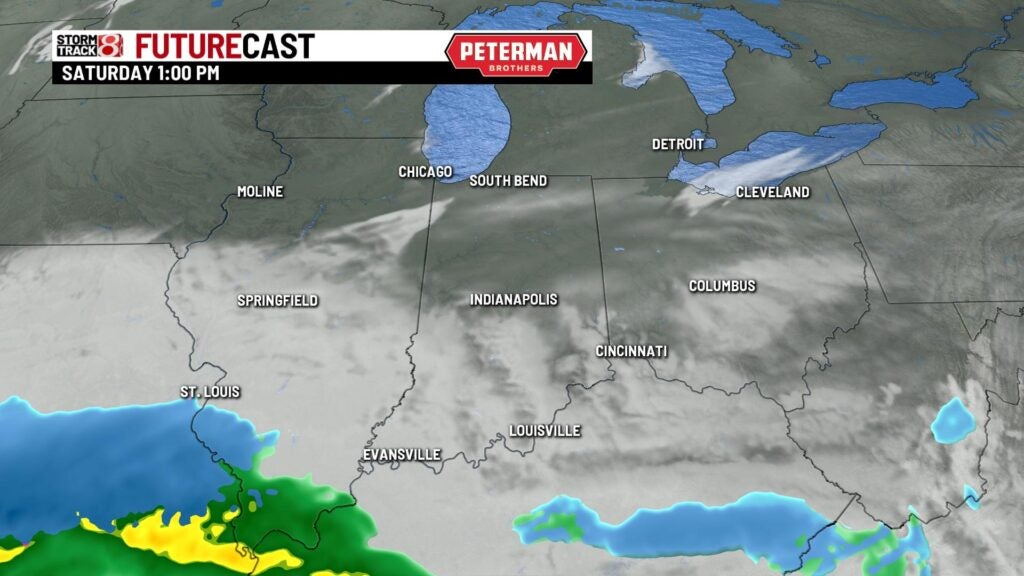
Saturday: The activity will continue to dip southward and exit our state by the late morning hours. This will lead way for decreasing clouds and colder temps.
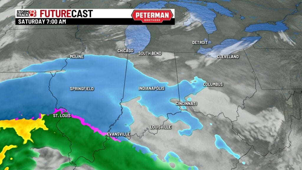
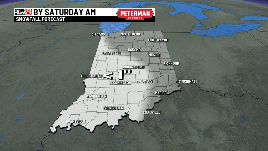
If any accumulation occurs, it will be mainly less than an inch for some of central and western Indiana.
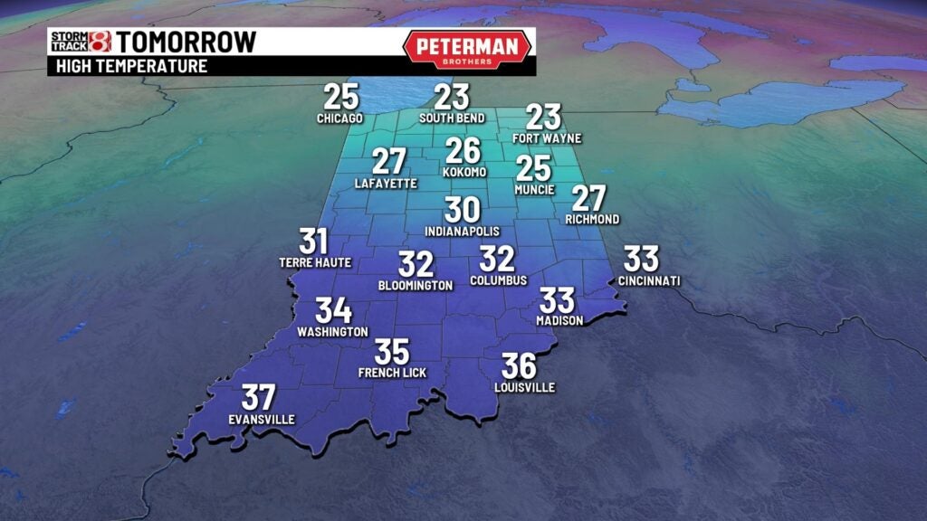
Highs look to only rise into the mid 20s to low 30s.
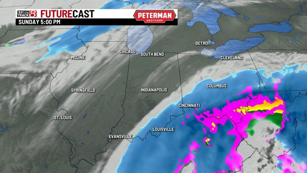
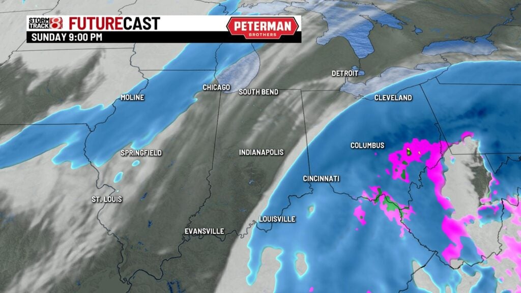
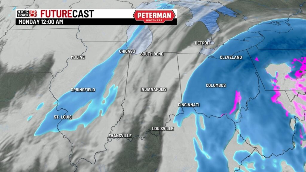
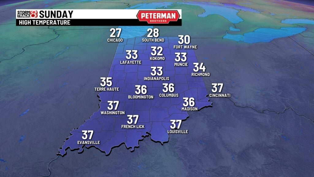
Sunday: Temperatures are set to return to near normal for Sunday. The system will begin swinging northeastward towards the east coast. Most of the snow is expected to stay out of central Indiana. The exception with the snow will be for southeastern portions of the state during Sunday afternoon and night.
Highs will rise into the mid 30s.
8-Day Forecast: A quick warmup will slide in during the first half of next week. Then, temperatures are set to slide back into the 20s briefly next Thursday.
