


Cooler air and rain chances to return
INDIANAPOLIS (WISH) — We had a tremendous end to the week with above average temperatures and bright skies. Cooler air is set to make a return along with several chances for precipitation ahead.
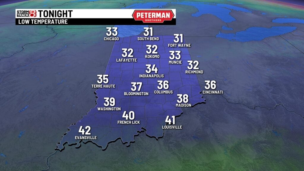
Friday night: Another mostly clear and chilly night will be on tap across the state. Lows will dip into the mid 30s.

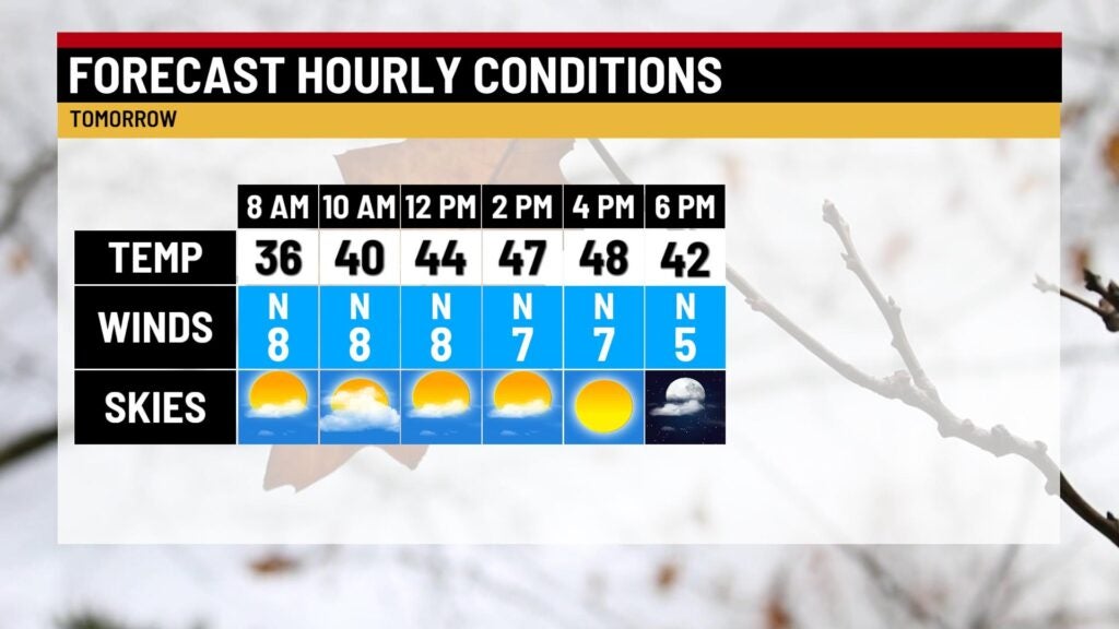
Saturday: We will work in cooler conditions for our Saturday after back-to-back well above average temperature days. Although it won’t be as warm as Friday, highs will manage to rise into the mid 40s to low 50s.

If you are heading out to Lucas Oil Stadium Saturday night for the Big Ten college football championship game, it will be chilly with temperatures falling into the 30s by kickoff at 8 PM EST.

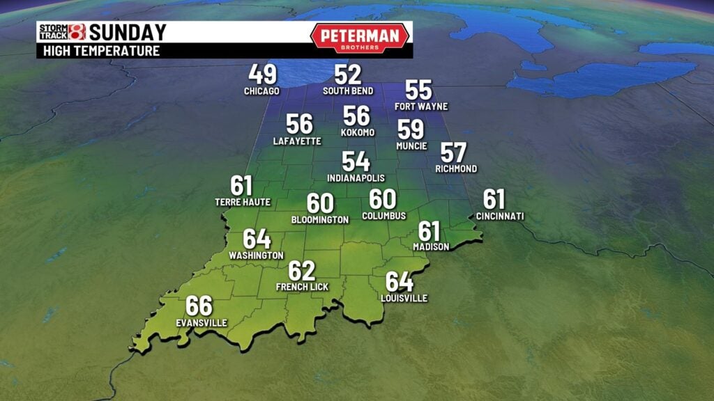
Sunday: Cloud cover will quickly increase Sunday morning ahead of the return of rain. Showers are likely mainly after the lunch hour with widespread coverage. There is even the possibility for a rumble or two of thunder.


Despite the rain and cloud cover, temperatures look to quickly return to the 50s. Breezy winds out of the south will help aid the return of warmer air. Wind gusts Sunday night could approach 30 MPH at times.
8-Day Forecast: Much colder air will roll back into the state to begin the new workweek on Monday. Temperatures will then struggle to get out of the 30s through midweek. It will also continue to be windy into Monday. There is the chance for a rain/snow mix from Tuesday through Thursday.
