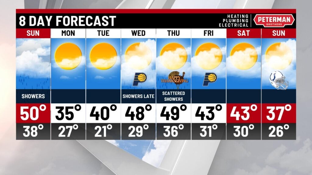
David’s Forecast Has Rain and Colder Weather
A weather system that moved through Indiana today just brought some clouds for the first part of the day. Then a gradual clearing helped salvage a pretty nice mid-November Saturday. We reverse the trend tonight. First clouds move back in and then showers by early Sunday morning. After the Sunday showers, much colder air moves in for a couple days.
Tonight – Increasing clouds with showers possible by early Sunday morning. Low 38
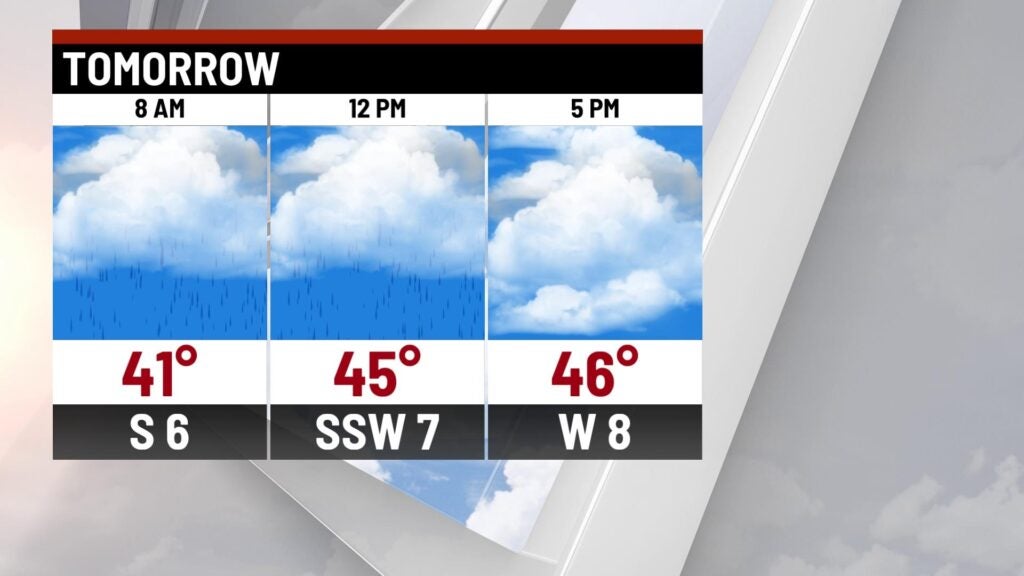
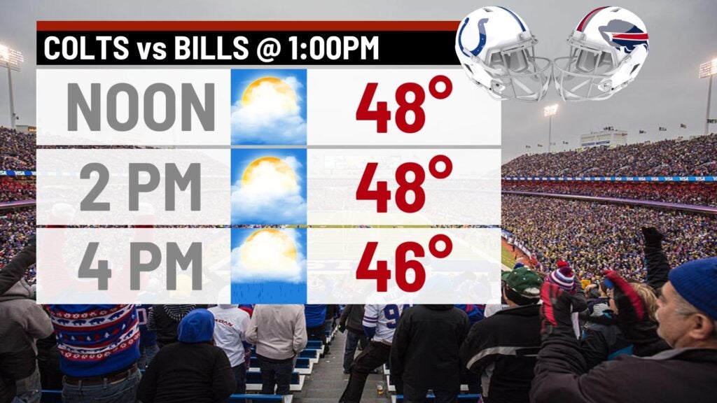
Sunday – Showers off and on until afternoon. Weather dries out late afternoon. High 50.
Monday – Mostly sunny but much colder. Low in the morning 27. High in the afternoon only 35.
It turned into a fairly nice day on Saturday considering we started the day with some light rain in western Indiana a overcast clouds through the early afternoon.

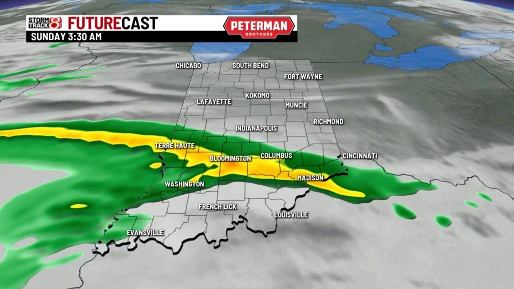
clouds and a south wind will keep the temperatures from getting too cold Saturday night. Rain arrives around 3 – 4 AM.

The next weather system is moving in quickly. Expect light rain before Sunday morning.
After the rain stops in the afternoon, we may hit 50 once again.

FutureCast shows the rain moving out of central Indiana during the afternoon.

Rain showers off and on until afternoon. Then our weather will dry out. After a cold front moves through, temperatures really drop Sunday night.
Weather in
8 Day Outlook – Stays cold Tuesday. Not so cold Wednesday with rain showers possible by late Wednesday into Thursday. Drying out Friday and Saturday but highs only in the low 40s.