


Fourth of July holiday weekend forecast
INDIANAPOLIS (WISH) — We had to deal with a rather stifling start to July with temperatures in the mid-90s for much of the state. Indianapolis had its second 95° day of the year, and we haven’t seen two or more of 95° days since 2013. Conditions are looking to be on the warm and muggy side for the holiday weekend with multiple chances to see rain and storms.
Friday night: Isolated to scattered showers and storms remain possible through the evening commute. Lingering isolated shower chances will then continue into the overnight hours.


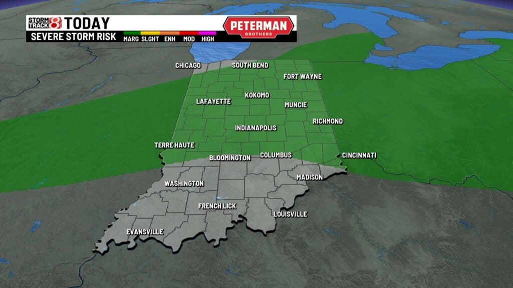
Before sunset, there is the potential for isolated strong to severe storms. Main threat is damaging winds, but large hail is also possible. Torrential rainfall and frequent lightning are hazards with any thunderstorm.
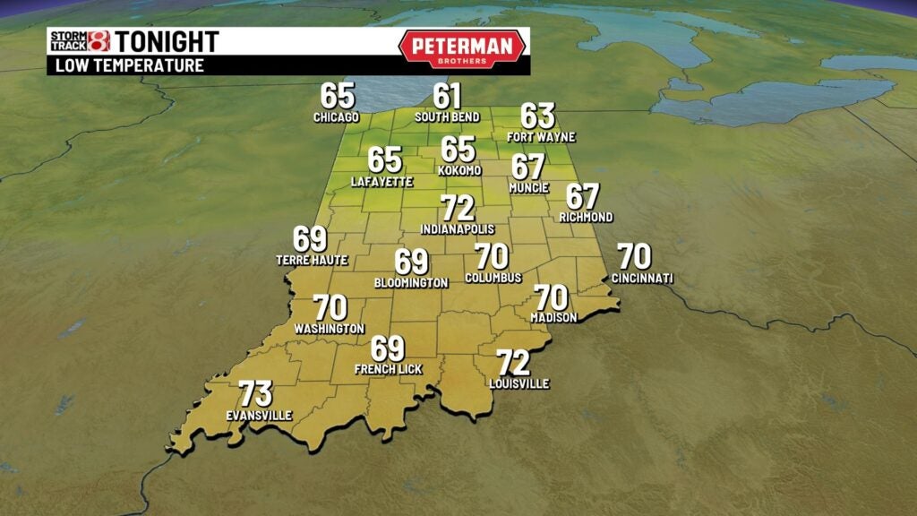
Expect a warm and muggy night with lows only falling into the upper 60s to low 70s.

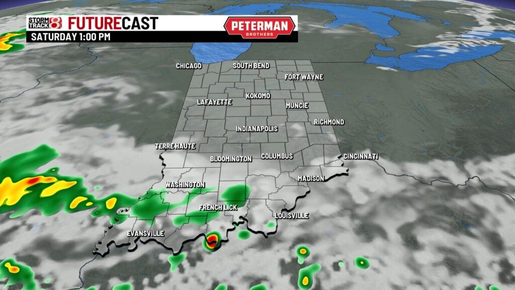
Saturday: We will settle into another toasty and humid day with spotty showers possible. The better chance for rain and storms are set to stay to our south during the daytime hours.

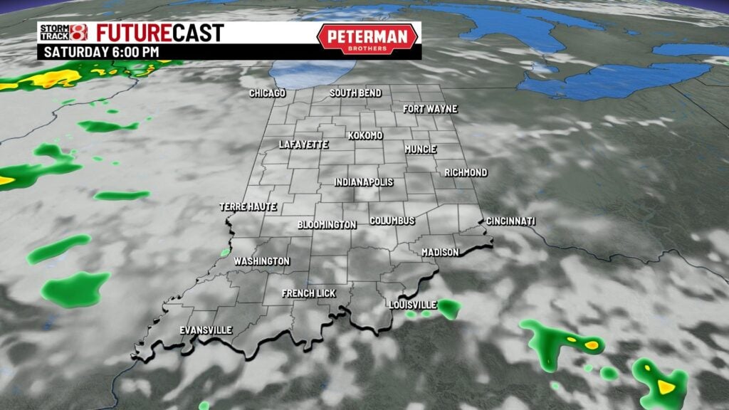
Additional showers are then possible by the nighttime hours.
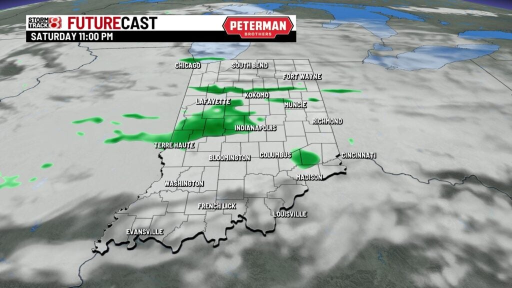
Highs will top out in the mid to upper 80s.


Sunday: You will want the umbrella on hand as on and off showers and storms look to develop through the first half of our Sunday. By the latter half of the day, we will quiet things down.


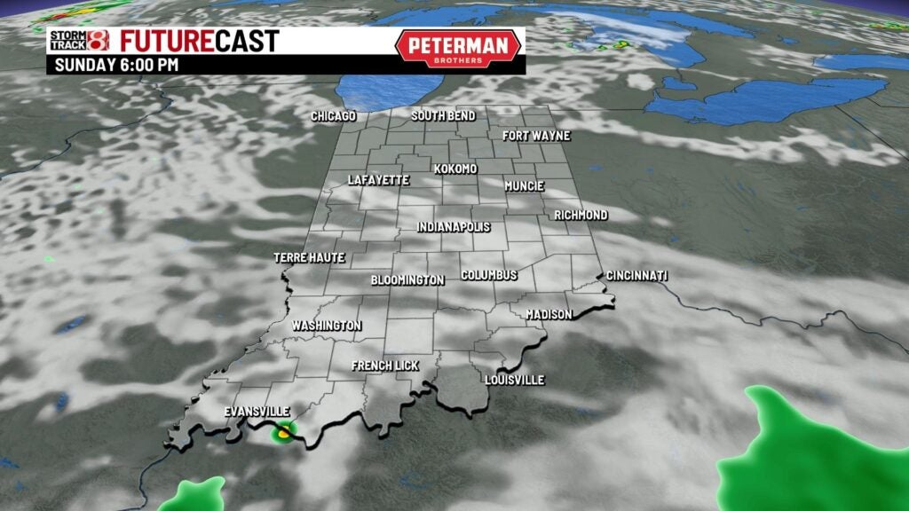
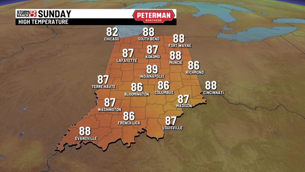
Another fairly warm and humid day is ahead with highs rising back into the mid to upper 80s.
8-Day Forecast: Hot and muggy weather is set to stay with us through much of next week. Fourth of July is still shaping up to be toasty with spotty storms possible. The active weather trend continues for much of next week as well. It is too early to say if there is potential for severe weather in the extended forecast.
